

After a restful night I am up early, having declined paying extra for a cooked breakfast I am lacing up my boots and strapping on the rucksack just before 6:30 to start another days walking. Today I have around thirty miles to cover, a bit more than I would usually tackle, but it fits in with my plan to complete this first section of my walk in six days.
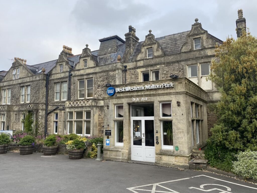
Last night’s accommodation was the Best Weston Walton Park Hotel, another of those hotels seeking to regain its former grandeur. It is a fine Victorian building with a magnificent cliff top location, all clean and tidy with friendly staff but not quite what it would have been in its prime.
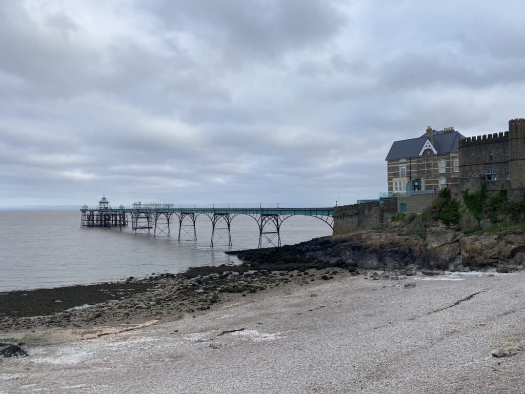
Leaving the hotel I head along the road to the seafront and stop once again to look briefly at the pier.
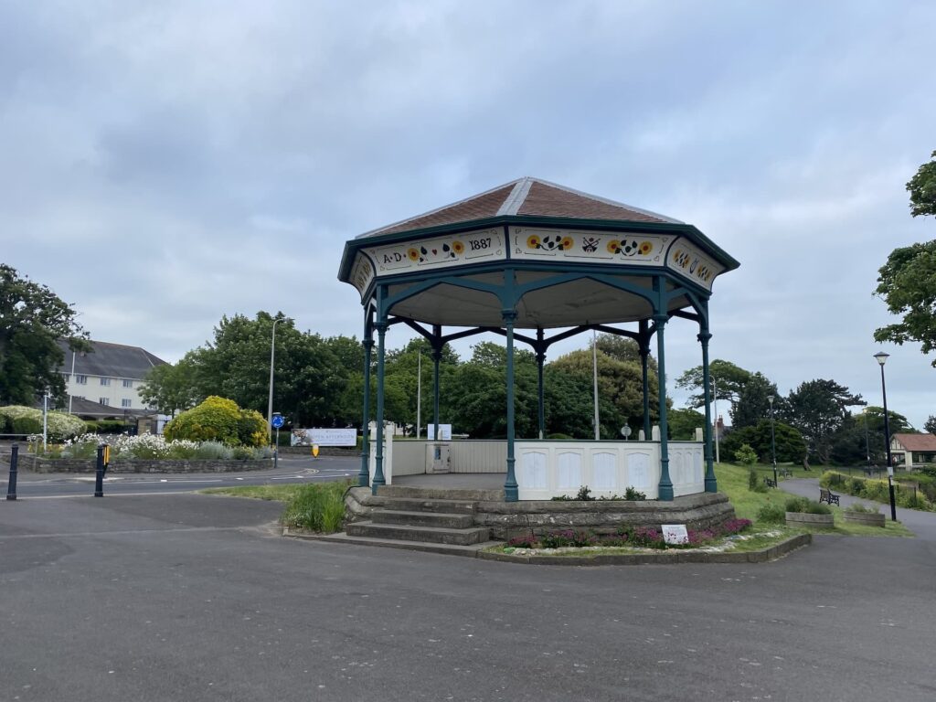
Clevedon has the feel of a holiday resort that has seen better days. The local tourist board describe it as a charming Victorian resort and there are certainly glimpses of this but it feels a bit run down. What would have once been a grand Victorian bandstand now has weeds growing out of it.
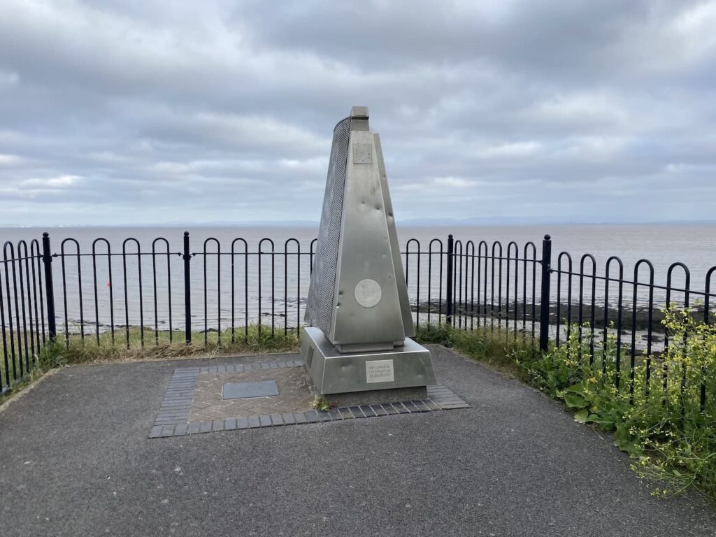
Close by is the Clevedon Millennium Monument, from a distance I was trying to work out the purpose of the structure, initially thinking it was some form of air vent, as I got closer I thought it resembled a structure to dispose of cigarette butts.
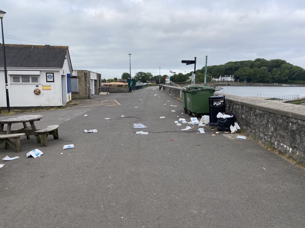
The path is strewn with litter from the overflowing bins, I assume gulls have pulled out the fish and chip containers and it is too early for the litter to be cleared, however, it raises the question of how frequently the bins are emptied and if there are enough.
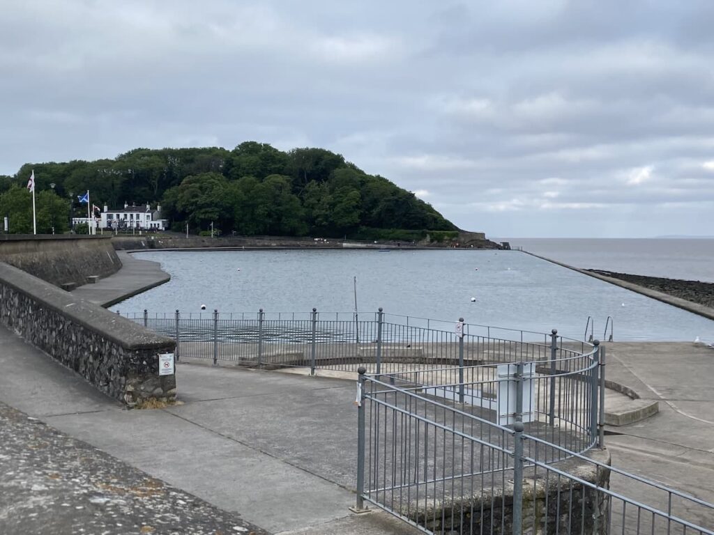
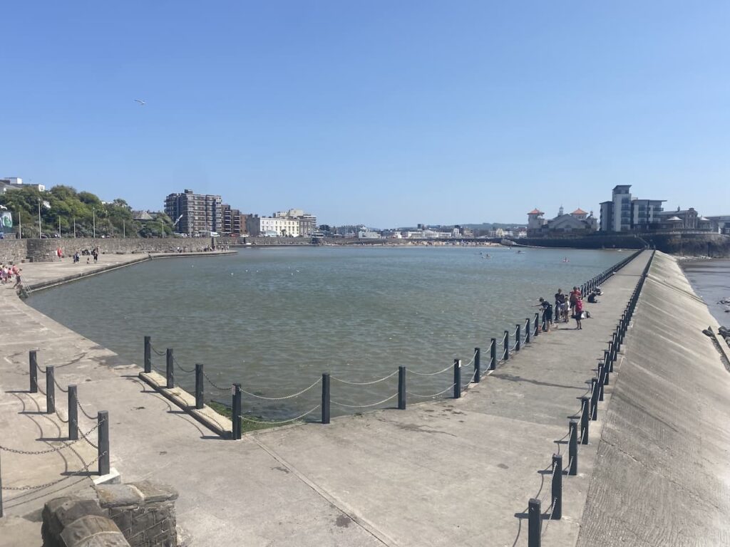
So far, apart from the pier, I have not been impressed with the town, but then I pass the Marine Lake. Opened in 1929 to provide residents and visitors with a safe place to swim the lake was designed to fill naturally at each high tide. It became a thriving spot with small boats and swimmers enjoying the water.
In the early 2000s the lake fell into disrepair and its future was in doubt. A local charity was formed and funding enabled the pool to be desalted, walls to be repaired and a safety upgrade. It re-opened in 2015 and once again became a popular spot, although at this time of the morning it only has a couple of hardy swimmers braving the water.
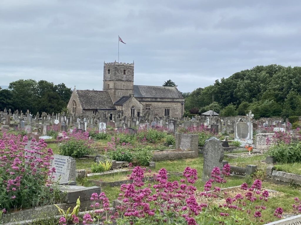
Leaving the town the path goes up Church Hill and passes St Andrew’s Church parts of which date from the 12th, 14th and 15th century.
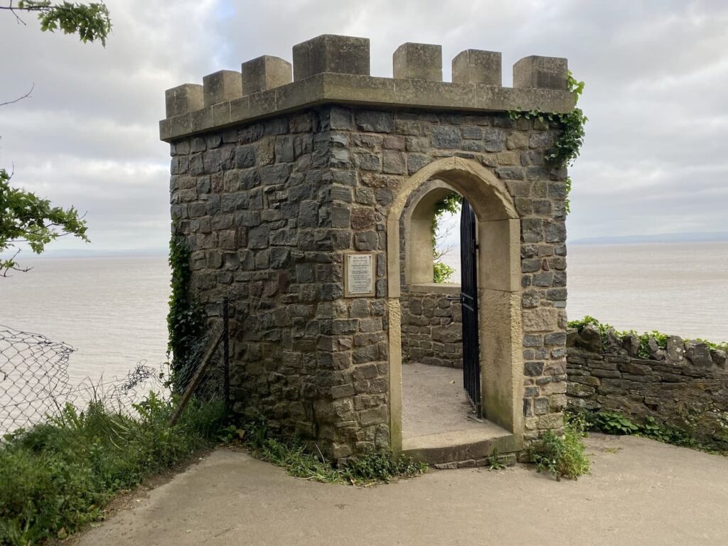
Staying on the coastal path I head around Wain’s Hill Fort, beside the path I pass a stone structure, this is The Lookout on which there is a plaque explaining that it was erected circa 1835 by Ferdinand Beeston and was said to be used by the Finzel Family who were sugar importers. They would come to this spot to view their sugar ships coming in from the West Indies.
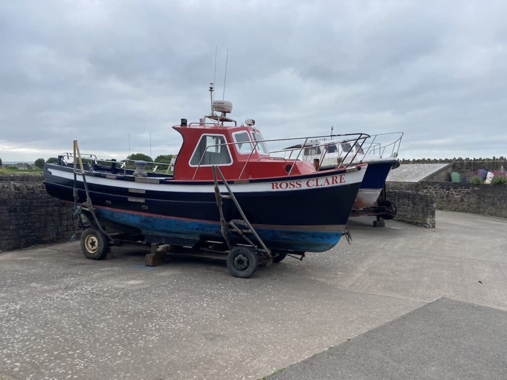
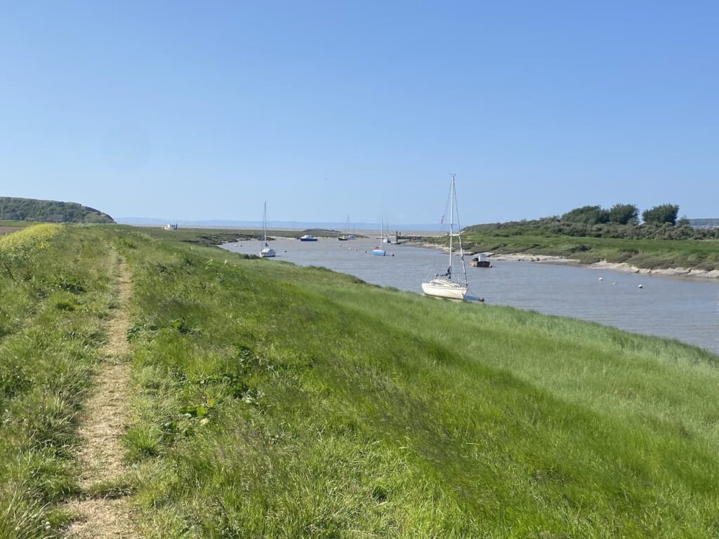
The path leads to a tarmac road where I turn right and head towards the waterfront passing fishing boats.
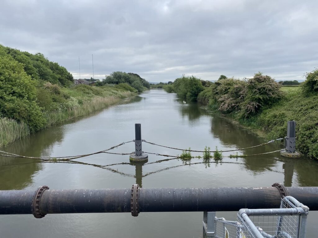
Turning left by a slipway the path soon crosses the Blind Yeo, this is a man made channel constructed in 1949 to help alleviate flooding in the Kenn Valley.
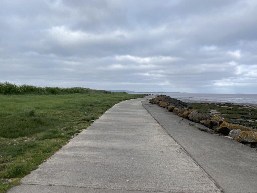
I now head along the sea wall.
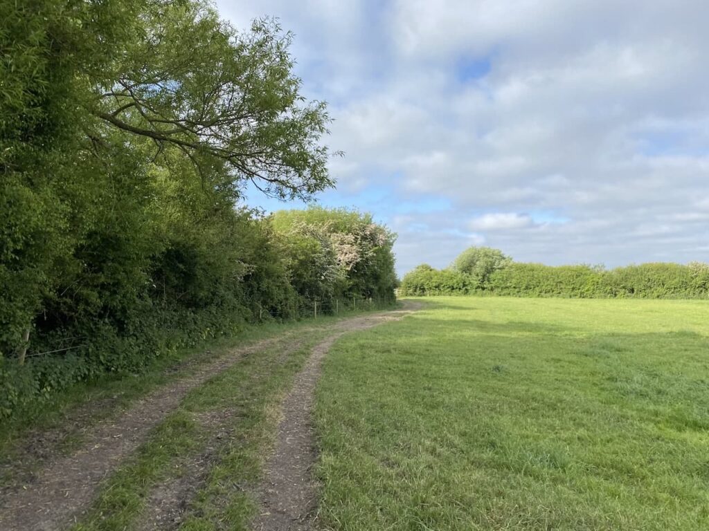
There is a path to my left heading to Dowlais Farm. Trying to decide which way to go I bump into a dog walker who tells me that I can continue along the sea wall, however I soon reach a gate which clearly informs there is no public entry. I decide it is best to turn around and take the path that leads inland towards Dowlais Farm.
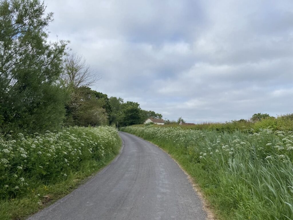
Before reaching the farm I turn right along a lane which passes Lower Farm and then just after passing Poplar Farm I turn right and follow this lane until I reach Broadstone Lane on the right.
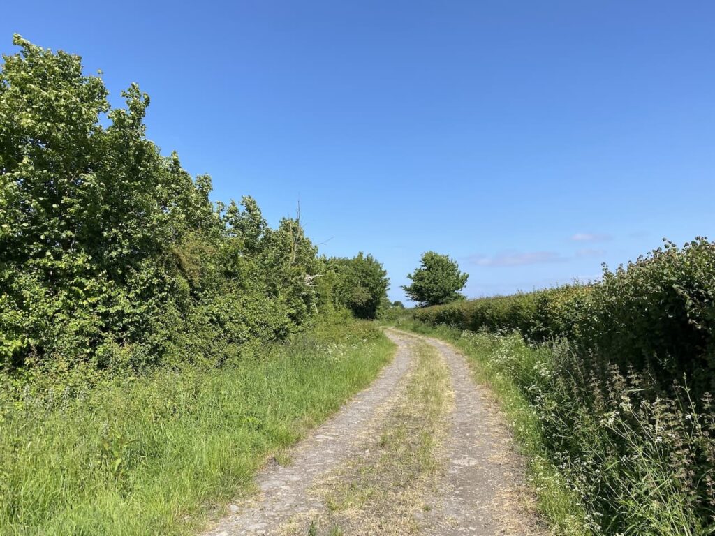
At a junction I turn left into Ham Lane and then soon after a junction with Yeo Bank Lane I take a footpath on my right. Just as I start along the path I bump into a local farmer and we chat about my route, he advises me that what the map shows as a subway is in fact a drainage ditch and the path is usually underwater. We chat about the alternative route, but this will add more miles to the 30 I already plan on walking today.
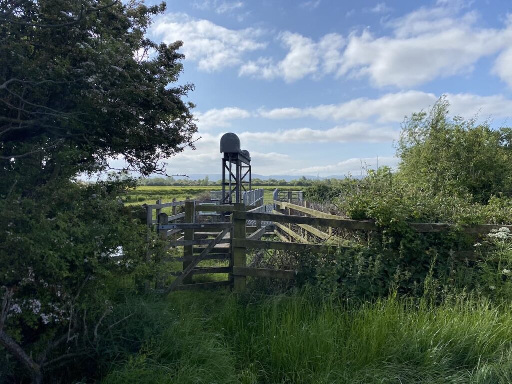
Stupidly I do not heed his advice and continue across the fields on the path to the subway.
On reaching the motorway I find the subway and indeed it is submerged. The farmer gave me a couple of plastic bags to use to wade through the water. So I put these over my boots and head down the steps.
I wade through the water but it soon becomes clear that there are a number of holes in the bags so by the time I get to the other side my boots and socks are absolutely soaking. Before proceeding I stop to try and dry things out a bit.
The route shown on the map below shows the route I should have taken which would have taken me on a bridge over the motorway. All I needed to do was walk about a mile further and I would have had dry feet, something I am going to regret for every step of the remaining twenty-three miles I have left to walk today. However, I have read blogs and seen pictures of people walking this subway under the motorway without having to walk in water!
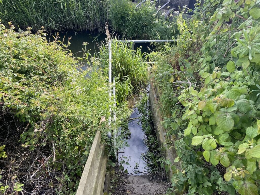
Resuming my walk I go alongside the drainage ditch to reach Phipps Bridge to cross the River Yeo at Phipps Sluice.
The path now goes alongside the river. My boots squelch with every step.
The path takes me across fields towards East Hewish. On joining a lane I walk through the hamlet heading towards a railway line.
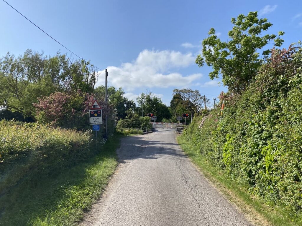
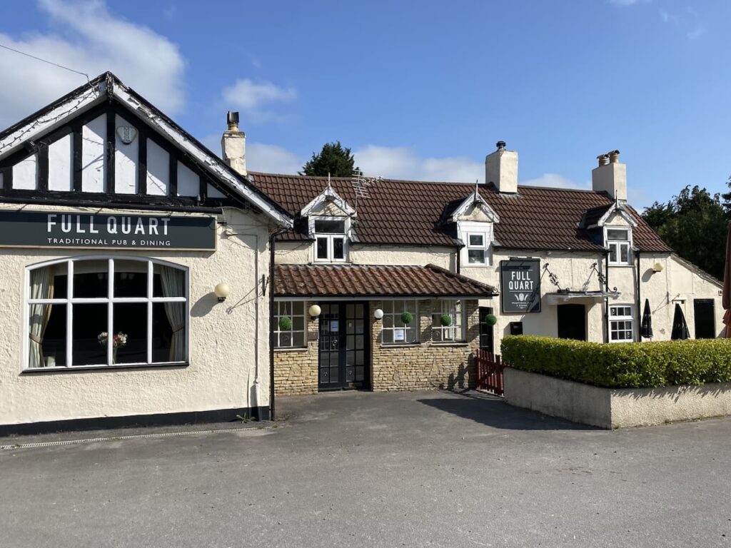
At the A370 I turn right besides the Full Quart public house.
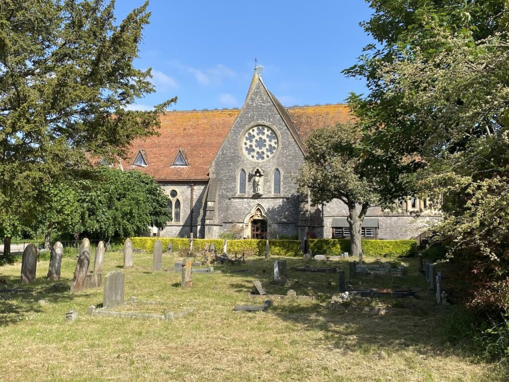
I soon pass the former St Anne’s Church, this church was built in 1864 and then in the 1990’s it was deconsecrated.
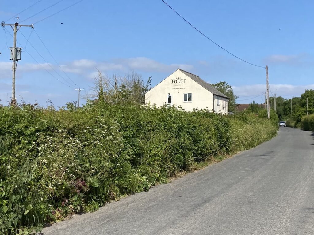
Fortunately I am not beside the main road for long. On reaching Wick Lane I turn right. This lane crosses the railway line and then passes the former RCH Brewery.
This brewery began in 1982 in the Royal Clarence Hotel (RCH) in Burnham on Sea and then in 1993 the brewery moved to the Old Cider Milll. In 2017 it ceased trading and the site was taken over by the Pitchfork Brewery.
Soon after the brewery I reach a bridge and cross the M5 to Ebdon Lane where I turn left and head towards Ebdon and Worle. At Ebdon Road I turn left and cross the River Banwell and then take a footpath on the right which passes Ebdon Farm and continues on a track across fields.
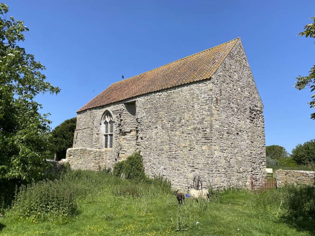
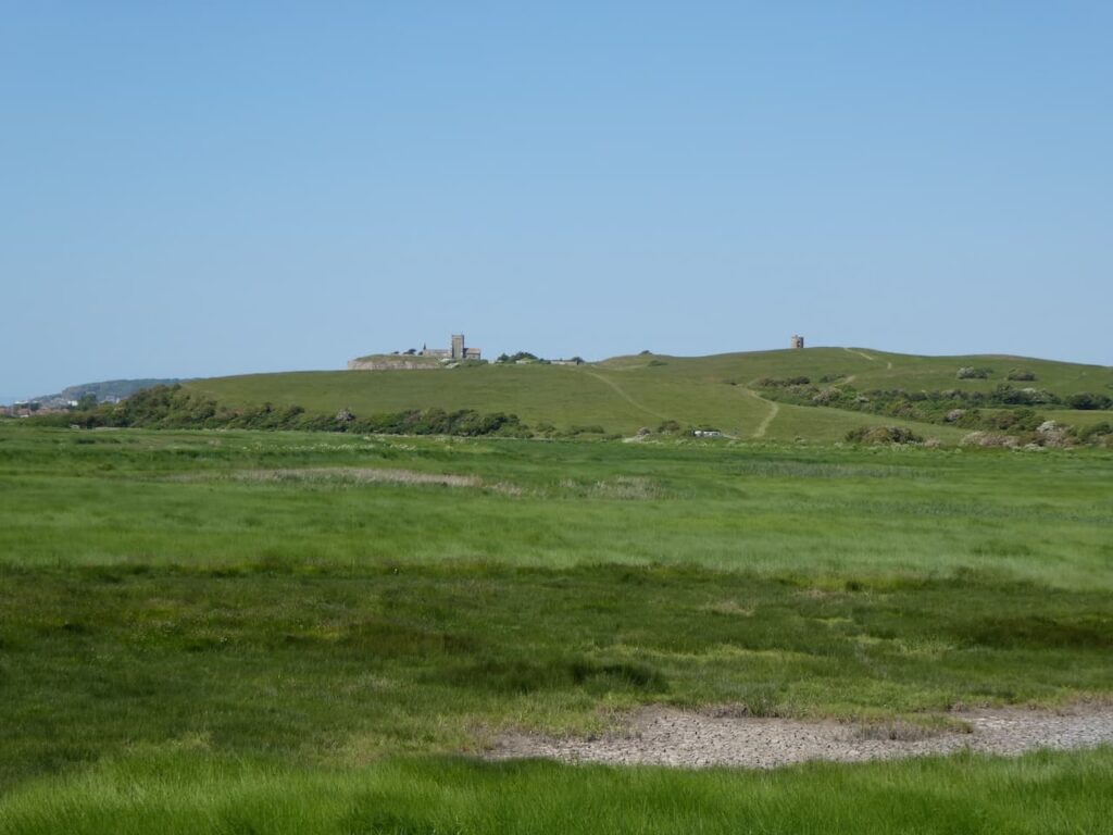
Following the footpath I reach Collum Lane and turn right and head towards Woodspring Priory. This former Augustine Priory was founded in the 13th century by William de Courtney and dedicated to Thomas Becket. Courtney’s grandfather Reginald Fitzurse was one of Becket’s murderers.
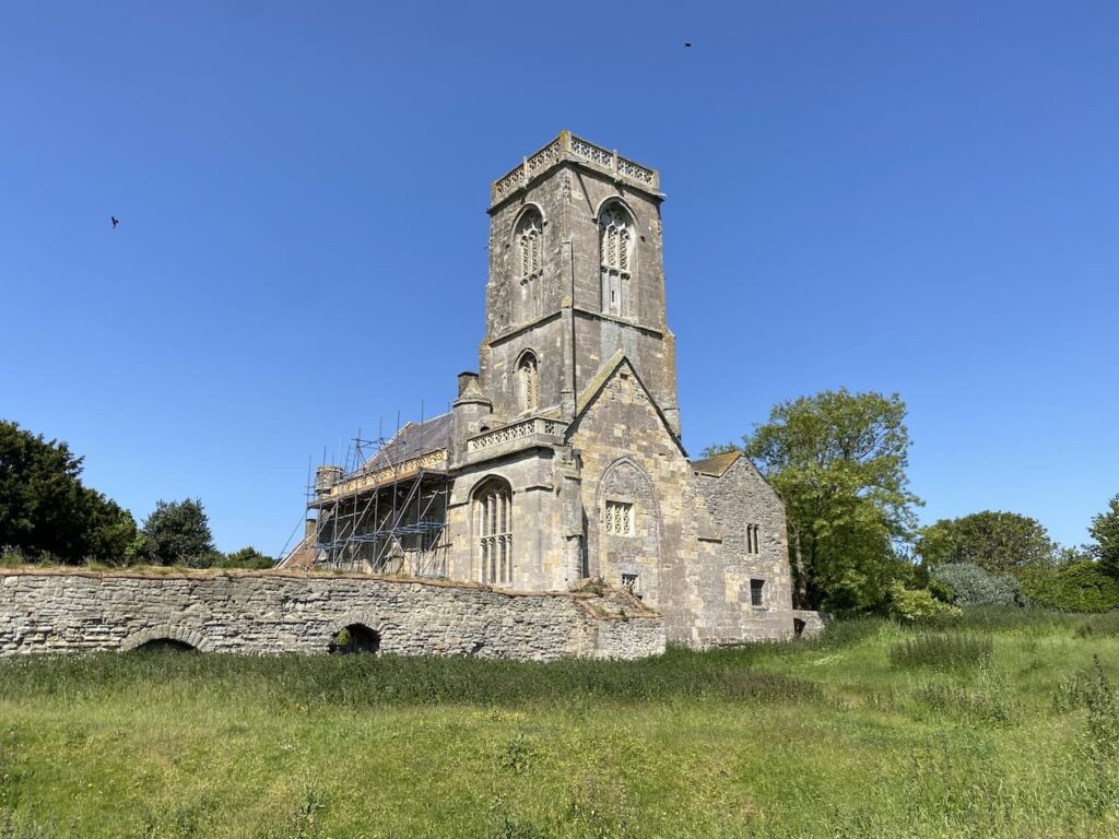
In 1536 Henry VIII’s dissolution of the monasteries led to the closure of the priory and it was granted to the politician and courtier William St Loe. In 1566 it was sold to William Carr MP and he converted it into a farmhouse. In 1968 the priory and surrounding land was purchased by the National Trust and in 1969 the Landmark Trust took over the priory and started restoration work.
The church is now a museum, unfortunately I don’t have enough time to visit, and the attached house is rented as holiday accommodation.
After having a look at the priory site I take a track to the right which heads towards a National Trust car park.
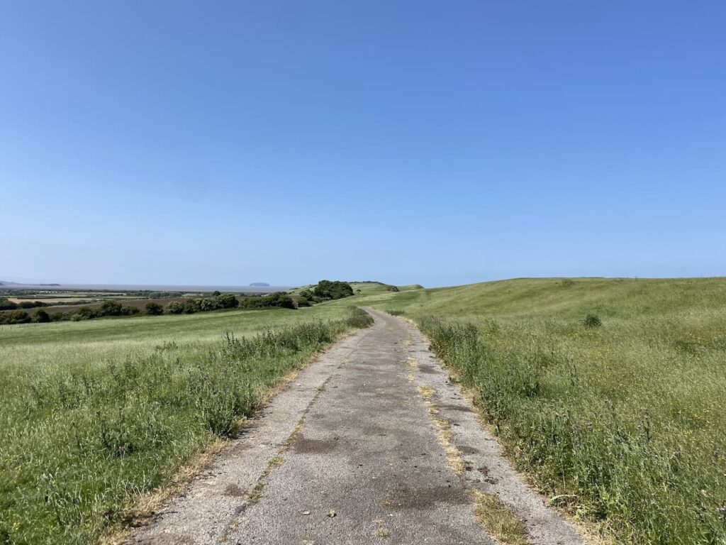
At the car park I follow a footpath on the left which soon leads steadily uphill above the priory and then I turn left to head left along the ridge.
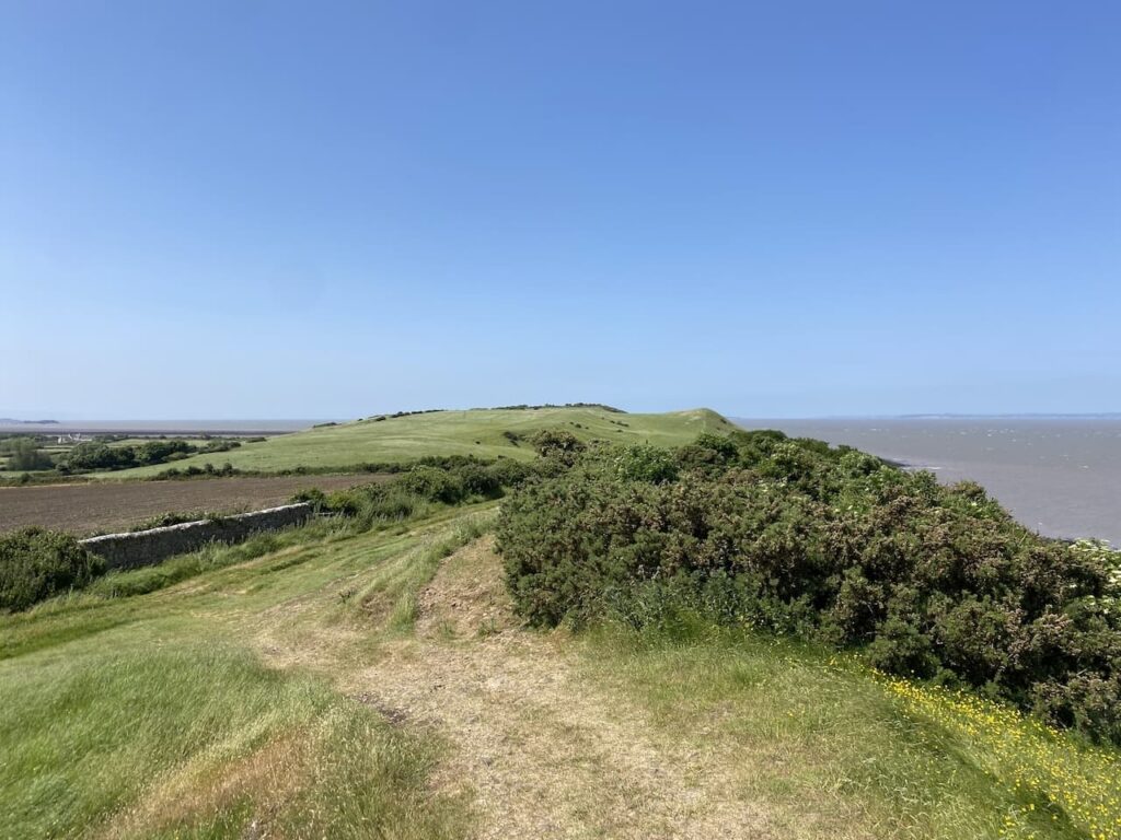
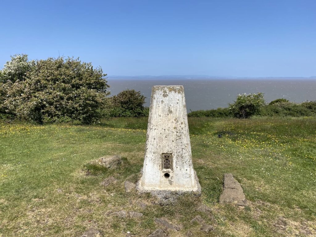
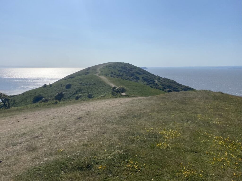
This is a cracking spot to walk and I continue along the ridge to reach the Ordnance Survey Trig Pillar at Middle Hope. This is the 382nd trig I have bagged.
From the trig I take a path which steadily descends Middle Hope heading towards Sandy Bay and Kewstoke.
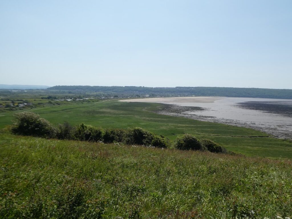
Reaching the seafront I continue along the coast path.
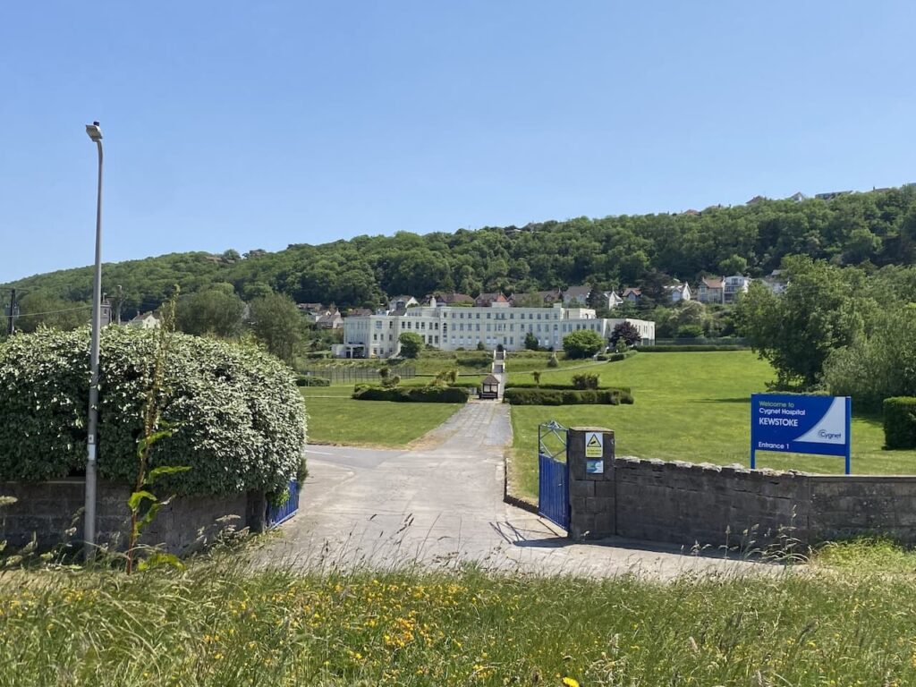
Kewstoke appears to be a mix of residential homes and a number of holiday parks. As I reach the far end of the bay I pass an impressive Art Deco hospital building. This is the former Kewstoke convalescent home, opened in 1933 by the Birmingham Hospital Saturday Fund as a convalescent home for women from Birmingham. During World War II it was used as a military hospital.
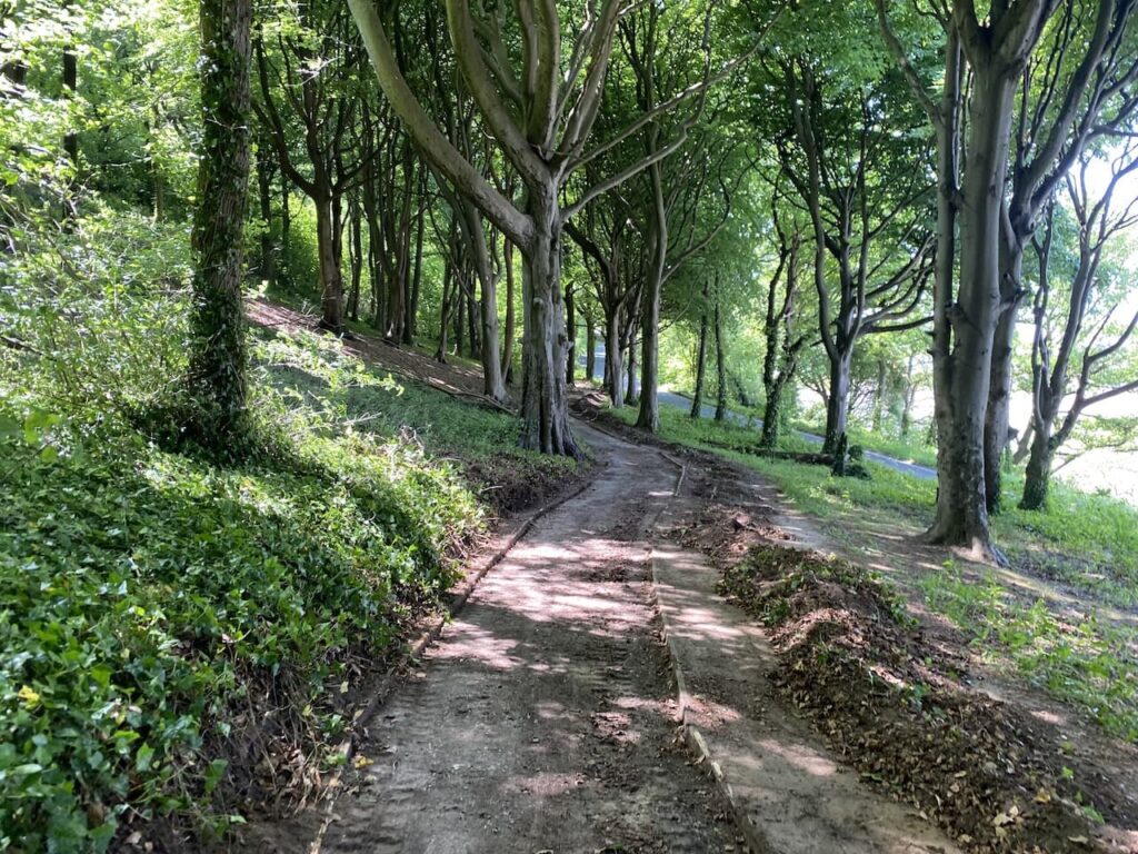
At the end of the bay after a short section beside the road I take a path on the right which heads up through trees to reach a road which I cross and then take a path on the left which runs parallel to the road as it heads around Worlebury Hill.
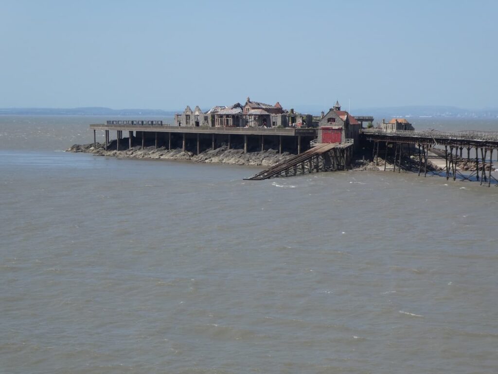
The path takes me to Birnbeck Pier, opened in 1867 it is said to be the only pier in the country that links to an island. In its heyday this pier was a popular attraction with funfairs and used by steamer ferries.
During World War II it was taken over by the Admiralty and used as a secret base for weapons testing. Following the war it returned to being a pleasure venue but like many piers it soon started struggling financially which led to poor maintenance and by 1994 it was closed to the public.
In 2020 North Somerset Council started the process of purchasing the pier and island with a plan for renovation.
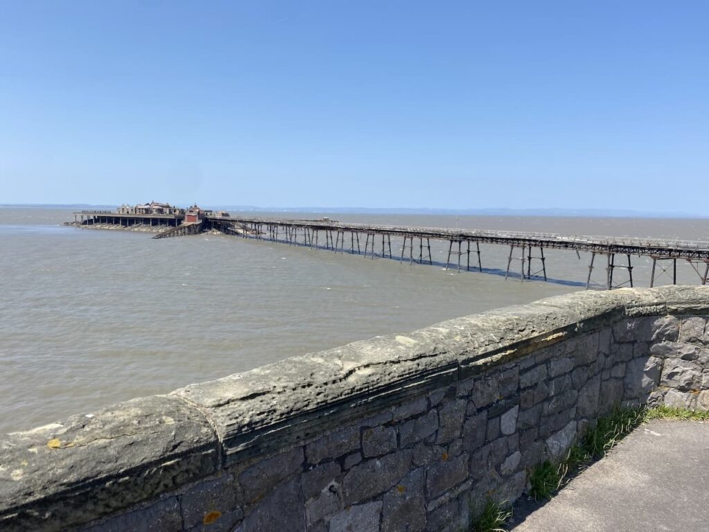
From the first opening of the pier the RNLI had a lifeboat station situated on the island, however in 2014 they were forced to close it as the pier was deemed too unsafe to use.
I continue on a path around the coast which eventually heads downhill to reach the Marine Lake at the north end of Weston-Super-Mare. After many years of discussion, which included an idea to create a two mile barrage from one end of the bay to the other, it was agreed in 1929 to construct a 270 metre barrage.
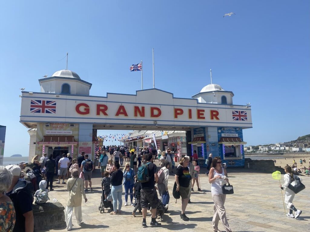
It is a sunny day and the marine lake is being well used and it is busy along the seafront as I head towards the Grand Pier.
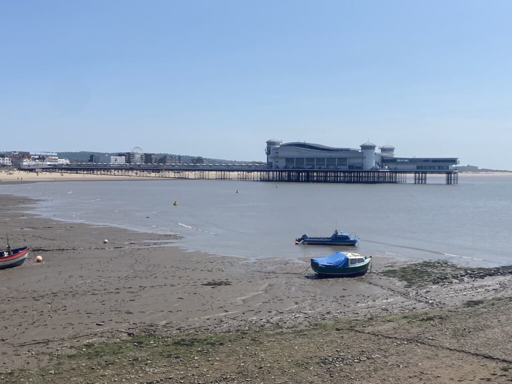
This pier opened in 1904 and survived a fire in 1930, however a fire in 2008 destroyed the pavilion at the end of the pier. By 2010 the pavilion had been rebuilt and it continues to be popular with locals and visitors.
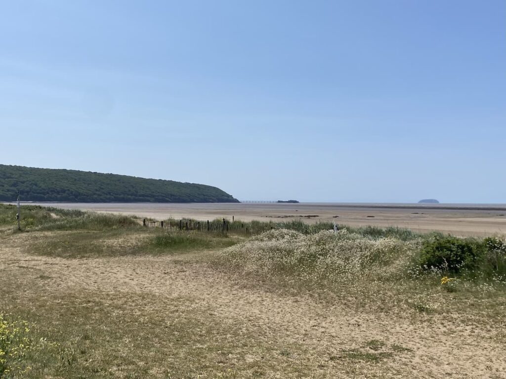
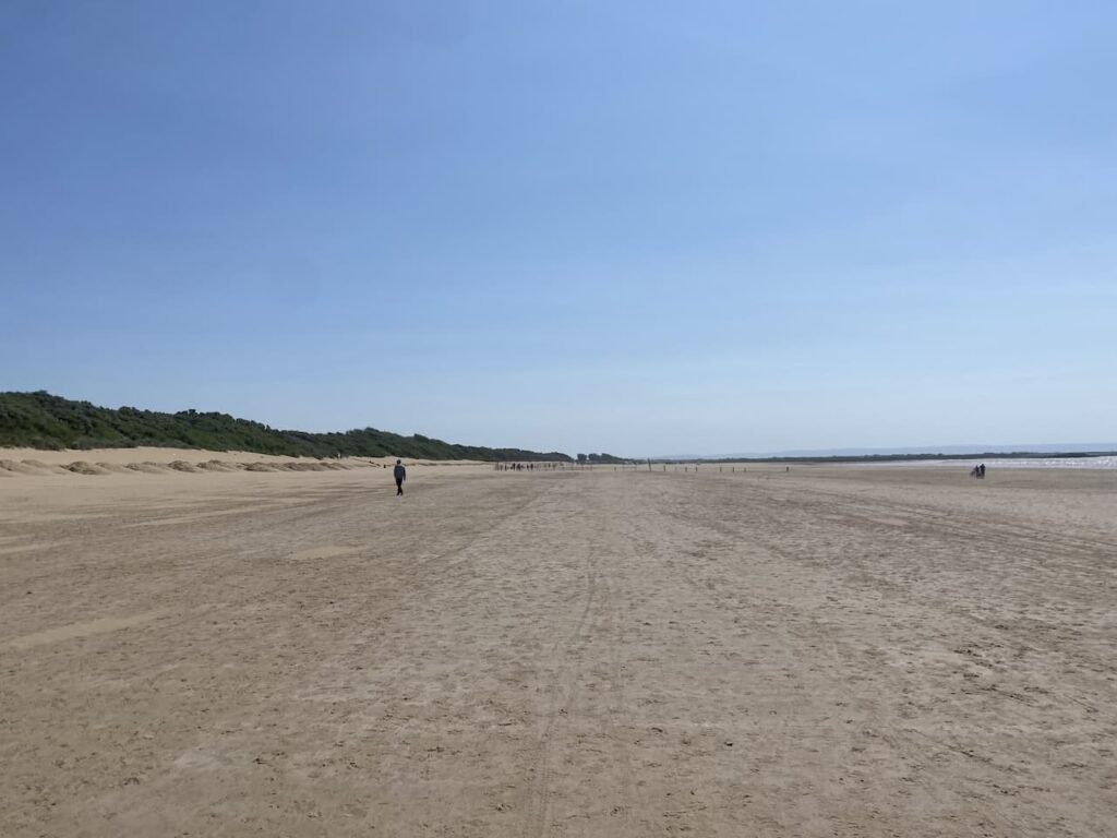
After walking along the promenade I join the path as it heads along the wide expanse of the beach.
On reaching a parking area on the beach I take a minor road through Uphill and then I take a path on the right which passes the yacht club and continues through a nature reserve on the route of the English Coastal Path.
There are a network of paths, but I stick with the sign post for the English Coast Path. After the hustle and bustle of the seafront this is a very tranquil spot.
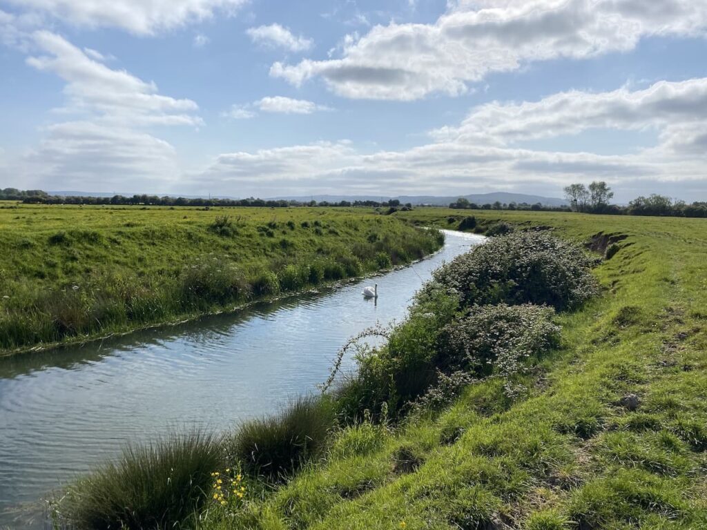
After crossing the Brean Cross Sluice I turn right alongside the River Axe.
After passing Brean Down Farm I head uphill onto Brean Down and then take the path along the top of Brean Down.
This is a cracking spot with far reaching views along the Bristol Channel. The track leads me to the Brean Down Ordnance Survey trig pillar.
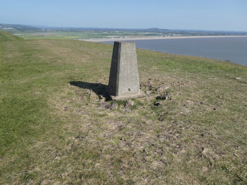
From the trig pillar I walk back along the ridge until I reach a path on the right which leads to a long series of steps going downhill towards Brean Sands.
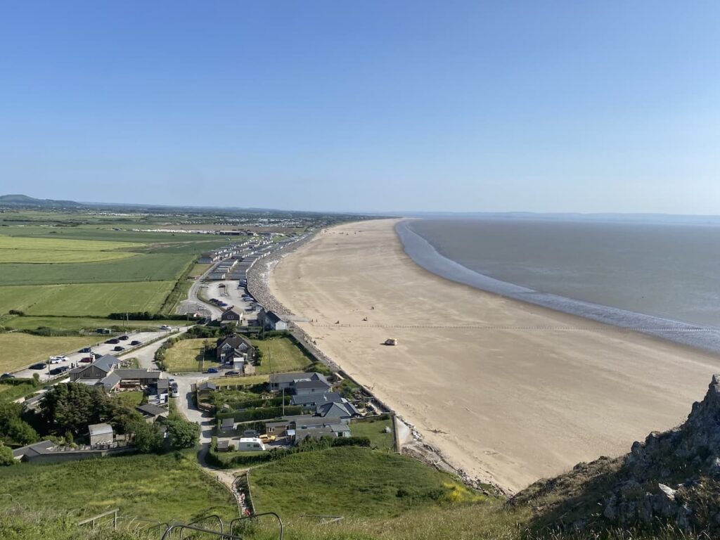
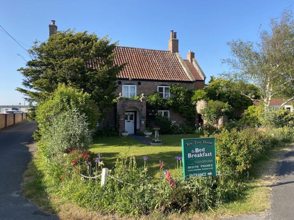
On reaching the beach I start walking along the sand, but after walking thirty miles, most of which has been in wet boots, the soft sand is hard work so I opt to walk along the road through Brean and pass a number of holiday parks to reach my over night accommodation at Yew Tree House bed and breakfast.
After a welcome shower and a chance to deal with some of the blisters on my feet it is time to try and find somewhere local for something to eat. The last thing I want to do is walk far so I opt for one of the bars in a nearby holiday park. But after walking almost thirty two miles I soon polish off my pie and pint and head back for an early night.
To follow this walk you will need Ordnance Survey OS Explorer – 153 – Weston-super-Mare & Bleadon Hill
You can view this walk and download the GPX File on OS Maps (OS Maps subscription required)
30th May 2023
© Two Dogs and an Awning (2023)
All information on this site is provided free of charge and in good faith and no liability is accepted in respect of damage, loss or injury which might result from it. To the best of my knowledge the routes are entirely on public rights of way or within areas that are open for public access.
Walking can be hazardous and is done entirely at your own risk. It is your responsibility to check your route and navigate using a map and compass.