

A few years ago Lynnie and I visited Lambert’s Castle hill fort. In those days I was not “bagging” trig points. Although I am pretty sure we visited the trig I have no pictorial evidence, so we are heading that way today as it is not too far from Hill Farm CL.
We start our walk from the National Trust parking area at Lambert’s Castle (EX13 5UT) and rather than go through the gate onto the access land around the castle we walk a few hundred years along the driveway and then take a footpath on the left heading alongside an area of access land.
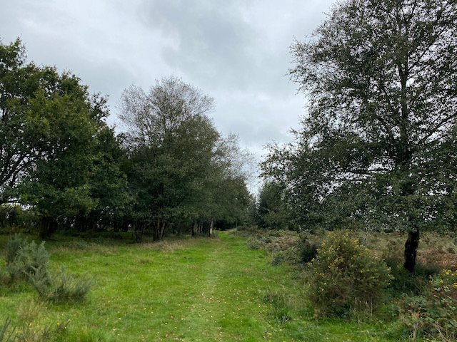
On reaching a minor road, Fishpond Bottom Road, we cross and join an attractive tree lined track heading south.

This track steadily descends to Trevett’s Corner where we join a minor road soon reaching a junction where we take the lane signposted to Fishpond. After a quarter of a mile, just as the road bends to the left in front of a house, we reach a footpath on the right. It was my intention to take this path across the fields to eventually reach Wootton Fitzpaine, however, a herd of frisky steers means we re-consider.
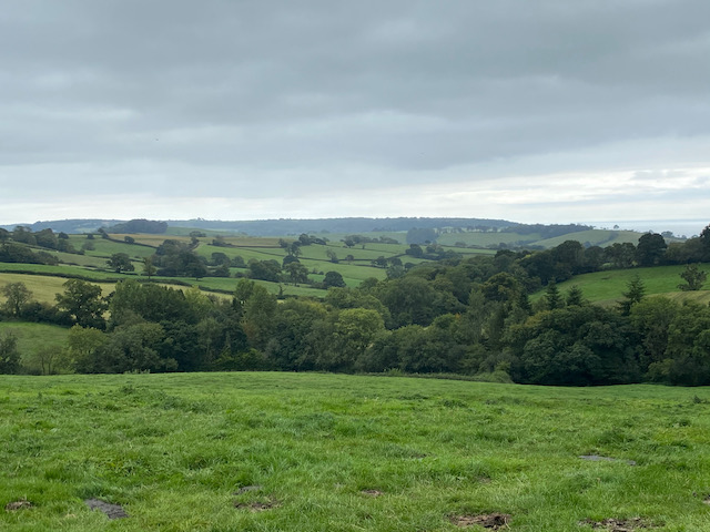
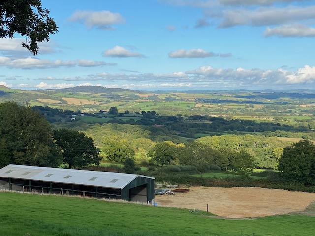
I am always cautious around cattle, but even more so when walking with a dog, so a quick look at the map has a new route plotted. We now continue along the road as it turns east and then north to ascend towards Sheepwash Farm. From a gateway we get far ranging views.
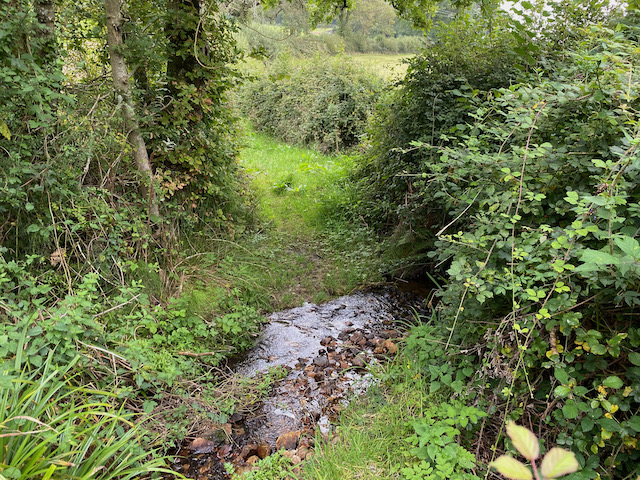
The road bends to the left on reaching Sheepwash Farm, we take a bridlepath besides the farm and then continues along a track to ford a stream.
We continue on the bridleway to reach Little Coombe Farm where we join a track and turn right. We continue on the track to pass Great Combe Farm and then head uphill to reach a minor road, Long Lane, here we turn right.

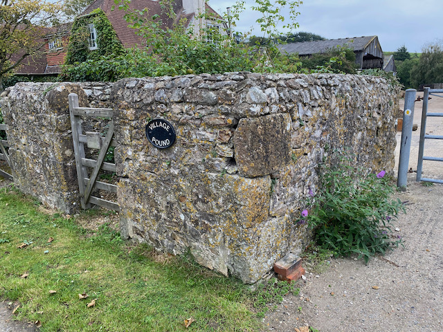
We stay with this quiet country lane for just over half a mile to reach Wooton Cross where we turn right and follow the lane into Wootton Fitzpaine. On entering the village we pass the old village pound. Such structures were used in medieval villages to impound stray livestock. They would be handed back to the owner on a payment of a levy.
We continue into the village to reach the gates of the Manor House.

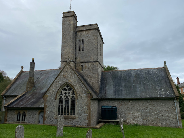
We go through the gates and follow the driveway to the village church which was built in the 13th and 15th centuries. It was restored in 1872. Unfortunately it is locked so we cannot have a look at the interior.
From the church we head up the manor driveway and after going through the gates turn right and head east out of the village to return to Wootton Cross where we continue along the road to reach Baker’s Cross. We now turn left into Abbott’s Wootton Lane and pass Lower Abbott’s Wootton Farm and then Higher Abbott’s Wootton Farm. After just over a mile and a half we reach a road junction where we go right and then after a hundred yards turn right again into a narrow country lane.
This lane runs below Lamberts Hill for three quarters of a mile with fine views across the valley.
At a fork in the road we go left and pass cottages and then just as we reach the B3165 we take a path on the left leading steeply uphill into woods.
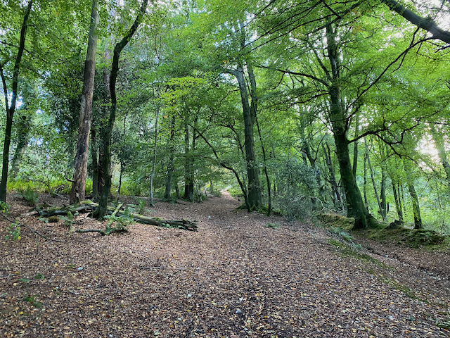
There is a network of paths in the woods, but we stay with the main path, which is the route of the Wessex Ridgeway, to reach the clear summit of Lambert’s Hill Fort.

We follow a clear path across the access land. Soon we spot the Ordnance Survey trig pillar and we make our way across to it. This is the 215th I have bagged.

There are some cracking views from this hillfort and we continue along the ridge and stop to look at the view towards Lyme Bay.

Nearing a tree line we turn right and head back to our starting point in the car park. Our wander around has been close to eight miles. Rather more road walking than planned, but the lanes have been quiet country roads and we have only seen a couple of cars.
To follow my walk you will need Ordnance Survey Explorer Map 116 Lyme Regis & Bridport
You can view this 7.75 mile walk and download the GPX File on OS Maps (OS Maps subscription required)
9th September 2020
© Two Dogs and an Awning (2020)
All information on this site is provided free of charge and in good faith and no liability is accepted in respect of damage, loss or injury which might result from it. To the best of my knowledge the routes are entirely on public rights of way or within areas that are open for public access.
Walking can be hazardous and is done entirely at your own risk. It is your responsibility to check your route and navigate using a map and compass.