

When we were looking for a place to stay on this trip I presented Lynnie with a list of potential locations, one of which was near Gillingham, the decision was quickly made. When at home Lynnie occasionally watches Escape to the Country, this is despite us living in a very rural location in Wiltshire. Anyway, one programme featured a couple looking to buy a property around Gillingham and Lynnie said she was surprised to see how attractive and interesting it appeared. So today we are walking from Wyndham Farm CL into Gillingham to see if it lives up to expectations.
Leaving the site we turn left along Waterloo Lane and follow this towards Silton soon passing Waterloo Mill and then continuing on to reach a road junction. Here we turn left into a lane called Pierston Fields. We are now on the route of the Stour Valley Way.
The Stour Valley Way runs for 64 miles between Stourhead and Christchurch we walked a small section a couple of days ago, but today we are going to follow it for a few miles. After passing Pierston Farm we turn right and pass Milton Farm and cross a river.
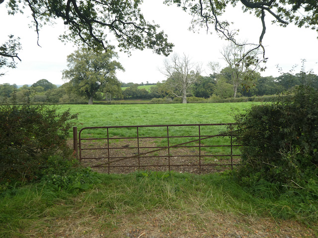
We continue heading south along the road and then as the road bends to the right we take a footpath on the left through a gate and continue across a field.

We stay with the Stour Valley Way to reach a minor road and cross and join Pound Lane and follow this into the village of Wyke. On reaching the B3081 we briefly turn right to view the old brewery building. From the early 1800’s this was the home of Matthews & Co and they produced ale for the pubs of Gillingham. The company was acquired by Hall and Woodhouse in 1963 and the brewery is now converted into residential accommodation.

We leave the Stour Way to head east along the pavement besides the B3081 towards the centre of Gillingham passing an old milestone along the way. Apparently this was erected in the 1800’s by the Shaftesbury & New Road to Blandford Turnpike Trust. It shows it is five miles to Shaston (Shaftesbury) and six miles to Wincanton.

At a junction with the B3092 we cross the road besides Plank House. During World War I this house was used as an auxiliary hospital to treat wounded troops.

After crossing the road we continue into The Square at the centre of Gillingham and then turn left to visit St Mary’s Church.

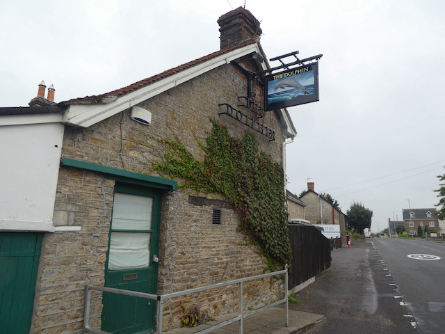
We now have a wander around the town before returning to St Mary’ Church and taking St Martin’s Road to head north out of the town. We follow this road to reach a junction with Queens Street, here we turn right still heading north to reach a roundabout close to a Co-op store. At the roundabout we take the B3092 heading towards Milton on Stour and follow the pavement to head out of the town, passing the Dolphin pub along the way.
We go straight across at the next roundabout, still besides the B3092 and then as we pass the last house the path goes inside the hedge line and continues on to pass the war memorial and entrance to a school. We stop to look at the church of St Simon and St Jude, built in 1868.

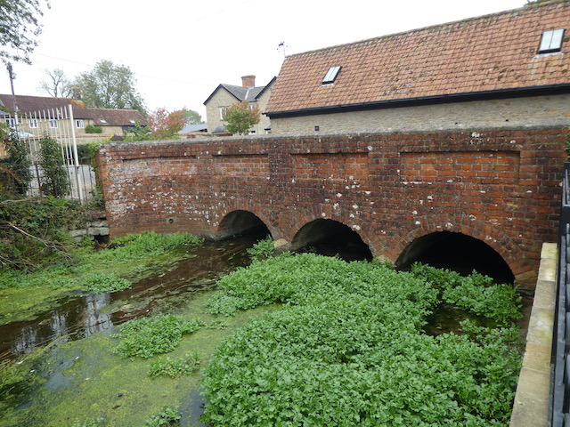
From the church we cross the road and head back south to reach the War Memorial and then turn right into the village along Post Office Road. At a junction we turn left on a lane signposted to Wyke. We stay with this lane to cross the River Stour.
On reaching the junction with Pierston Fields we turn right and retrace our steps back towards Silton. At Waterloo Lane we turn right and wander back to Wyndham Farm CL. Our walk has covered just over 6.5 miles and it was interesting to visit Gillingham. It was not as I expected from Lynnie’s description from Escape to the Country, nor did it meet her expectations. We decided there must have been some judicious use of camera angles there were a few old attractive buildings in the town but the more modern housing developments have not added to its charm.
To follow my walk you will need Ordnance Survey Explorer Map 129 Yeovil & Sherborne
You can view this 6.5 mile walk and download the GPX File on OS Maps (OS Maps subscription required)
22nd September 2020
© Two Dogs and an Awning (2020)
All information on this site is provided free of charge and in good faith and no liability is accepted in respect of damage, loss or injury which might result from it. To the best of my knowledge the routes are entirely on public rights of way or within areas that are open for public access.
Walking can be hazardous and is done entirely at your own risk. It is your responsibility to check your route and navigate using a map and compass.