

Somethings are a given when we stay at Brigholme Farm CL, top of the list is that during the stay I will walk up Ingleborough. Usually I manage it at least twice during our stay and I will definitely be there tomorrow when I take on the Three Peaks again. Lynnie does not share my enthusiasm for this mountain. She has walked it plenty of times and is usually reluctant to ascend it again. So imagine my surprise when she suggests we both walk to the top!
The route we are taking is via Ingleton, this is a walk we did back in 2018 with both dogs. Sadly Dexter passed away in the Spring so it is just us and Crosby heading up today. It is a route we stupidly attempted when the children were small. Lolly was in a buggy at the time and we did not get far!
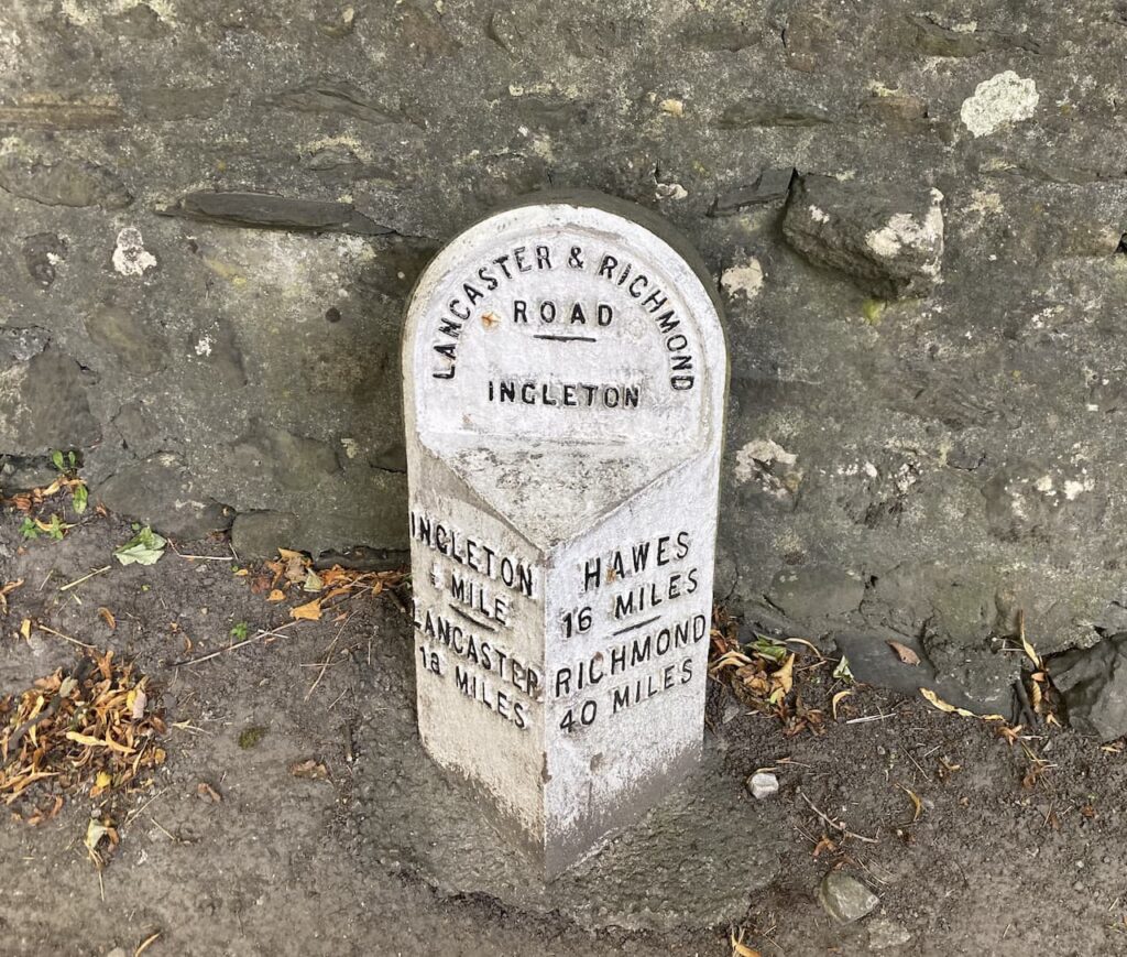
Today we start from the car park in Ingleton; this is the location of the Community Centre and Library and is also home to the Tourist Information Centre. We leave the car park to walk into Ingleton and then follow the road towards Hawes.
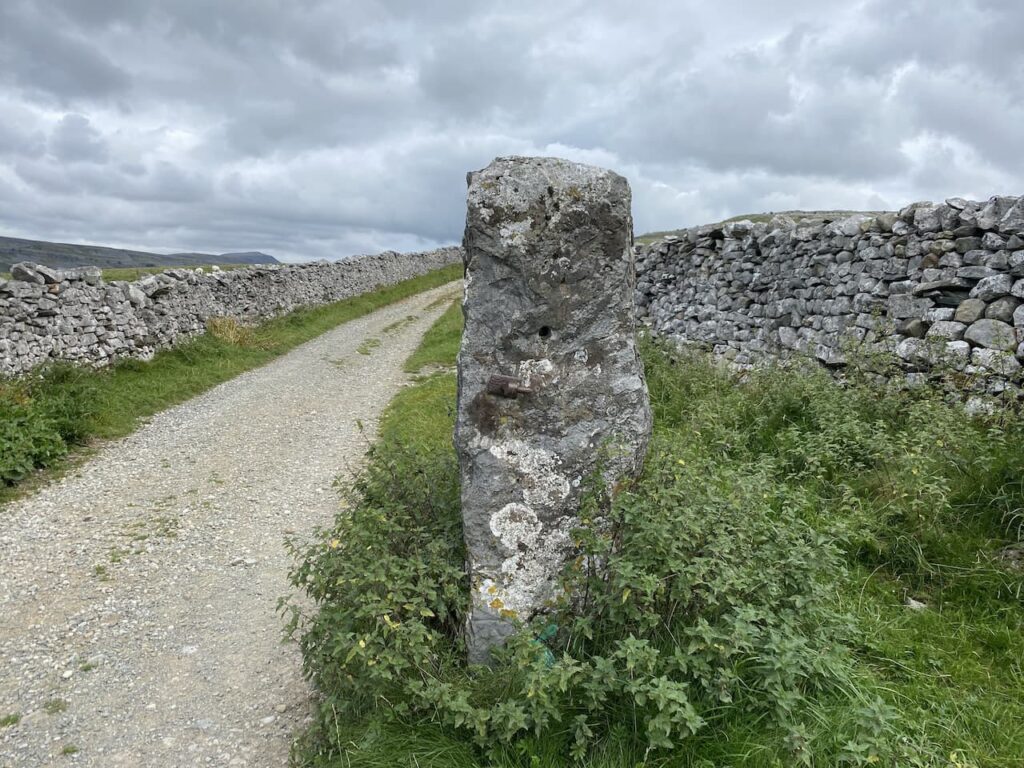
On reaching Storrs Common we fork right to follow a track continuing uphill across the common. At a fine old gate post with an Ordnance Survey benchmark we continue along the now walled track.
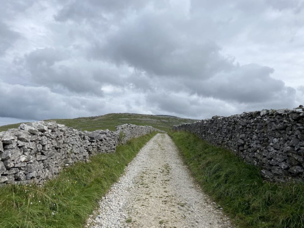
We follow the track uphill to join the wall-lined track, Fell Lane. This is an easy route to follow and pleasant walking on a fine day. I still find it hard to imagine why I thought it was a good idea to try and push Lolli up here in a buggy.
We go through a gate and the track continues ahead towards the remote farmhouse at Crina Bottom.
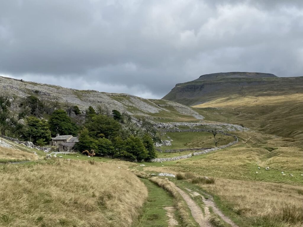
As we near the farmhouse the track forks to the right away from the farm driveway. The path is still well defined as we pass the stunning White Scars where we find a spot to stop for lunch.
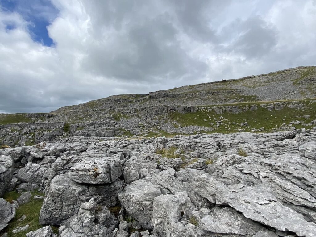
The other side of this scar is the entrance to the White Scar caves. These are said to be the longest show caves in England and contain the Battlefield Chamber which is 90 metres long. The caves were first discovered in 1923 by two amateur geologists. Christopher Long and J.H Churchill first spotted a small entrance which led to a waterfall. At that time they were not able to progress further, but over the years further discoveries were made. We visited the caves when our children were small. I am not keen on the claustrophobic feel of caves so will not be venturing in again.
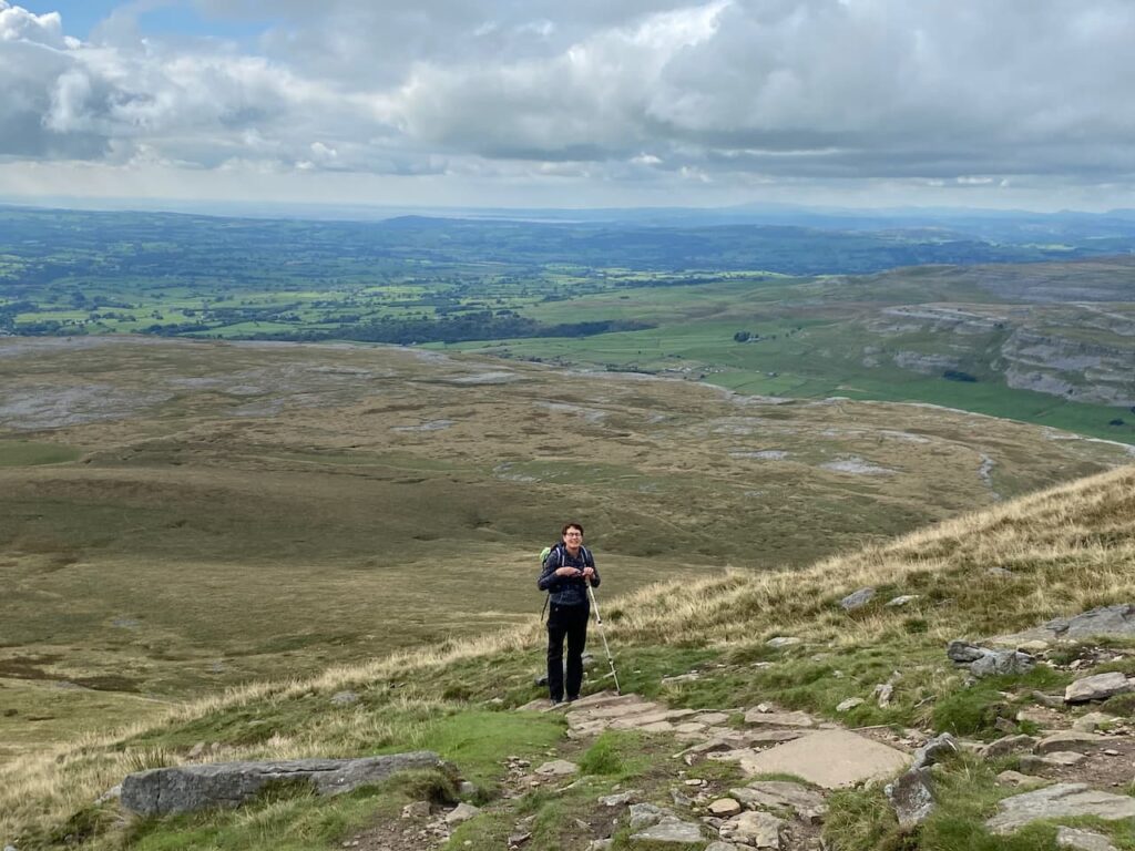
Refreshed from our lunch we continue up the path towards the summit of Ingleborough. The ascent is now steep and I am grateful for the hill walking I have done over the summer to prepare for a fortnight in the Dales. Lynnie is finding it hard going and is regretting suggesting we walk up here.
We arrive on the plateau at the top and walk over to the trig point for the obligatory photo. This is the trig I have visited most on my walks but I still take a picture every time I get here. Lynnie suggests I take her photo with Crosby because she has no intention of walking up this hill again. I am not sure if she means on this trip or ever again.
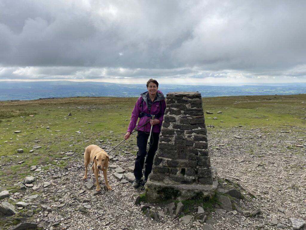
Whilst at the trig we are joined by a couple undertaking the Three Peaks Challenge, the chap is overjoyed at getting to the summit of the final peak. He explains that on his first attempt to complete the walk, on a hot day last year, he had to bail out after descending Whernside because he was badly dehydrated. A good reminder to ensure that I put an extra water bottle in tomorrow before I head off on my clockwise route around the peaks.

Our route off the summit is the path leading over Little Ingleborough. I know this route across the plateau well but decide it would be good to take a compass bearing from the trig to our descent route. Since doing a navigation course a couple of years ago I have made a habit of using a map and a compass to ensure I retain the skills for when I really need them. We leave the plateau by a cairn and start the clear descent across Little Ingleborough.
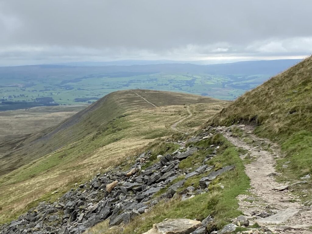
At the cairn on the summit of Little Ingleborough we leave the main track and take a footpath on the right. This is a lot clearer than the last time we walked it in 2018 and is easy to follow as it descends across Newby Moss.

Approaching Newby Cote I take a peek over the wall at the lime kiln. A few years ago I purchased an excellent book by Dr David Johnson on Lime Kilns in the Yorkshire Dales. It has provided a fascinating insight into the importance of these kilns on the agricultural development of the Dales. I now keep an eye out for these old structures as I walk around.

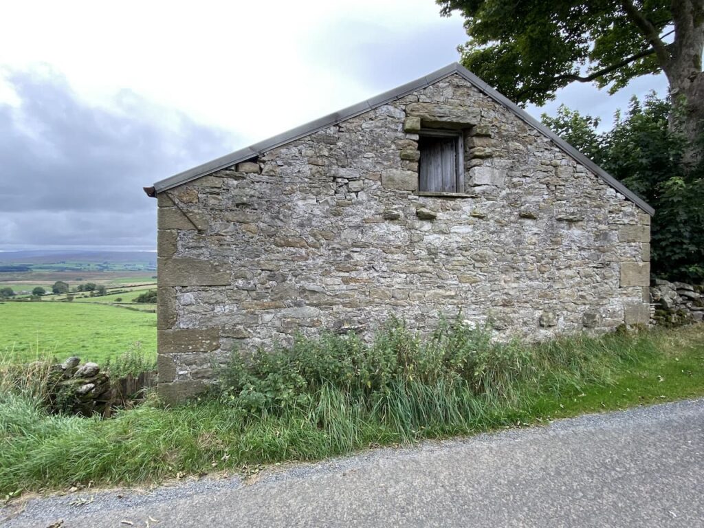
Following a farm track we reach a particularly high ladder stile besides a gate. The gate is locked and it is a real challenge getting Crosby over the stile without injuring him, or me! I understand wanting to keep the field secure, but do not believe it needs to be so challenging to access. We continue on a farm track to reach a minor road where we turn right beside some farm barns .

We head along the minor road (Old Road) towards Ingleton. This is a very quiet road and pleasant walking, it passes a collection of small farms and cottages. At each farm I keep an eye out for any sign of an Ordnance Survey benchmark. Details of all the logged benchmarks can be found on the ordnance Survey website, but I prefer to go “wild” and look for them as we go along. There are over 500,000 dotted around Britain so one is never too far away.

Entering Ingleton we turn left downhill to walk through the village back towards the car park. Our walk has covered close to ten miles. I think it has been a cracker and Lynnie is relieved to tick off Ingleborough safe in the knowledge she won’t be walking up there again soon.
To follow our walk you will need Ordnance Survey Outdoor Leisure Map 2 – Yorkshire Dales Southern & Western Area
You can view this 10 mile walk and download the GPX File on OS Maps (OS Maps subscription required)
14th September 2021
© Two Dogs and an Awning (2021)
All information on this site is provided free of charge and in good faith and no liability is accepted in respect of damage, loss or injury which might result from it. To the best of my knowledge the routes are entirely on public rights of way or within areas that are open for public access.
Walking can be hazardous and is done entirely at your own risk. It is your responsibility to check your route and navigate using a map and compass.