

Yesterday I promised Lynnie a walk through Crummack Dale and then whilst walking decided to alter the route to take a trip over Ingleborough. The pie and pint in the Talbot in Settle last night provided some compensation, but now I need to deliver the walk Lynnie had been expecting. So we are off to Clapham again to complete a curricular walk through Crummack Dale.
Like yesterday the walk starts by heading towards Clapham village church and keeping it on our left leave the village though the tunnels besides Ingleborough Hall. Following the track uphill we are soon at a junction of paths where we keep straight on along Thwaite Lane.
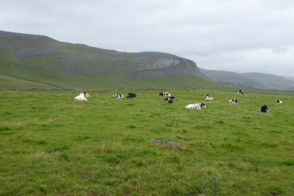
We pass a field of cows below Robin Proctor’s Scar nearly all are lying down. It may be an old wives’ tale, but I take this as a harbinger for more wet weather.
We stay on Thwaite Lane right the way to the end. When the track meets a road we go straight across continuing on a track until we reach a second road. Here we turn left towards Wharfe. On reaching Mill Bridge we turn left just before the road crosses a brook. This track leads us on a winding journey into Wharfe which is a delightful hamlet.
After passing the Manor we turn left and then left again along a track that runs along the top of the village towards Crummack. We stay on this track as it winds it’s way below White Stone Scar, stopping to admire the views into the Dale.
Just before reaching Austwick Beck we fork off to the right to follow another track between dry stonewalls. This route leads through bracken and just as we turn towards Studrigg Scar it starts to drizzle. Today’s forecast suggested that once it started to rain it would continue all afternoon, so we decide to clad ourselves in waterproofs.
Passing through a gate, where the wall on one side has fallen into disrepair, the track continues and swings to start climbing towards the scar face . There looks like there is no way through but as we go through a gate a clear path becomes visible and we follow this to the top of Moughton Scars. This is a cracking spot. On one side stunning views across Crummack Dale and then as we turn there is a huge expanse of limestone pavement flowering with heather.
Our route continues through the limestone pavement, passing grouse butts to reach a ladder stile. We cross and then turn left to follow a path alongside the wall. The weather is now miserable but thankfully the rain is at our backs. Through a gate and across a field we arrive at a junction of paths. We turn left heading towards Ingleborough and the wind and rain are driving in from our left.
On reaching a crossroads we turn left towards Sulber Gate. We are now walking directly into the wind and almost horizontal rain as we follow the Pennine Bridleway towards Long Lane. The low cloud makes it difficult to get a view of Moughton Scars and Crummack Dale to our left.
At the gate for Long Lane we go straight through and follow this track back towards Clapham. As the name suggests it is a long straight lane.
Along the way cows in the adjoining field observe us closely. They look fine with a wall between us but I would not venture in with the dogs.
At the end of the lane we turn right onto the track that leads downhill and through the tunnels to return to Clapham.
Our walk has covered ten miles, it is a real cracker even in the wet and windy conditions. We now need to head back to Brigholme Farm CL to try and get our waterproofs and dogs dry!
To view this walk on OS Maps Click Here
To follow our walk you will need Ordnance Survey Outdoor Leisure Map OL2 – Yorkshire Dales – Western Area
7th September 2017
© Two Dogs and an Awning (2017)