If I am totally honest there are many things that I use whilst not understanding how they work. When it comes to things like the car I comprehend the principles of the combustion engine and the mechanics of how it is constructed. However, I would not for one minute consider doing anything more technical than cleaning it (occasionally), putting fuel in it and checking fluid levels and tyre pressures.
There are parts of the car that I just don’t understand the workings of; one being the satellite navigation system, I know how to press the screen to get the information into it, but don’t understand how it works out how it will get me from one location to another.
Sometimes the little chaps determining the route think I would prefer the shortest route, even if this involves driving down incredibly narrow lanes. Other times it thinks lets direct him to the most major road possible even if it takes him thirty miles in the wrong direction to start with. The solution is to carry an old road atlas and trust in my navigator to take me from our current location to our planned destination.
Today our planned destination is Dunkery Beacon on Exmoor about 25 miles away from our site in a North Westerly direction. We set off on the route I have agreed with my navigator and for good measure programme the “sat-nav” as back up. We drive through Wellington chatting away and I keep an eye on the screen, without instruction from my navigator I follow the muted screen. I then realise we are heading South Westerly, but by this time we are so far along the route that it would take almost as long to turn around so we follow the sat-nav.
After a while we are heading up the Exe Valley, had I planned to go for a beautiful scenic drive this would have been the ideal route, but we want to walk before it gets too dark. Then the road is closed and we are diverted towards Dulverton, quickly the diversion signs end and we are left to fend for ourselves. Do we gamble and try and rejoin our original route a few miles further up or do we take a long arc to ensure we can keep going?
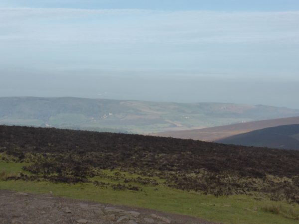
Opting for the latter we end up in Exford, a delightful location, but not on our planned route! From here it is not too far to the car park besides the minor road just to the east of Dunkery Hill. To the east there are fine views towards Dunster and beyond, we are heading west to the Beacon on top of the hill.

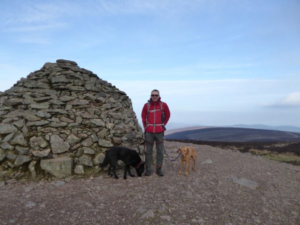
We follow the road briefly before picking up the well-worn track on the left to climb steadily towards the Beacon. This is an exposed spot and the wind adds a decided chill factor, stupidly I left my bonnet in the car so have cold ears! We soon reach the top and enjoy the panoramic views.

Dunkery Beacon sits on top of Dunkery Hill and at 1,705 feet is the highest point in Exmoor and Somerset. Of course, we have cheated a bit by parking half way up the hill because we do not have sufficient daylight to start from a lower point. The hill is littered with Bronze Age burial mounds and remnants of settlements.
This is the first time I’ve been up here, we have seen it in the distance whilst walking in the area, but never ventured to the top. It is a busy location being the meeting point of a network of paths and tracks, but it is too cold for folk to hang around so although there are a dozen folk there when we arrive within minutes we are on our own.

Colonel W.W. Wiggin donated the hill and 960 acres to the National Trust in 1932 and a Mrs. Hughes donated a further 945 acres in 1934 in memory of her husband Alan, apparently they lived nearby in Lynch Allerford, Minehead. A plaque on the beacon commemorates these generous donations.
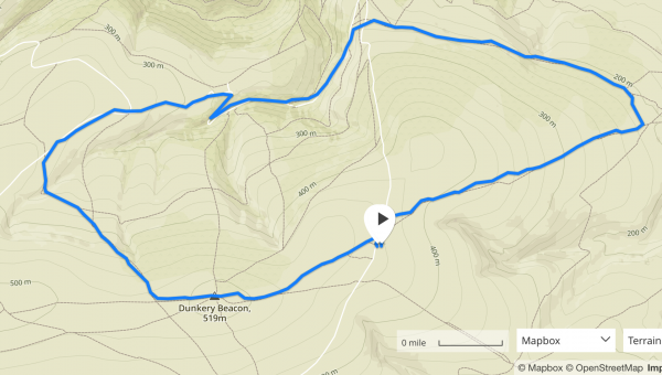
Leaving the Beacon we continue west and after about a quarter of a mile take a path on the right that leads downhill across Goosemoor Common.

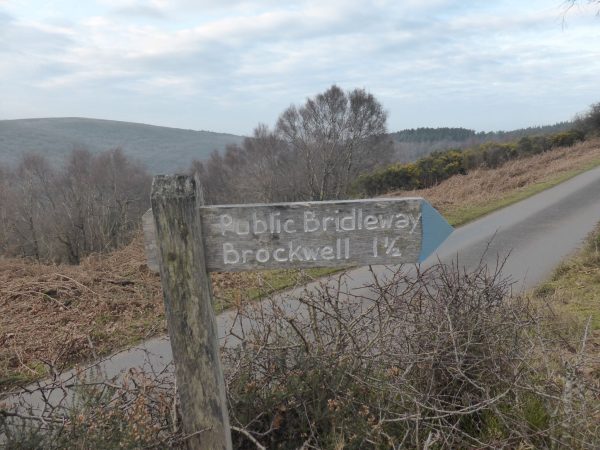
This brings us to a track and we turn left to follow this through Bagley Combe then climbing to reach a minor road. Turning right on the road towards Cloutsham Gate, we carry on along the road through Cloutsham and then steeply downhill, still on the tarmac road, to reach the bottom of East Water Valley. This route takes us across a ford and then starts to climb steeply we ignore a couple of paths on our right. But then take one that is signposted to Brockwell.

This path soon crosses the minor road leading from Dunkery Hill and then carries on towards Brockwell. The well-defined route is easy to follow, there are paths leading away to our left and fainter tracks to the right. The mist is beginning to descend on the hill above us so we decide on caution and stick to main tracks. Just short of Brockwell we take a path on the right following around the hill until it joins with another well-defined path climbing up Dunkery Hill from Brockwell.
It is getting late in the afternoon and with the mist descending it will soon be getting dark so we press on up the hill. The only stop is for Lynnie to take a picture of sheep with a lamb. This is her first sheep picture of 2017, but I am sure it will not be her last.

For the last mile we are shrouded in mist and with the failing light it starts to get a bit eerie. This is not a place I would want to be after dark. Our route is clear and well marked and we can see car lights on the road in the distance, a welcome sight. It is with relief that we reach the car. Darkness is falling; we have head torches in the rucksack, which were nearly required.
We have walked close to seven and a half miles. Relatively short by our standards, but there have been a couple of good climbs and the convoluted journey here and failing light cut down our walking time. The next time we are here I hope for a clear day so that we can get the full benefit of the views.

17th February 2017
[To follow our walk you will need Ordnance Survey Outdoor Leisure Map 9 – Exmoor.]
© Two Dogs and an Awning (2017)
