

We have decided to get away for another week in the caravan. We have not been shopping since the start of the Covid 19 pandemic relying on home delivery instead, we have worked out we can get a week’s supply of food in the caravan without needing to visit a supermarket.
As we are only away for a week I am keen not to drive far, so we are exploring more of Wiltshire and have found a pitch at Horse Lane Farm CL, just outside the village of Rowde near Devizes. It is only a thirty mile journey, so within an hour of setting off we are pitching up. Once everything is sorted the boots are on and we are off for a wander from the site.
Leaving the CL we turn right to take a farm lane and follow this to a gate which we go through and continue across a field. From here we get a good view of Oliver’s Castle Hillfort. This is an Iron Age Hillfort originally known as Roundway Hillfort. Apparently during the English Civil War the battle of Roundway resulted in Parliamentarians fleeing the Royalists and inadvertently riding their horses over the steep edge of the hill fort and falling to their deaths.

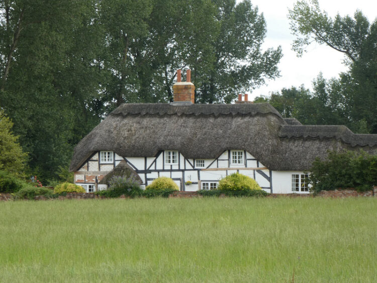
We continue across the fields with an attractive thatched cottage to our left, soon reaching a gate onto a track which we follow to a minor road where we turn left.
We follow the minor road past Durlett Farm and then Lower Durlett Farm and then take a footpath on the left along a wide grassy track.
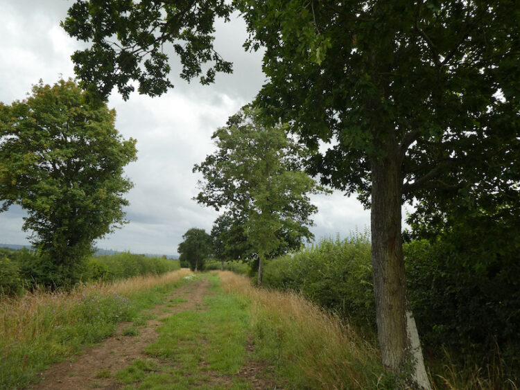
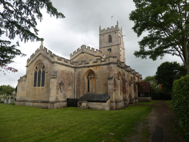
We stay with this track as it sweeps to the south to reach a minor road. Here we turn left and follow this country lane for a mile to reach Rowde. In the village we take a footpath to St Matthews Church. This is a large church for the size of the village. The tower was built in the 15th century but the rest of the church dates from the 1800’s when it was totally rebuilt.
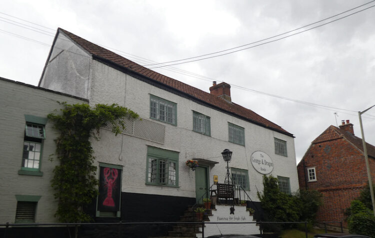
From the church we wander through the village passing the two pubs. First the Cross Keys which was built in the 1930’s to replace a pub that had burnt down on the same site, and then the George and Dragon which dates back to the 16th century. Sadly we will not be visiting either pub on this visit.
Our route now heads north out of the village on the pavement besides the A342 for just over half a mile. Our little wander has covered just short of four miles and has given us a feel for the area. Now it is time to settle down to plan walks for the next few days.
To follow my walk, you will need Ordnance Survey Explorer Map OL157 Marlborough & Savernake Forest
You can view this 3.8 mile walk and download the GPX File on OS Maps (OS Maps subscription required)
26th July 2020
© Two Dogs and an Awning (2020)
All information on this site is provided free of charge and in good faith and no liability is accepted in respect of damage, loss or injury which might result from it. To the best of my knowledge the routes are entirely on public rights of way or within areas that are open for public access.
Walking can be hazardous and is done entirely at your own risk. It is your responsibility to check your route and navigate using a map and compass.