

When away we try to shop at a local butcher’s or farm shop. I have found that a local butcher is usually a good source of information, including where to walk. There is a cracking butcher’s in Blairgowrie, H.W Irvine. When I popped in earlier this week to buy one of their award winning pies we got into conversation about walking and I was given a few tips of places to go.I have in mind a walk up Schiehallion, a Munro that features in my 100 Great Walks book. We have done a few walks from the book and they all, apart from the walk from Braemar up Morrone a couple of days ago, rank highly in our 100 worst walks. When I mention my plans to the butcher, he doesn’t try to dissuade me but says it is just an up and down route and quickly starts talking about other walks.
I get the impression this might not be the ideal walk to tackle today and being my forty-nineteenth birthday opt for a pleasant stroll. A few days ago we popped into Dunkeld and it looked an interesting place, so I suggest to Lynnie we walk from there and then have a wander around.
We start our walk from Birnam heading west along the Perth Road back towards Little Dunkeld. On the way we pass the Beatrix Potter Garden, Lynnie is keen to have a look around later. At a road junction we turn right and then almost immediately take a left passing the Doctor’s surgery and continuing on a path with playing fields to the right.
We go under the A9 and carry on straight ahead, not crossing the River Brann, we soon reach a minor road and turn right towards Inver Bridge, there is a caravan park over the wall to our right. At Inver Bridge we do not cross the bridge, instead we fork left up the hill to reach Inver Brae car park.
Walking through the car park to a gate we see a notice stating the footpath to The Hermitage is closed because of a landslip. This is the route we planned on taking, sometimes in such circumstances a local will tell you it is still passable, in the absence of any locals to tell us otherwise we decide a path through a gorge with a landslip is not for us!
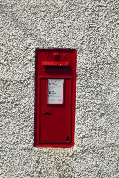
The map shows an easy alternative route, so we turn around and walk back down to Inver Bridge, this time we turn left and cross the bridge and walk into Inver. This is an attractive hamlet and one of the houses has a Victorian post box in its wall.
The lane leads to The Hermitage car park, it is at this point that we realise the schools in Scotland have broken up for the summer holidays. We are used to school holidays starting towards the end of July.
We go through the lower part of the car park and through a tunnel under the railway to continue alongside the River Braan. This is a well-worn path and it is busy, not the type of walk I had envisaged.
It is not too long before we reach a bridge over the river, the path from Inver Brae would have led us to the other side of this bridge, but it is clearly closed. The Black Linn Falls are here and, as always in such locations, there are youngsters clambering over the rocks trying to get as close to the falls as possible. Besides the bridge is a folly with a viewing platform providing a stunning view of the river, far safer and better than risking life and limb!
The folly, known as Ossian’s Hall was built for the 2nd Duke of Atholl in 1757 and is a stunning building, unfortunately, with so many people about it is not easy to linger here with the dogs.
Continuing our walk alongside the river we soon reach Ossian’s Cave, or the Hermit’s Cave, built around 1760. Apparently at the time attempts were made to recruit a hermit to occupy the cave as an attraction, they were unsuccessful. What is not clear is why you would think a hermit, by definition someone seeking solitude, would want to be an attraction for people to gawp at. No wonder the recruitment failed!
These woods contain a number of Douglas Fir Trees reportedly some of the tallest trees in Britain.
We continue along to a junction of paths with a wall in front of us and turn left on a path marked “Braan Path to Rumbling Bridge”. We go over a footbridge and then through a gate to cross open grazing land passing an interesting rock formation to the right. I am not sure if the rock has been placed on top of the other two or whether it has eroded that way over time.
A kissing gate leads to a minor road and turning left we soon reach Rumbling Bridge, after crossing the old stone bridge we get glimpses of the waterfalls flowing into the gorge.
A hundred yards along the road we turn left onto a path marked with a green arrow. This goes uphill through the trees to a viewpoint over the gorge. I should know by now that a walk with a viewpoint near a gorge is not likely to be one where I am comfortable.
Trees obscure the view but in any case I didn’t intend getting anywhere near the edge. We continue through the woodland and thankfully the way does not get too close to the edge of the gorge. On reaching a road we go straight across taking the track opposite.
This goes steadily uphill and at a junction of tracks we turn left following the ‘Braan Walk’ way marker leading around Tomgarrow.
At a gate we head into woodland, just before reaching a house we fork right onto a footpath passing the house to cross a small bridge and then through a gate into Ladywell Plantation. On reaching a forest track we turn left, following the way markers, and keep on this track as it descends through the woodland to reach the A822. We cross the road to join a path opposite that briefly goes through trees before reaching the minor road close to Inver Brae car park. From here we retrace our outward route back towards Birnam.
As we go through Little Dunkeld we decide to wander up to the War Memorial and take a breather before contemplating the second stage of our walk. It is always a risky business walking a loop that gets close to the car Lynnie is invariably disappointed in such circumstances. I am constantly reminded, indeed berated, about a walk we undertook in the Peak District in 2014, at one point we could see the car in the distance but turned away from it and walked for another couple of hours!
So it is with trepidation that I mention to Lynnie that I have plans to add another small loop to our walk. (Small is not a precise term in such discussions and can describe anything from two to six miles!) For some reason Lynnie feels the need to take a “Birthday Selfie”, I am not into this fad so it takes some persuading to get me to look at the camera.
We walk back into Birnam, stopping to visit the Beatrix Potter Garden. The author spent childhood summer holidays in the area and drew inspiration for some of her characters here.
From the gardens we walk up Station Road, passing the Arts Centre and follow the path as it goes under both the A9 and the railway line. We turn left along a tarmac lane and follow the signs for the Birnam Hill path. The lane passes a number of houses and then as it sweeps to a driveway of a house, we continue along a path which forks to the left.
The path heads through trees and climbs around the back of disused quarries (no steep drops to worry about) and then enters a section of tall fir trees.
On reaching a forestry track we turn left and when we see an arch under the railway line we turn right up a well-defined path. This climbs steadily. It is a warm afternoon so the dogs are grateful when we reach a small stream so they can have a drink.
At a junction we ignore a path on the left marked for ”Pass of Birnam’, and carry straight on. At another junction we take the path on the left, signed to Stair Bridge Viewpoint, this is a short detour to admire the ornamental Stair Bridge and the fine views.
Once again the word viewpoint should have been a warning, there is a drop here that I try to ignore, luckily it is helpfully masked by trees. I am still relieved when we return to the main path and continue climbing up the hill. The way is now more exposed on open moorland and we are grateful for the breeze.
The path is clear and follows a route that contours to the right of Birnam Hill. At a marker post we turn left onto a path that soon climbs steeply to the top of Birnam Hill. The summit is known as King’s Seat, compared to many of the hills around here this is not high, 1325 feet, but it is still a good climb rewarded by stunning views from the cairn.
Initially the route down is on a short, steep, rocky path that then crosses a boggy area; thankfully it has been dry so it is not too bad. The path then leads through trees to reach a rocky outcrop overlooking Dunkeld. This is definitely a spot where I am steering clear from the edge!
The path then descends steeply, it is one of those routes where the knees take a bit of a bashing, so we take it steady. Eventually the path reaches more level ground and we turn right to follow the track back to the point where we initially came under the railway line and the A9 to head back into Birnam.
Our two walks have covered just over ten miles, with the first loop being slightly longer than the second. It has been a warm day and a cracking walk so it is time to head back to Quarryhill CL and crack open a cool, birthday beer.
To view this route on OS Maps Click Here
To follow this walk you will need Ordnance Survey Explorer Map 379 –Dunkeld, Aberfeldy & Glen Almond
5th July 2017
© Two Dogs and an Awning (2017)