It is another cracking day weather wise, time to get the boots on and go for a decent walk. Lynnie’s back is still giving a bit if discomfort after her fall last week, so we plan a walk which is mainly flat.
We walk from the site into Durham and on reaching the Marriott hotel turn left up the hill and at the fork in the road go right. Through the churchyard where we greet an old chap out for his daily walk, we are treated to the response “It’s a grand day for a gallop”. Indeed it is. We descend to the river and follow this until we reach the Prebends Bridge, built in 1778 it is now used only for foot traffic.
After the bridge we leave the river on the footpath that slopes up the hill on the left and emerge on a road by Durham School. From here we follow a series of roads and footpaths until we reach the B6302, which we follow for half a mile, after crossing the main railway line we take a footpath onto the disused Lanchester Valley Railway. Soon we join the Deerness Valley Railway Path.
The Deerness Valley Railway was an eight mile branch line that ran along the valley of the River Deerness to serve the collieries alongside the route. The line opened in 1858 and started taking passengers in 1877 with stations at Waterhouses and Esh Winning, later in 1884 a station was opened at Ushaw Moor.
The number of collieries in this stretch is amazing to a chap from a non-mining community. The eight miles of track served seven collieries with pits at Ushaw Moor, Waterhouses, Hamsteels, Esh, Cornsay, New Brancepeth and East Hedley Hope.
Our walk takes us by two of these mining villages, New Brancepeth on the left and Ushaw Moor on the right, but before we reach Esh Winning (what a cracking name) we leave the railway path and walk to Hag House Farm, as we climb we get a view of the valley and there is no obvious sign of the mining past. After walking through Hag House farmyard we continue up hill towards a track that with a left turn takes us to Esh Hall.
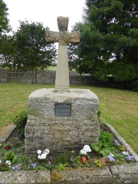
At the Hall we turn right on to the drive and walk down towards Esh village. Just after the gates of the Hall we spot a cross, apparently this is known locally as St Cuthbert’s Cross and dates to 1687.

On reaching the road we consult the map, there is a footpath along here somewhere but no sign. A friendly local points the way, clearly this is another of those footpaths that the landowner would prefer unused. We walk through a yard and a gate leads us down hill through a couple of fields packed with horses, one of which, much to Lynnie’s consternation, decides to follow us closely for a while.
We emerge onto a track taking us down to a road, a left turn and after a few hundred yards we take a farm track on our right, skirting the farm we arrive at the Lanchester Valley Railway Path. Here we turn right and head back towards Durham.
The Lanchester Valley Railway opened in 1862 and was initially built to carry iron ore from Middlesbrough to the Consett Steelworks. The track was twelve miles long and operated a passenger service until 1939.
Soon after joining the path we skirt Langley Park with its rows of old terraced houses and then we come to Diggerland, billed as “A fantastic day out for the whole family”. I offer Lynnie the opportunity to explore this delight, but she declines. So we continue on our own fantastic day out.
At we approach Bearpark we take a footpath on our left towards Bearpark Hall and follow the track down to a minor road, turning left we head up to and cross the busy A167 then follow the signs to lead us back to the centre of Durham.
Our walk has been almost sixteen miles and it has indeed turned out to be a “Fine day for a gallop”. Tomorrow sees us heading north towards the Scottish border so time to once again start packing.
To follow our walk you will need Ordnance Survey Explorer Map 308 – Durham and Sunderland
You can view this 15.5 mile walk and download the GPX File on OS Maps (OS Maps subscription required)
2nd July 2014
© Two Dogs and an Awning (2014)
All information on this site is provided free of charge and in good faith and no liability is accepted in respect of damage, loss or injury which might result from it. To the best of my knowledge the routes are entirely on public rights of way or within areas that are open for public access.
Walking can be hazardous and is done entirely at your own risk. It is your responsibility to check your route and navigate using a map and compass.
