

Following my walk with Crosby earlier today it is now time to head out again with Lynnie and Dexter for a shorter walk in nearby Horner Wood. These days Dexter struggles to walk very far, he was okay on yesterday’s twelve-mile walk to Dunster but he is not able to do that distance everyday.
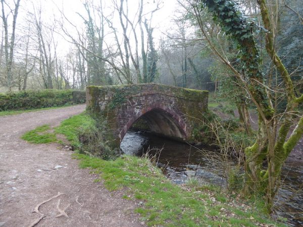
Horner Wood is only a short drive from the caravan site so it is not long before we are lacing up the boots and heading out of the National Trust car park to join the road by the National Trust tearoom. We turn left as the road sweeps to the right and walk along the track to cross the old pack-horse bridge.
We now follow the path through Rey Combe with Horner Water to our left.
We cross the water at a footbridge on the left.
There is a network of paths here, we follow one that initial has the water to our right.
After a short distance it forks to the left uphill through the trees.
We now join a footpath that heads steeply uphill whilst providing some stunning views.
The path reaches a clearing with even more impressive views.
The route now takes us through a car park at Webbers Post. After crossing a couple of minor roads we take a footpath on the left leading down a track towards Luccombe.
On reaching a gate we do not go through but instead turn left along the edge of the bottom of Luccombe Plantation with a herd of sheep walking in front of us.
On reaching a gate to join a minor road we turn right to wander down to Chapel Cross. Here we take a few moments to stop and look at the remains of the medieval St Andrew’s Chapel.
Our route continues by taking a gate at Chapel Cross leading to a track that heads along the edge of Horner Wood and leading back to the village.
Back in Horner we return to the car park having completed almost four miles. As we are taking our boots off we get into conversation with a couple walking their dog. It transpires they are fellow caravanners staying at the site in Horner, what started as a quick hello ends up as a twenty-minute interesting chat. I do enjoy these chance encounters with strangers.
To view this four mile walk on OS Maps Click Here
To follow this walk you will need Ordnance Survey Outdoor Leisure Map OL9 – Exmoor
29th March 2019
© Two Dogs and an Awning (2019)