

Over the years Lynnie and I have adopted differing ways of predicting the weather. I tend to opt for the look out of the window approach, if there are dark clouds then we might get some rain, when we are home it is a bit more sophisticated. If I can hear the trains a few miles away to the South West then there might be rain later. Lynnie favours the look at the BBC Weather app approach, this uses modern technology and meteorologists to forecast.
Packing the rucksack for our walk today I ask Lynnie if she thinks we will need our waterproof over-trousers. They normally reside in the bottom of the bag, “just in case,” but for some reason I have taken them out. I am reliably informed it is going to be a dry day. That’s good enough for me!
Our walk starts from opposite the Cotton Arms at Wrenbury-cum-Frith we walk the short distance along the road to Wrenbury Bridge and turn left along the canal towpath with the Dusty Miller pub on our left. It is Saturday afternoon and a few folk are enjoying the countryside, but after about half a mile we have the towpath to ourselves.
The canal is busy today. There appear to be a number of groups being shown how to use the barges they have hired. I have not previously thought about it, but obviously anyone can hire a barge and it would be mayhem if they were not given a few basic instructions and shown how to operate a lock.
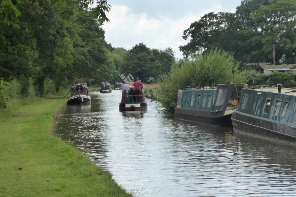
As we walk along we speculate how long it will be before various parties fallout with each other. One barge manned by several young people has all the chaps at the back, glasses in hand, while the female members are in the galley. All terribly stereotypical and we predict it is bound to end in disaster.
We soon pass Wrenbury Frith Bridge, this is a lifting bridge, but has been left up. Whether intentionally it is difficult to tell.
After passing under Thomason’s Bridge (No 22) we reach Church Bridge (No 23) where we cross the canal. This bridge is right by Marbury Lock with it’s lock keepers cottage.
We head under Steer Bridge (No 24) and approaching Quoisley Bridge (No 25) we hear a rumble of thunder and the sky looks a little ominous, but the oracle has told me there is no likelihood of serious rain so I am not too bothered.
Arriving at Willey Moor Lock we stop to watch a barge pass through. To my untrained eye this always looks to be a complicated and physical process. The lock has a rise of six feet, and it takes a while for the barge to pass through.
We are in no rush and had the Willey Moor Lock pub been open we would have stopped for some refreshments and watched the passing barges.
Leaving the canal we turn left to cross it and then pass the pub car park to join a lane heading to the A49. There is a small caravan park on our left and we are half way along the lane when the first drops of rain splash down. Within seconds I realise we are in for a sharp shower, but it comes so quickly that I am struggling to get our jackets out of the bag.
There is absolutely no shelter here and the rain is torrential so we head to the A49, cross and turn right then almost immediately left up a tarmac lane and shelter under a tree. We are absolutely drenched and the rain soon turns the road into a bubbling torrent of water rushing down the hill. It takes about fifteen minutes for the storm to pass. Resuming our walk is an unpleasant experience, soaking wet trousers sticking to your legs is no fun!
We have now joined the Bishop Bennet Way, a thirty-five mile route named after William Bennet (1745-1820), Bishop of Cork and Ross and the Bishop of Cloyne. Apparently he conducted a survey of Roman Roads in the area.
Our route is uphill along the tarmac lane, which soon becomes a track as it heads towards Wirswall. The path is clearly marked and the only challenge is the thick mud created by the sudden downpour.
In Wirsall we follow a way-marker to turn right at a junction. We are still soaking and the map is tucked away in the rucksack, I know we follow the road for a while and there will be an option of a path on the right soon. The sun is now breaking through and we are drying out, or steaming, thank goodness for decent walking trousers! At a footpath we decide to stay on the road (which turns out to be a wise decision) and then almost half a mile later we are on the edge of a golf course.
It is time for me to consult the map; I do not recall a golf course on our route! I immediately realise that my instinctive feel back in Wirswall was a mistake and we are approaching the outskirts of Whitchurch. This is probably a very pleasant town, but it is not on our route today! So we turn around and trudge back to Wirswall.
It is unusual for us to make a mistake on our walks, but when we do it is not forgotten. I occasionally (about twice a week) remind Lynnie of the time (when she was navigating) that we added a couple of hours to a walk in North Wales because we were heading to a power station rather than the desired railway station! Somehow I think this slight mishap will be used against me in the future. Perhaps I should start using the OS digital map on my phone. I have subscribed to this for months but not put it to use. I prefer good old-fashioned paper maps and have a collection of over one hundred and sixty explorer maps.
Back in the middle of Wirswall we continue on the tarmac lane following the road out of the village. We have decided to walk along the quiet country lane, it is firmer under foot and we can make up some lost time. Thankfully we are almost dry as we reach the top of the hill by Wickstead Hall. The views from here are cracking.
This is a pleasant lane to walk along and the hedgerow is full of blackberries and cobnuts. I think this a harbinger for a hard winter, whereas Lynnie suggests its an indicator of a good summer. Time will tell! Passing a stunning old barn at Quoisley Hall we continue on towards Marbury.
In the village we turn left down School Lane and follow this down to rejoin the Llangollen Canal at Church Bridge. Here we turn right and follow the towpath back to Wrenbury-cum-Frith.
It has been an eventful walk of just over eleven miles, so we decide to pop into the Cotton Arms for a sharpner. It is a busy pub with a wide selection of real ales, usually in such circumstances I opt for a local brew, but today the choice includes The Reverend James, one of my favourite beers and it is a while since I had a draught pint. I am not disappointed!
To view this walk on OS Maps Click Here
To follow this walk you will need Ordnance Survey Explorer Map 257 – Crewe & Nantwich
22nd July 2017
© Two Dogs and an Awning (2017)