

We have been at home for almost two weeks and I have cut the grass (several times) and done other chores, although Lynnie insists there are more to do, but I am getting restless for a decent walk. We have a couple of family events to look forward to over the coming weeks so a trip away in the caravan is not feasible. I have covered all my usual walking routes (and strimmed one because it was overgrown) so have decided to go for a bit of a jam about today.
It is odd that whilst away I walk for miles from the caravan, but at home I do my familiar routes with the dogs, they are all decent walks of an hour or two, but covering the same territory. Don’t get me wrong I am never bored walking these paths I have walked for the past fifty years, but occasionally I wonder what is a bit further afield.
There is also something different about walking with a rucksack, immediately it is on my back I feel like I am going for a proper walk. I am fortunate to live in good walking country. If I didn’t we would have to move. The Clarendon Way passes our doorstep; this is the twenty-five mile route between the Cathedrals of Salisbury and Winchester. I half consider doing this walk, but the logistics of doing it on my own defeat me so I settle for a stroll that expands the usual boundaries of my walking.
My starting point is Pitton’s village pub, the Silver Plough. I head out of the village along The Green on the Clarendon Way towards Winchester, or to be more accurate Winterslow and soon pick up the drove that goes over the downs to reach West Winterslow.
As I enter the edge of the village I turn left on the track that leads up to the church, until this point the dogs were covering familiar ground, but when we cross the road to walk besides All Saints Church, they are slightly confused. This church is only a couple of miles from my home but in almost sixty years I have never stepped inside. This is unusual, as I have attended weddings or funerals in most of the village churches hereabouts.
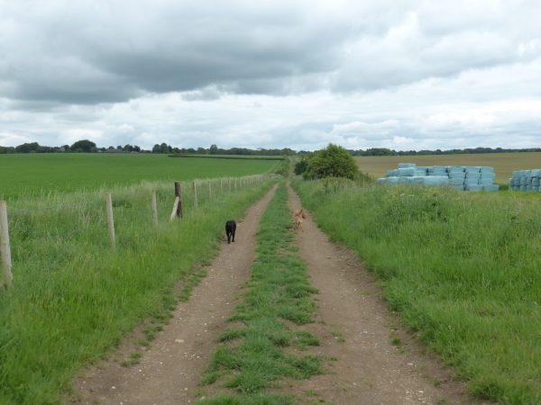
Walking past the church there are numerous options of footpaths. I take the one waymarked for the Clarendon Way and head along the top of the down with views over Dunstable Crossroads and Firs Down. It is odd to view such familiar places from a new perspective and I am still only two miles from home!
The Clarendon Way continues through woodland and then arrives in Middle Winterslow. On reaching the road I turn right and carry on ignoring roads to the right and take the first footpath on the left, heading down a fenced path between houses and into fields. At a fork in the path I take the left option and go into an arable field with a water tower slightly to the left of the path.
At a crossroads of paths I turn right joining a bridleway leading back into Middle Winterslow at the top of Gunville Hill. I walk down the hill and take the first turning on the left, Witt Road. I recall going a couple of hundred yards down this lane some forty years ago, but have never ventured further. On the corner is the Church of St John the Baptist, another church I have never entered.
Alongside it is St John’s Schoolroom.
I head along Witt Road; I am amazed at the number of thatched cottages that I didn’t know existed along this lane. At the end of the lane I enter Bentley Wood. I have walked in these woods previously, but usually from Farley or Tytherley. There are a network of paths in the woods and for me they have always been a bit of a maze. Today I am heading towards East Grimstead which lies to the southwest. I check the sun and use that as my compass.
To put this into context, I am not talking about a few trees; Bentley Woods along with neighbouring Blackmoor Copse covers over 1,600 acres. A man could easily get lost in woodland this size if he did not have his wits about him! It is at moments like these that I am grateful for the full survival kit in my rucksack!
After a while I stop to eat some lunch, saving some in case I need it later! Bentley Wood is an area of special scientific interest and renowned for it’s rare butterflies and moths. I would struggle to identify any other than the common butterflies (including the blighters whose offspring eat my greens in the garden), but as I sit on a bench and have lunch there are plenty of different varieties flitting about.
Resuming my walk it is not too long before I reach a gravel track and I turn right and head towards Howe Cottage, I know where I am now. Just after Keepers Cottage I take a wide path on the left and at a point where footpath signs appear on either side I take the path on the right to walk through Hawks Grove. This path leads to the edge of East Grimstead and I walk along Bugmore Lane.
At the end of the road I turn right and then quickly take a footpath sign on the left. I struggle to see where this path leads, there are private driveways and none appear to indicate where the path goes, a bit frustrating, I will have to check with a friend who has detailed knowledge of this village.
An alternative option is to walk down through the village and take another path, which later joins with the one I was hoping to take. Walking down through the village I miss this path, either I was not being observant or it was not marked. Then I see a footpath sign and climb a stile into a field. There is recent evidence of bears and as I head into the field I spy them and they spy me. They have calves and are not too pleased to see the dogs so I turn around and make a hasty retreat back over the stile.
I am now on Plan D; this involves walking a bit further down the road and then turning right to walk along a road to Butter Furlong. These are quiet country lanes so it’s not an issue, just rather frustrating that the paths are not clearly marked and accessible.
Walking along the road I spot deer in the field to my right and stop to admire the view to the left across to Dean Hill.
At the Butter Furlong road junction I take a footpath on the right going along a wide track and then through a gate to continue on the edge of Hazel Hill Wood before entering pasture and carrying on along the edge of woods. In the field a deer is grazing and although alert does not seem too bothered by either the dogs or I walking so close by.
The path continues up a driveway to reach Farley, I turn right and then quickly left to walk down Parsonage Hill and then take the Pitton Road out of the village. Just after passing the farm buildings I turn left along a drove. This is part of one of my regular walk and the dogs immediately recognise they are back on familiar territory.
I follow this path along the drove and then over a couple of fields to join another track, Cock Row, where I turn right and from here follow the path back into Pitton.
It has been an interesting stroll, covering thirteen miles, I have visited places although only a few miles from home I have never been to before. I will have to start exploring my local area a bit more to see what’s about!
30th May 2017
[To follow this walk you will need Ordnance Survey Explorer Map 131 – Romsey, Andover and Test Valley]
© Two Dogs and an Awning (2017)