

So far on this trip we have been really fortunate with the weather and today it is forecast to be very hot and sunny. I have in mind a walk to bag another trig point but due to the heat Lynnie opts to stay at the caravan with the dogs whilst I go wandering. First I need to take the dogs out for their morning walk, they might be let off heavy walking duties but they still need to clock up a few miles.
Dogs walked I set off from Brigholme Farm CL turning right to head into Settle and from the market square head up Constitution Hill. On reaching a footpath on the right I follow it steeply uphill on a wall-lined track.
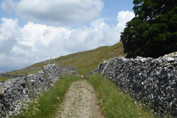
Soon after going through a gate I head right to follow the route of the Dales High Way footpath. This is a ferocious climb at the best of times but a real challenge on a hot day. Fortunately the path soon levels and the reward is a fantastic view of Attermire Scar.
I am following the Dales High Way route and plan to keep on this route toward Rye Loaf Hill; however, as I reach the junction with a path turning right to Sugar Loaf Hill I spot a walker in some distress. I wander over to see what the problem is and he explains he is part of a group of long distance walkers and he is a bit out of condition. He initially assumes I am one of his group, but after clarifying the situation he says there is a checkpoint at the junction of Stockdale Lane, if he can get there he will be able to rest and then head down into Settle.
As I am talking to him others in his group pass by appearing unconcerned for him and focussing on their own target of reaching the next checkpoint. We make slow progress and he is clearly struggling so I offer to call for assistance, but he declines. He also declines an offer of a drink, saying he has plenty. It looks to me as if he is seriously dehydrated, so eventually he agrees to stop and have a drink.
Continuing at a slow pace we go over Sugar Loaf Hill and eventually meet the stile to Stockdale Lane. Another couple of walkers from his group catch us up at the stile and say that they will make sure he reaches the checkpoint safely. So I bid him well and turn left to walk along Stockdale Lane.
This is a salutary reminder that even the most experienced walkers get it wrong sometimes and it is vital to make sure you keep well hydrated, especially on hot days. I know in the past I have been guilty of not taking on as much water as I should, but after this experience I will be carrying extra supplies.
The route along Stockdale Lane is straightforward and on reaching a gate I rejoin the Dales High Way and turn right along a stony track. To my right is Rye Loaf Hill and I know there is a trig point up there I want to “bag”.
I use a trigpoint website to check access to trigs and read a couple of posts from others saying that the best way to the top of this hill is through the gate and across the access land following a track. After passing Stockdale Farm I spot a gate on the right at the foot of the hill. There is a bit of a track but this soon runs out and I am left to identify the best route as I cross a stream and then go up the hill.
It is a warm afternoon and by the time I reach the summit I am grateful for a couple of minutes to catch my breath and admire the views. This is the 63rdtrig point I have bagged and it is a cracking spot.
From the summit I can clearly see the track that others had referred to as the route to the trig. It runs from a gate a bit further up the Dales High Way track. So I descend to join this track and then follow it around the margins of a field to reach the gate. Passing through the gate I soon turn right through another gate to rejoin the Dales High Way and follow the clear track through crags.
The track continues into another field, at the far side I turn left to follow the Dales Way markers. Soon I get a great view of Malham Tarn in front of me.
I walk the tarn is in front of me, a couple of years ago Lynnie and I walked around it and I contemplate heading over there now, but in the distance I can hear the rumble of thunder and don’t want to be caught up there with lightening about. So at a junction with the Pennine Bridleway I turn left to follow along a track.
The sky has turned very dark and the thunder appears to be getting closer. I prepare myself for the oncoming downpour, but to my relief all I get is steady drizzle. Soon I get a cracking view of Pen-y-ghent.
This is fantastic walking, there is nobody else about and I appear to have the Dales all to myself. The route is clear and easy to follow along the track so I don’t need to worry about navigating and can just enjoy the views
As I approach Jubilee Cave I clock up 1,000 miles “boots on” walking this year. I still have a way to go to reach my 2,018 miles target for the year but I am above schedule at the moment. After passing the cave I go through a gate, still on the Pennine Bridleway, and follow the track downhill.
Through another gate I briefly join the road and then follow the Pennine Bridleway path back towards Settle. This is a route I have walked regularly in the past few days, but it is still worth stopping to admire the view. The disused Langcliffe quarry looks stunning.
I stay on the Pennine Bridleway below Blua Crags and then head downhill to Settle entering the town down Constitution Hill.
From the market square I head back to Brigholme Farm CL, Lynnie says I have missed a heavy rainstorm. My walk has covered twelve miles and despite the drizzle has been a stunning afternoon’s jamabout.
To follow this 12 mile walk on OS Maps Click Here
To follow our walk you will need Ordnance Survey Outdoor Leisure Map OL2 – Yorkshire Dales – Southern & Western.
10thJune 2018
© Two Dogs and an Awning (2018)