

The forecast for the day does not look promising. Frankly it is cold. To add to the chill there is rain forecast. By now I was hoping to have given my legs an airing, but a boy needs all the protection he can get at the moment. Like Mary Poppins I am waiting for the wind to change (I don’t mind admitting that’s the bit in one off my favourite films that always makes me cry!).
After studying the map and discussing our options we agree on a circular walk from Aveton Gifford to Burgh Island. It appears a pleasant stroll alongside the River Avon and then, if the tide is right, a walk across the sands to Burgh Island.
Aveton Gifford is only a few miles from Coldharbour Farm CL so it meets the requirements of not driving far. After passing through the pretty village we park with ease in the free car park besides the A379, it is ideal because from here we can pick up the Avon Estuary Walk.
We start our walk by following a footpath leading to a road by the estuary. The OS map advises that this “Tidal road is liable to flood”, however, even with the tide clearly in this does not appear to be a problem. Reaching a ford we can see that cars would need to proceed with caution, but our route takes us inland across some boggy ground.

Then we encounter stepping-stones a foot under water. Clearly this is impassable, we either have to wait for the tide to recede or retrace our steps and take an inland route.

I try the King Canute approach to persuade the water to “go away” well that’s the printable version of the language I use! Having no impact we trudge back to the car park and start again. Never a great start to a walk, but we are made of sturdy stuff so this minor setback will not deter us.
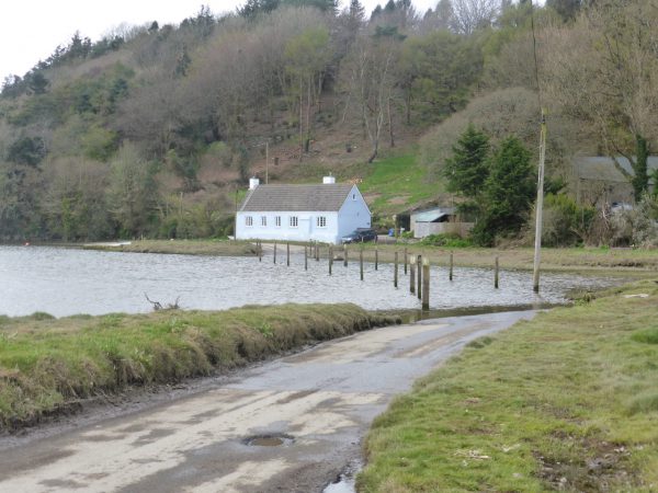
Our route is now through an underpass below the A379 and then we turn left on a footpath that runs beside the road and then crosses it on a fast stretch. We take the lane on the opposite side leading down to Waterhead Bridge. After climbing up the other side we turn left following the footpath in front of a cottage and then on a lane take a stile into a field.

It is a stiff climb to the top of the hill, but by now we are hardened to the short sharp inclines that are a feature of Devon. The route is well marked and we cross a stile to follow the Avon Estuary Walk.
After crossing another field we join a track that soon heads steeply downhill and joins a road for a brief section at Foxhole before turning left and becoming a path alongside a stream. This takes us below Milburn Orchard and then back across fields. This is long gradual climb across the slope of the hill, very tough on the ankles as we are walking at odd angles.

After passing the top of Doctor’s Wood (presumably named because those walking across the fields might need medical attention to their backs and legs) we pick up a permissive path running besides the B3392. We are always grateful for such paths and thankful to those individuals with the forethought to remove pedestrians from narrow lanes where they are bound to encounter cars. The farmer has given up a small strip of land, but presumably has been compensated, but even if this is not the case it is eminently sensible to avoid the risk of serious accidents for a small strip of land.
As the permissive path ends we carry straight on down a track towards Lincombe, keeping on it as it turns sharply back towards the estuary. We walk through a wildlife conservation wood. This appears to be breeding pens for pheasants that are released to have their wildlife abruptly ended by someone with a shotgun who will have paid a fortune to blast them out of the sky.
Passing some houses we have a conversation with a lady who assures us that despite rain being forecast we are in an area with a micro-climate and we should be fine. She sounds knowledgeable and it is pleasantly warm as we head back in land towards Hexdown which appears to consist of a farm and converted barns. Here we pick up a track and start back up hill. Lynnie announces that she is not feeling 100% as we head upwards. I put this down to a lack of ice cream, but then get a bit concerned, as she does look very pale. There is no way that I am going to be able to carry her to the top of the hill!

We take it steady up the hill, at the top we are on the edge of Bigbury golf course, there is a cooling breeze and from here the route is downhill towards the estuary. The path passes Cockleridge (home to a summer ferry, not yet operational) and then round to a small stony beach at Cockleridge Point where we sit and enjoy our lunch.
It is with a feeling of trepidation that I start off again we are on the coastal path and I am concerned about how close we will be to the cliff edge. We soon enter a field where we climb, and climb and climb. Thankfully there is no need to get too close to the cliff edge and we are soon very high above the estuary and whilst the views are stunning they make me feel uncomfortable.

Eventually we reach Mount Folly Farm and pick up a footpath that leads down to Bigbury-on-Sea. We were last here over thirty years ago when young Fred was a nipper, but not much has changed. There is a new, luxury resort close to the slipway to Burgh Island and many of the houses have been subjected to the “Grand Designs” make-over, our main interest is in strolling across to Burgh Island.

The tide is out and the boys enjoy running around on the expanse of sand. Burgh Island is fascinating, cut off by the tide for periods each day, but easily accessible when the tide is out. The art deco hotel (a stay would be way out of our price bracket) is a prominent feature; also The Pilchard Inn dating back over 700 years.

The island also has a chapel thought to have been linked to a former monastery once situated on the island.

When we visited years ago young Fred was fascinated by the tractor carrying passengers across the causeway when the tide was in. We contemplate wandering onto the island to look around, but the breeze is freshening and feels like a harbinger of rain.

Instead we retrace our steps back up the hill to Mount Folly, rather than crossing to go through the farmyard we take a footpath on our left and then at a junction of paths take the route to Ringmore. There is light drizzle in the wind so we don our waterproofs before descending through a field of sheep.
As we go down a farmer in his 4-wheel drive heads our way. I check the map, we are on a footpath and the dogs are on leads so I wonder why he appears to be in such a hurry to get to us. We meet in a gateway and he hops out of his truck and greets us warmly. He is checking for Blue Tits that usually nest in the rotting gatepost and points out the remains of an old wall and stone gate post that we would have otherwise passed by. He then gives directions and recommendations for a good pub meal at The Journeys End in Ringmore.

We continue downhill, and then up, before going down again and finally uphill into Ringmore. By now the drizzle has turned to steady light rain, we see the sign for the Journeys End, but our journey is far from ending! Through Ringmore we pick up a permissive path alongside the road (with thanks again to those who implemented the scheme) and follow it to St Ann’s Chapel. When we set off I had thought we might explore here, but now the rain is heaving down and we still have a distance to go.
At a crossroads we take the route to Easton, we are walking into the wind and rain which is becoming tiresome. Thankfully we then take a left to walk through Easton and get a little respite from the rain blowing in our faces. This road takes us back to Foxhole where we pick up the outward route and return back to Aveton Gifford on the Avon Estuary Walk.
We are both relieved to get back to the car; we have two soaking wet dogs and we are exceedingly damp. Lynnie looks decidedly miserable. On a fine day this would have been a cracking walk, but in the cold, wet and windy conditions we have encountered it has been a hard slog.

My Suunto Traverse says we have covered 12 miles, it feels like a lot more. We contemplate heading back to Ringmore to avail ourselves of The Journeys End, but decide it would be better to get back to the Coachman to dry off and warm up.
To view this walk in OS Maps Click Here
To follow this walk you will need Ordnance Survey Outdoor Leisure Map OL20 – South Devon
14th April 2016
© Two Dogs and an Awning (2016)