

After a good night’s rest I am ready to set off on day two of my long distance walk. Knowing that over the next few days I will be offered a full English breakfast at a number of my overnight stops on my trek to Bridgewater I decide to decline the offering at the TravelLodge.Instead I head to a nearby shop to pick up fruit juice, bananas and a croissant.
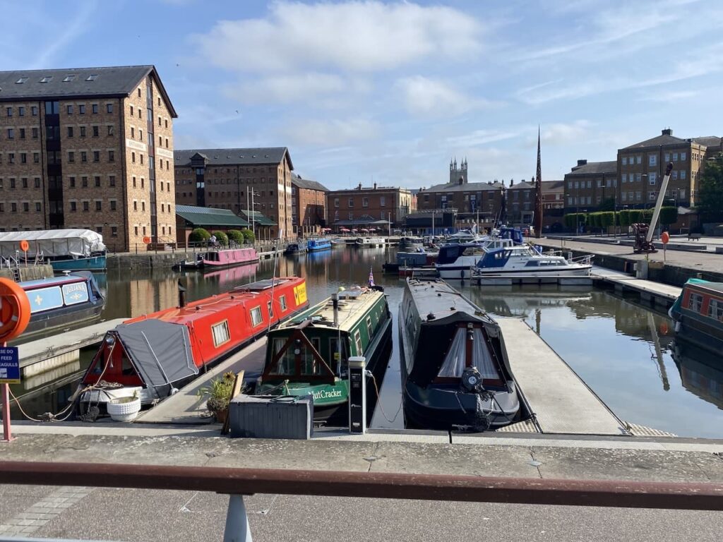
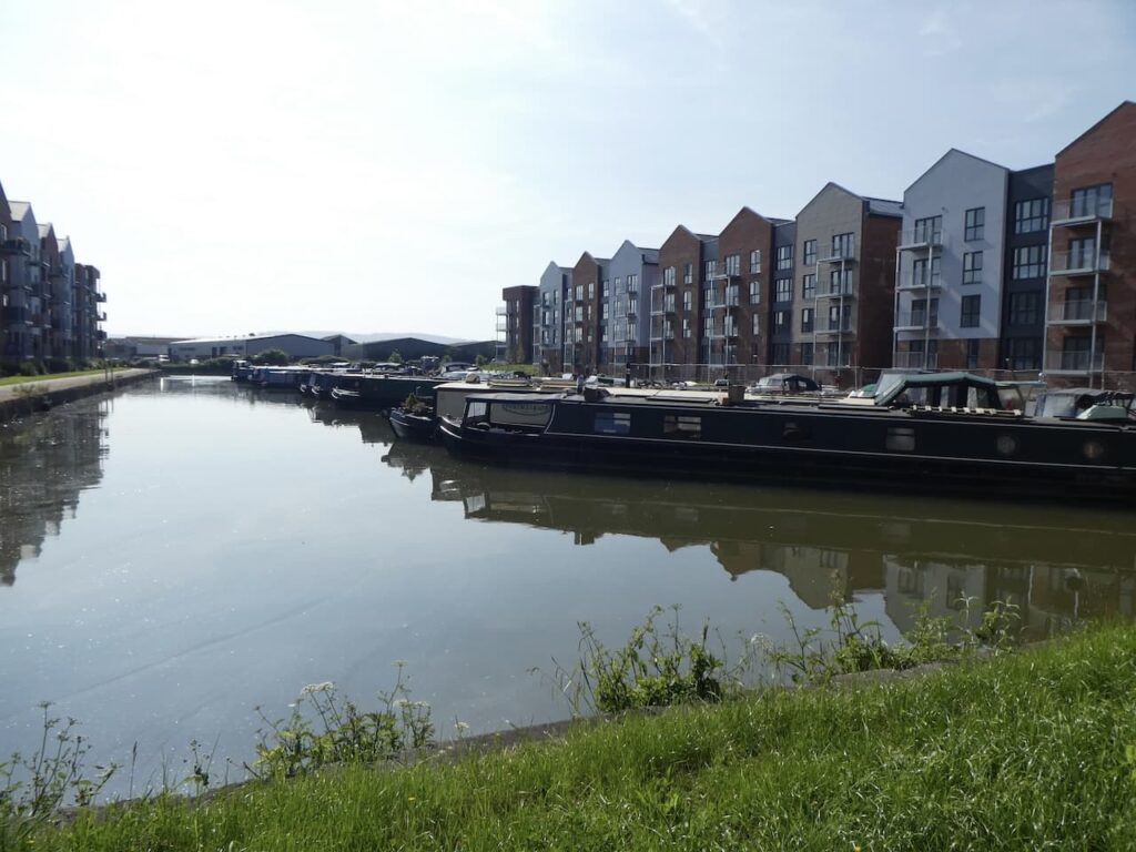
I start my walk by heading to Gloucester Docks, despite having a full days walk ahead of me I take a few moments to wander around and have a look at how the docks have been redeveloped.
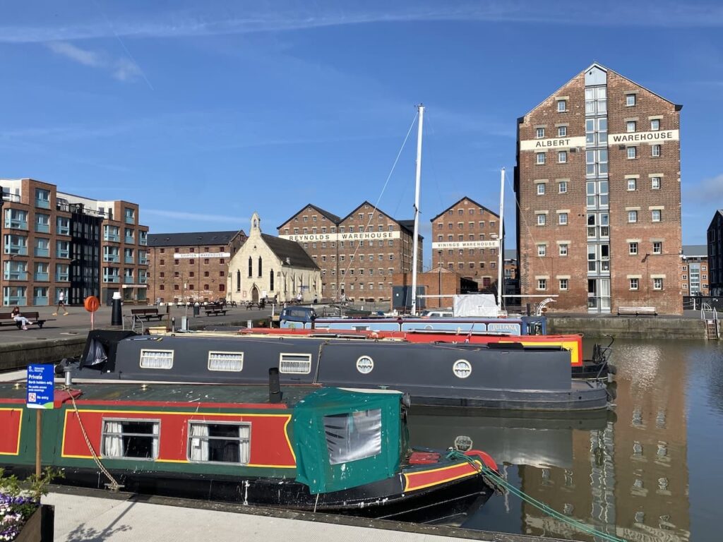
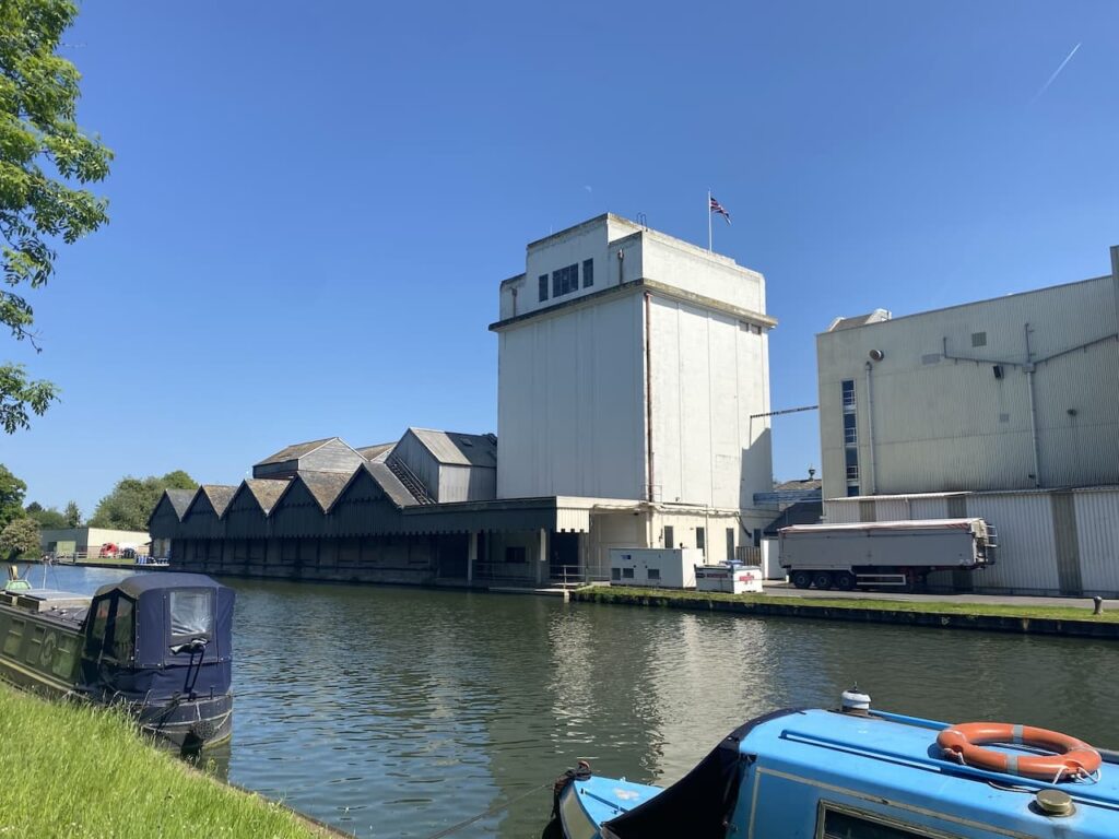
The Albert Warehouse was a bonded warehouse built in 1851 by William Partridge a corn merchant and property developer from Birmingham. In 1869 it was converted to a flour mill for James Reynolds. Alongside it sits the Vinings Warehouse and Reynolds Warehouse, these were also once owned by James Reynolds. Like many of the old warehouses around the docks they have been converted into flats.
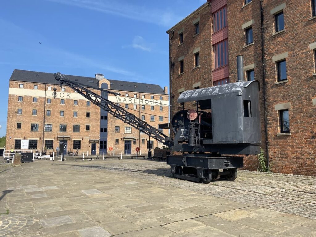
Continuing to explore around the docks I reach an old 7.5 ton steam crane. It looks like it would have always been here, but apparently it was built in 1944 during World War II by Joseph Booth & Brothers of Rodley Leeds. It wasn’t used until the 1950’s when it was sold as MOD surplus to a boat repair yard in South Shields. It wasn’t until 1994 that it was relocated to Gloucester Docks as a reminder of the steam cranes that once worked here, however it is for display purposes only.
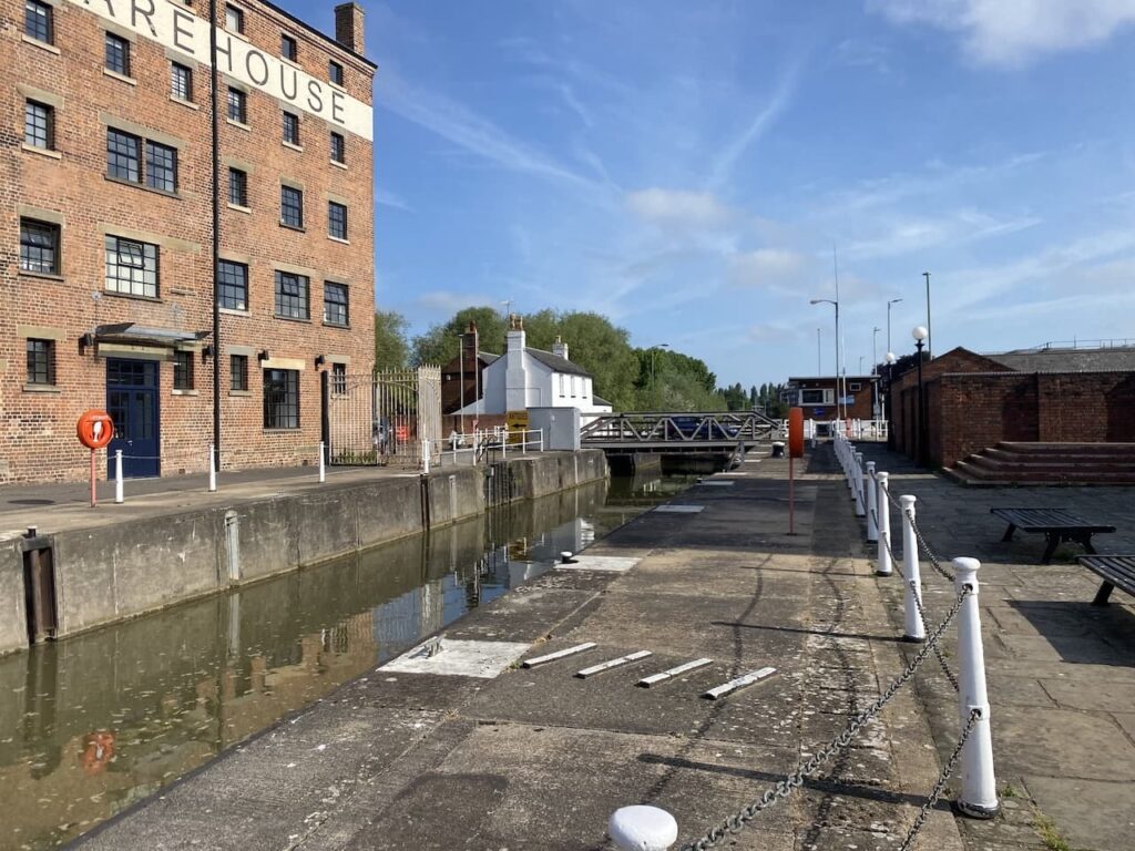
I leave the docks by joining the Gloucester to Sharpness canal. To reach today’s destination in Berkley I plan to walk twenty-five miles and much of it will be beside the canal so it will be easy navigation and little ascent.
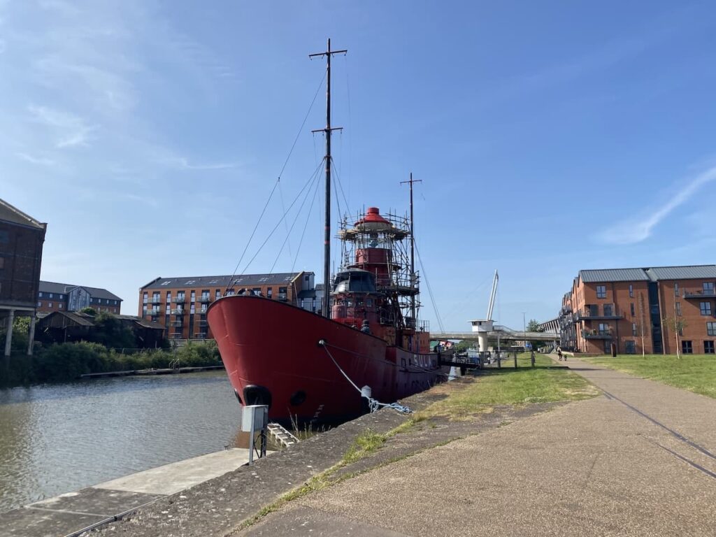
Soon after joining the canal I reach “Sula” a Light Vessel 14 which was originally called Spurn. Constructed in 1958 she was one of three light vessels stationed off Spurn Point by Trinity House. crewed by two sets of seven men working fortnightly shifts followed by a fortnight off she also provided coastguard cover and was a weather station.
After being withdrawn from service in 1985 she was sold and then changed hands a number of times before ending up in Ireland. She was due to be scrapped when she was purchased in 2007 and towed to Sharpness Dock. Following a major refit she was moved to this location and is now used as self catering holiday accommodation.
When built in 1827 the Gloucester and Sharpness canal was apparently one of the broadest and deepest canals in the world. This was required in order to carry the vessels into Gloucester Dock which previously used the River Severn which had navigation hazards and was dependent on tides to allow vessels to make the journey to and from the docks.
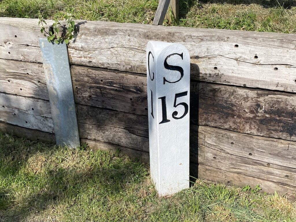
A mile from Gloucester I reach the a milestone showing it is fifteen miles to Sharpness. Although it will be a bit further because I aim to make a slight diversion to bag a trig point along the way.
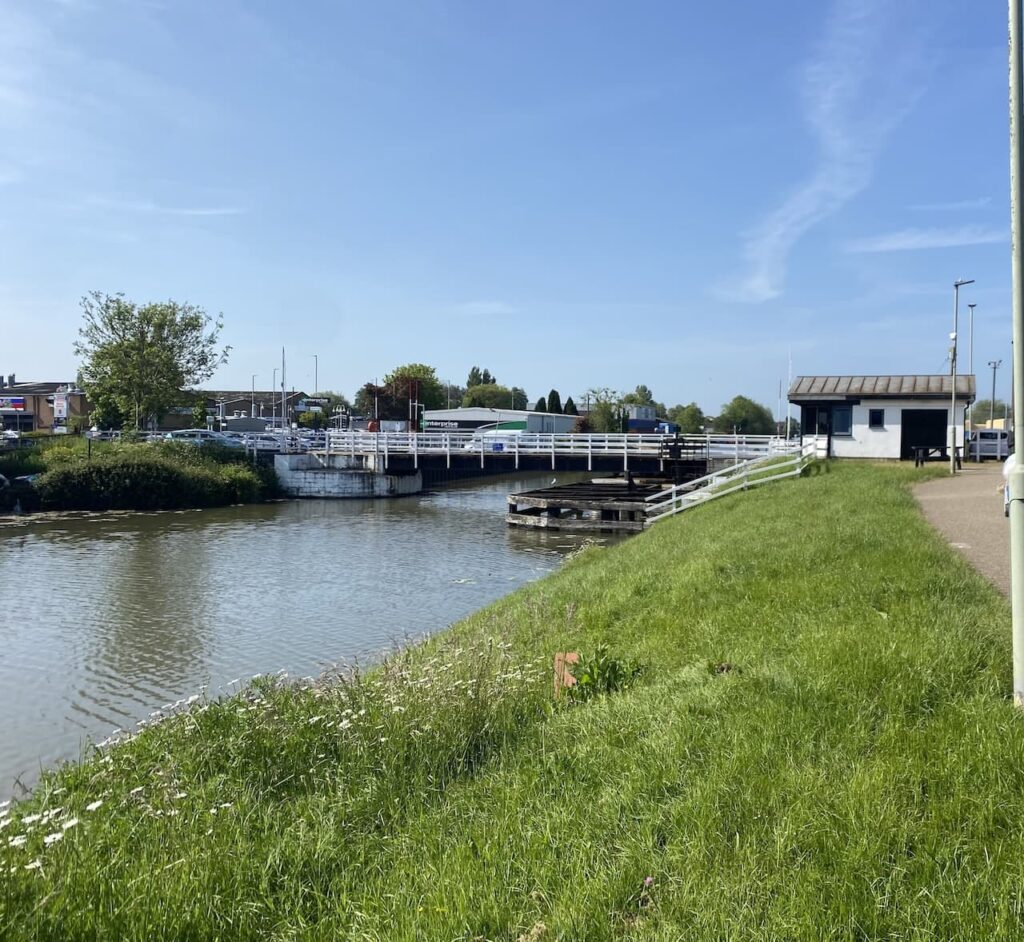
It is not too long before I reach the Lower Hempsted Swing Bridge, this is a pedestrian crossing over the canal. Here I stop to chat to the Canal and River Trust volunteer operating the bridge, coincidently it transpires that he grew up on a farm below Haresfield Beacon and some of the fields I walked over yesterday are still owned by his brother.
After passing a large Sainsbury Supermarket the towpath goes around an old dock which is now a marina for barges overlooked by recently constructed flats.
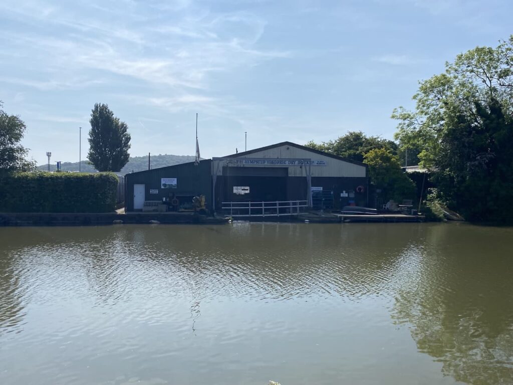
After going around the dock I am back beside the canal, on the opposite side is the Hempsted Dry Dock. According to the company’s website this is the largest indoor all weather facility on the canal network. But I am more interested to read elsewhere that this was once the home of the Gloucester Ferro-Concrete Shipbuilding Company. In 1918 they built six concrete barges. I have never heard of concrete ships, but apparently they were developed because of a shortage of steel. The Crete Fleet website provides a fascinating insight into the development and use of these barges and other concrete boats.
The barges built in this boatyard were apparently uniquely launched broadside which created a massive wave that surged across the canal and over the hedge beyond. Those observing the launch from where I am now stood would have been soaked!
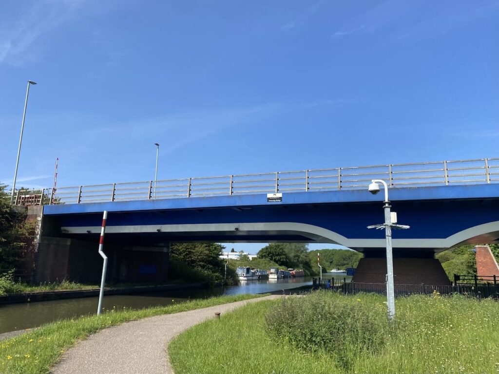
Two miles along the canal I pass under a modern bridge carrying the A430 over the canal. An information board by the two mile marker explains that in 2006 as part of the construction of the Gloucester South West Bypass this section of the canal was diverted and the bridge constructed at a height of 4.7m which enabled the majority of boats to travel under without the need to open the bridge and hold up traffic.
It is a cracking day and as I get further away from Gloucester there are fewer people on the towpath.
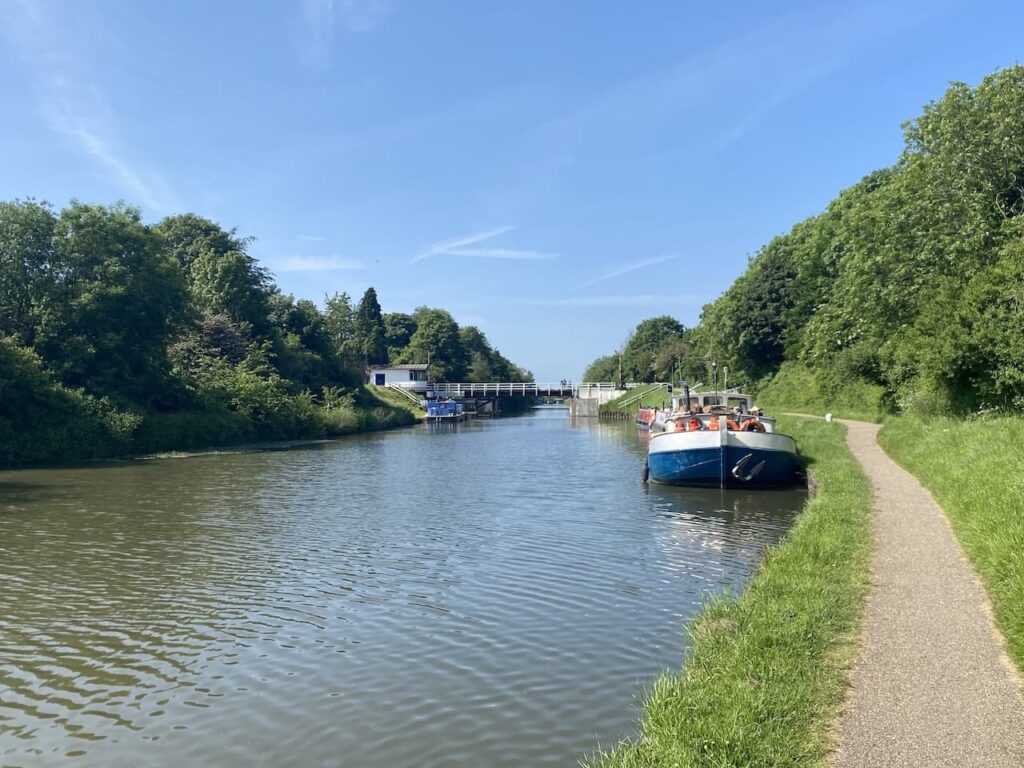
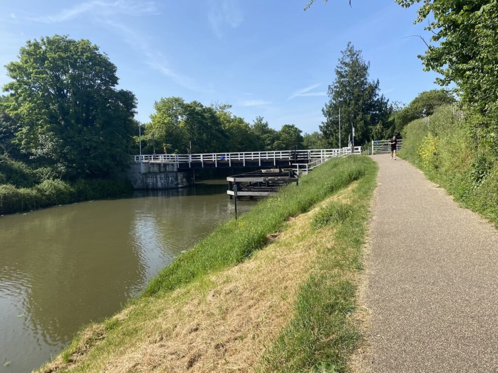
One of the features of the canal is the number of swing bridges, by the time I get to Rea Bridge I am beginning to loose count, and I am only three miles from Gloucester Dock.
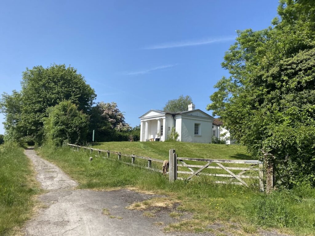
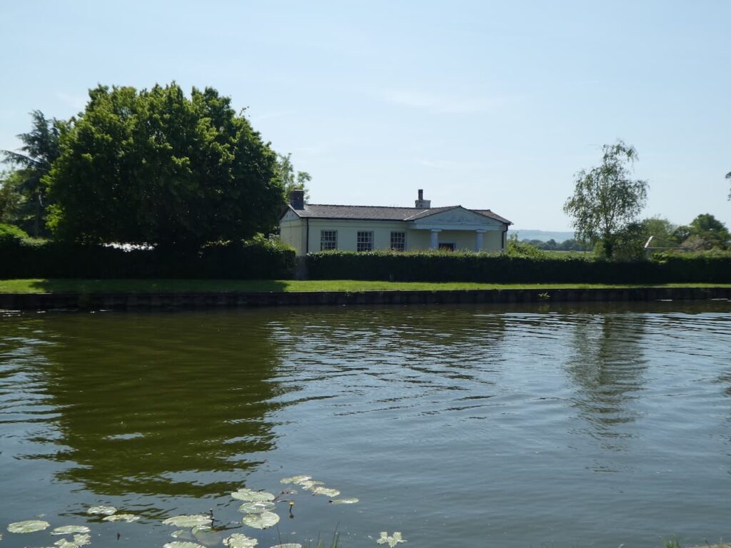
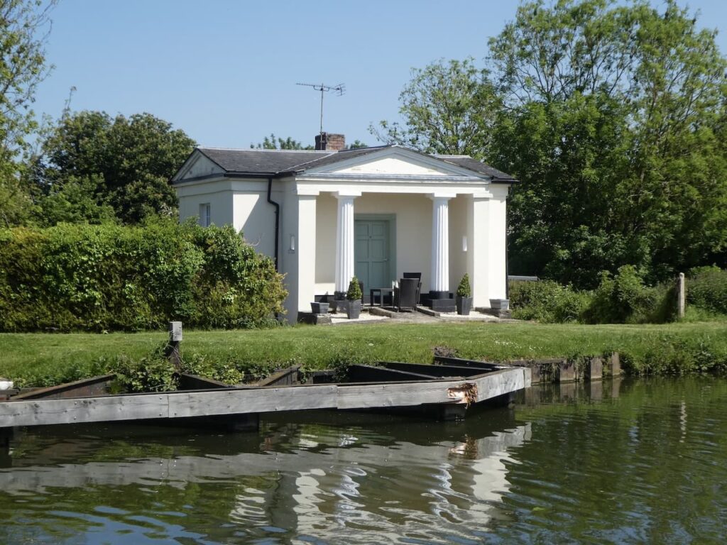
I pass Sellars Bridge with the Pilot Inn on the far side and then reach the site of the now disused Hardwicke Bridge. To my right is the distinctive bridge house, there are eight of these along the canal, they provided accommodation for the bridge men. All the houses were originally built to the same Neo-classical style with grand columns on the porch.
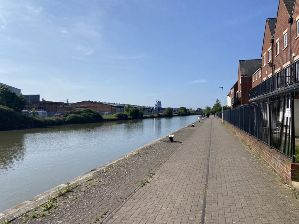
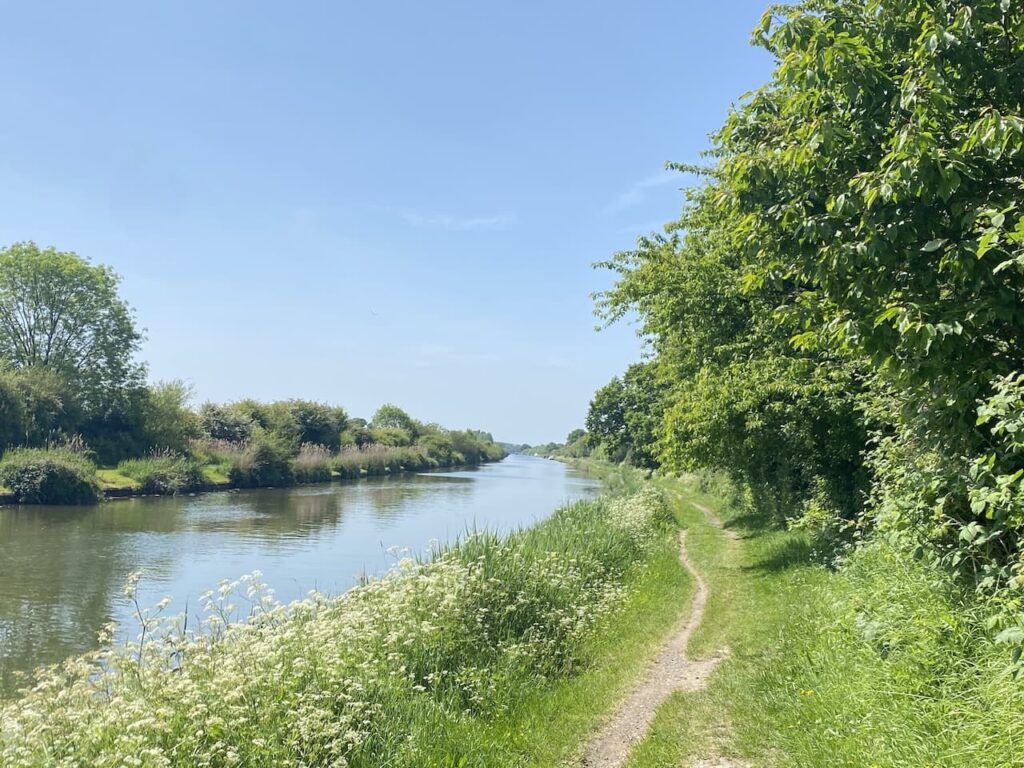
I am now in open countryside and the scale of the canal can be fully appreciated. In comparison to other canals it is huge and it must have looked impressive when large boats were passing along it.
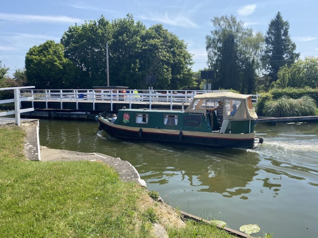
Nearing Parkend Bridge it becomes clear that the swing bridge is about to operate so a boat can pass through.
On the opposite side of the canal is the bridge house, it looks like this one has been extended, originally it would have been a basic one bedroom property with a living room and scullery.
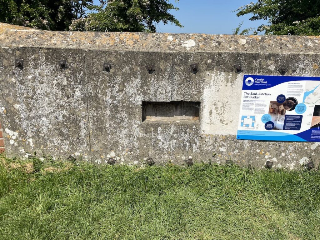
At Saul Junction I stop to look at the World War II Pillbox, this has been converted into a Bat Bunker. The information board explains the importance of bats to the canal with a Common Pipistrelle Bat eating approximately 3,000 midges and mosquitoes a night. I seem to attract midges and mosquitoes so anything that prevents me getting bitten is very welcome!
This Pillbox formed part of the World War II Green Line, part of a series of Stop Lines which were intended to divide the country into defendable areas in the event of an invasion by German Troops. Where possible the lines used natural objects like canals and rivers to form part of the defence line.
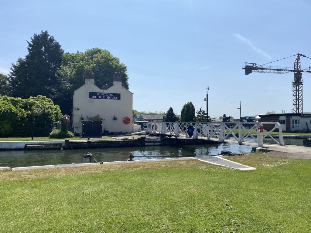
Saul Junction is the point where the Gloucester and Sharpness Canal meets the Stroudwater Canal. The latter opened in 1799 and runs for eight miles from Stroud to the River Severn.
At the junction of the two canals sits Junction Bridge House, this was the home of the person who operated the bridge and recorded the traffic passing along each canal.
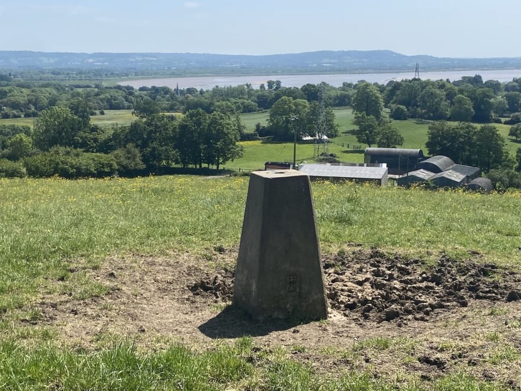
Just after Saul Junction I reach Sandfield Bridge where I leave the canal towpath and take a diversion to do a bit of trig bagging. Turning right from the canal I head along Church Lane into Saul and turn right by the church, soon turning left into Passage Road. Just after Glebe Farm I turn left along a lane and then take a footpath on the right shortly before reaching Lower Mangrove Farm.

After crossing a couple of fields and passing a copse I briefly leave the footpath to walk up to the top of Barrow Hill to bag the Ordnance Survey trig pillar. This is the 378th trig I have bagged and it has good views across the River Severn and the Arlingham peninsula.
From the trig I retrace my steps back to Saul and then return to the canal towpath and turn right to resume my journey towards Sharpness. It is not long before I see on the opposite side of the canal the Frampton on Severn flour mill. Apparently this used to be the crumb factory for Cadbury’s biscuits
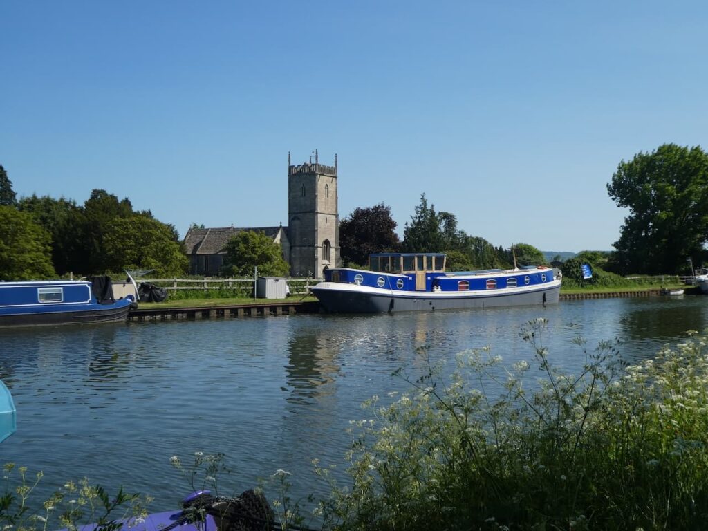
After passing the Fretherne swing bridge, which leads to Frampton on Severn, the towpath heads south and soon passes St Mary’s Church on the opposite side of the canal. This church was consecrated in 1315 and has been a place of worship ever since.
After passing Splatt Bridge I spot the Bridge House on the far side of the canal. This one looks to still be its original size.
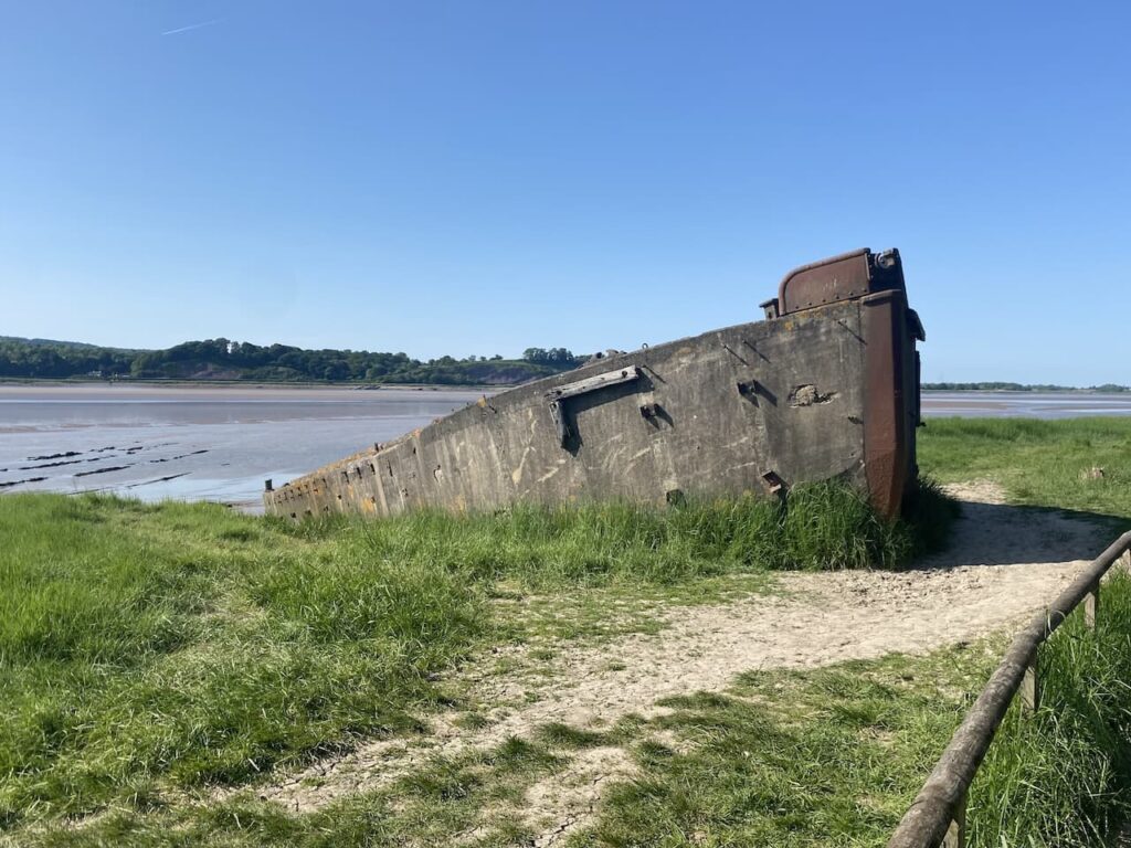
Just after passing Purton I briefly leave the towpath to visit the Purton Ship Graveyard. An information board explains that from 1909 to 1965 unwanted vessels were beached on the foreshore of the River Severn and allowed to fill with silt. This was done to stop the erosion of the river bank endangering the canal.
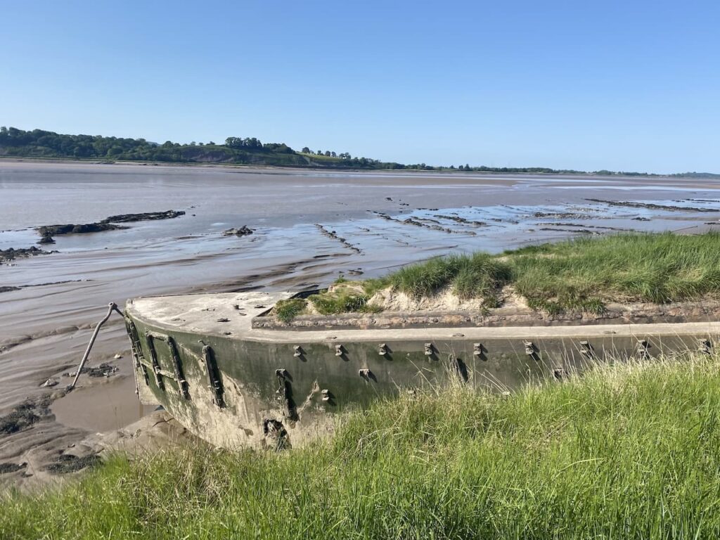
There are said to be 86 vessels beached here, some are difficult to distinguish as they are on top of others. To assist some have small plaques providing information.
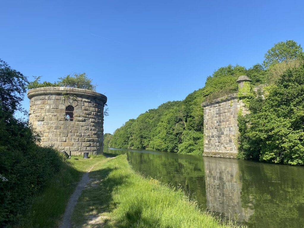
Back by the canal I reach the parapets of the former Severn Railway Bridge. This bridge opened in 1879 to carry coal from the coalfields in the Forest of Dean across the river from Lydney to Sharpness. Unfortunately the amount of coal transported was not as high as anticipated and the single track railway was barely viable.
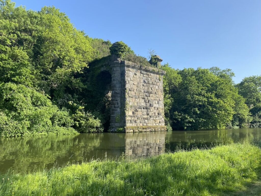
There were 21 spans to the bridge causing some challenges to vessels using the river with a number of incidents when the bridge was struck and vessels sank with the loss of life. There are also reports of RAF Spitfires flying below the arches, eventually the RAF court martialed individuals involved in this practice which proved sufficient deterrent to others.
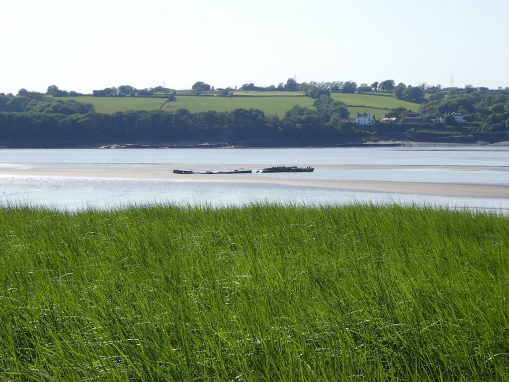
Tragedy struck when on 25th October 1960 two barges overshot Sharpness Dock due to thick fog. The barges collided and smashed into a bridge pillar causing a partial collapse of the bridge. One barge, carrying petroleum, caught fire and exploded, the other vessel had a cargo of black oil that ignited. A significant fire ensued and five people lost their lives. It was decided that it was uneconomical to repair the bridge so the whole bridge should be demolished and by 1968 it was all removed.
It is low tide and I can see the wrecks of Arkendale H and Wasdale H, the two barges that collided with the Severn Rail Bridge, still lying in the middle of the river.
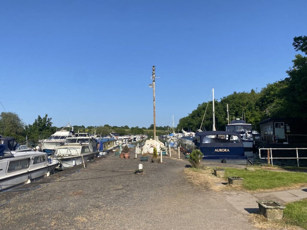
Soon after the bridge I reach the busy Sharpness Marina.
I now follow the Severn Way way-markers, they take me past a pub and then over a swing bridge leading over the canal and Sharpness Docks. The docks were built in 1874 to develop Sharpness as a port. Prior to that there was a dock further to the north that opened in 1827 to provide access to the Gloucester and Sharpness Canal. This later dock continues to be used as a commercial port but is only accessible to vessels at high tide.
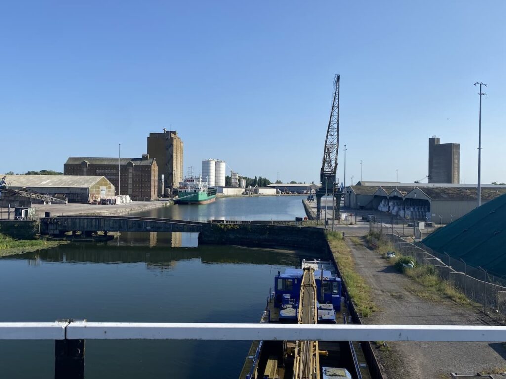
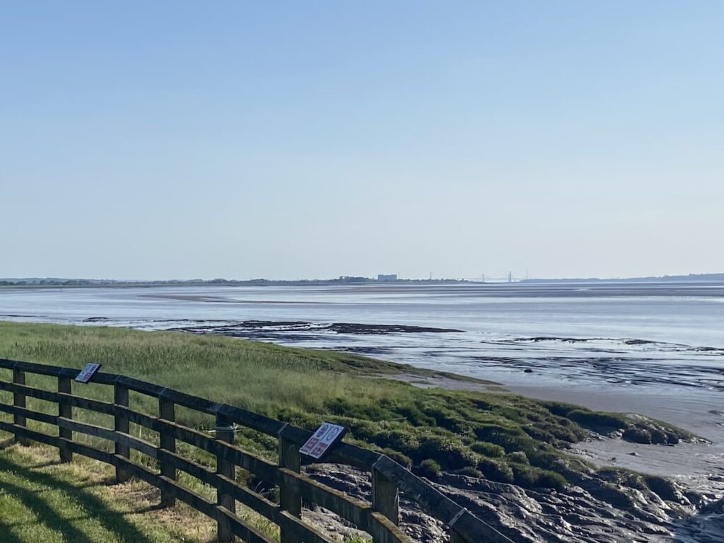
Walking through the dock roads I reach the piers at the dock entrance, looking down the River Severn from here I can see the Severn Road Bridge in the distance. On tomorrow’s walk I will pass the bridge on my way to Bristol.
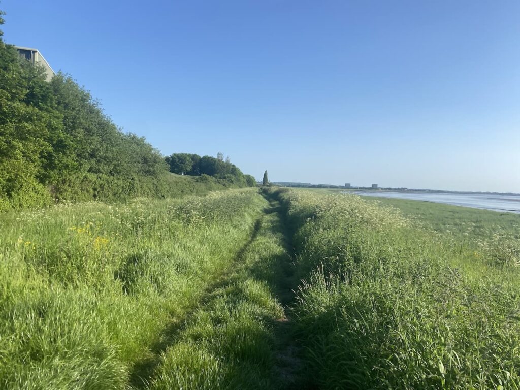
From the Dock entrance I pass some cottages to rejoin the Severn Way and follow this south.
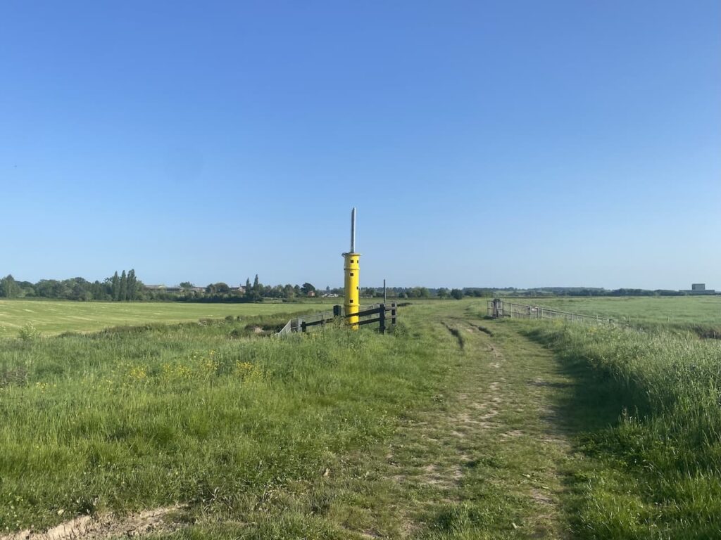
A short distance further on I pass a navigation beacon, these are strategically placed to guide shipping on the River Severn.
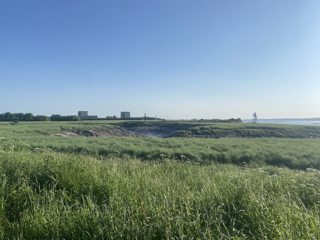
At Berkley Pill the path goes inland with the now disused Berkley Nuclear Power Station a bit further down the river. This power station started generating electricity in 1962 and closed 27 years later in 1987. The former power station is in the process of being decommissioned and this should be completed in 2070. So less than 30 years of power generation takes over eighty years to tidy up.
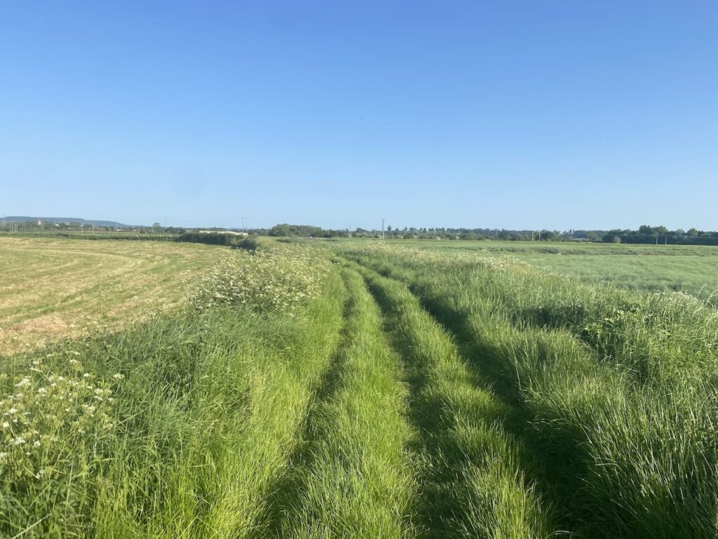
The well worn path heads across fields towards Lynch Road Industrial Estate.
On reaching a road I leave the Severn Way and instead cross the road and join a footpath that continues beside Berkeley Pill, this leads me to the centre of the village and my overnight accommodation at the Berkeley Hotel.
It has been a full day’s walking and I have covered over twenty-five miles, most of it has been flat, but it has still been challenging with a full rucksack on my back. After a shower I will be off for a pie and pint before getting an early night in preparation for tomorrow’s long walk to Bristol.
You can view this 25 mile walk and download the GPX File on OS Maps (OS Maps subscription required)
To follow this walk you will need Ordnance Survey OS Explorer – 179 – Gloucester Cheltenham & Stroud; OS Explorer Leisure – OL14 – Wye Valley & Forest of Dean; and OS Explorer – 167 – Thornbury, Dursley & Yate
27th May 2023
© Two Dogs and an Awning (2023)
All information on this site is provided free of charge and in good faith and no liability is accepted in respect of damage, loss or injury which might result from it. To the best of my knowledge the routes are entirely on public rights of way or within areas that are open for public access.
Walking can be hazardous and is done entirely at your own risk. It is your responsibility to check your route and navigate using a map and compass.