

One of the challenges of long distance trail walking is sleeping in a different bed every night. At home I sleep on a firm bed and rarely find a hotel or guest house with anything as comfortable. As a result I either don’t sleep well or wake up with a stiff back, neither of which are ideal for a chap walking over twenty miles a day.
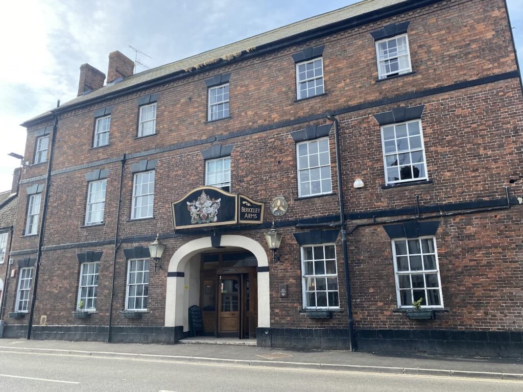
My accommodation last night was The Berkeley Arms Hotel, which is a grand old former 16th century coach house. In it’s heyday it would have been a very impressive place to stay and still ticks all the boxes for being warm, comfortable and friendly. It just has the feel of many old, large hotels of being a bit tired around the edges, easily addressed with a few new carpets and a lick of paint, but it must cost a fortune to run and maintain a building like this.
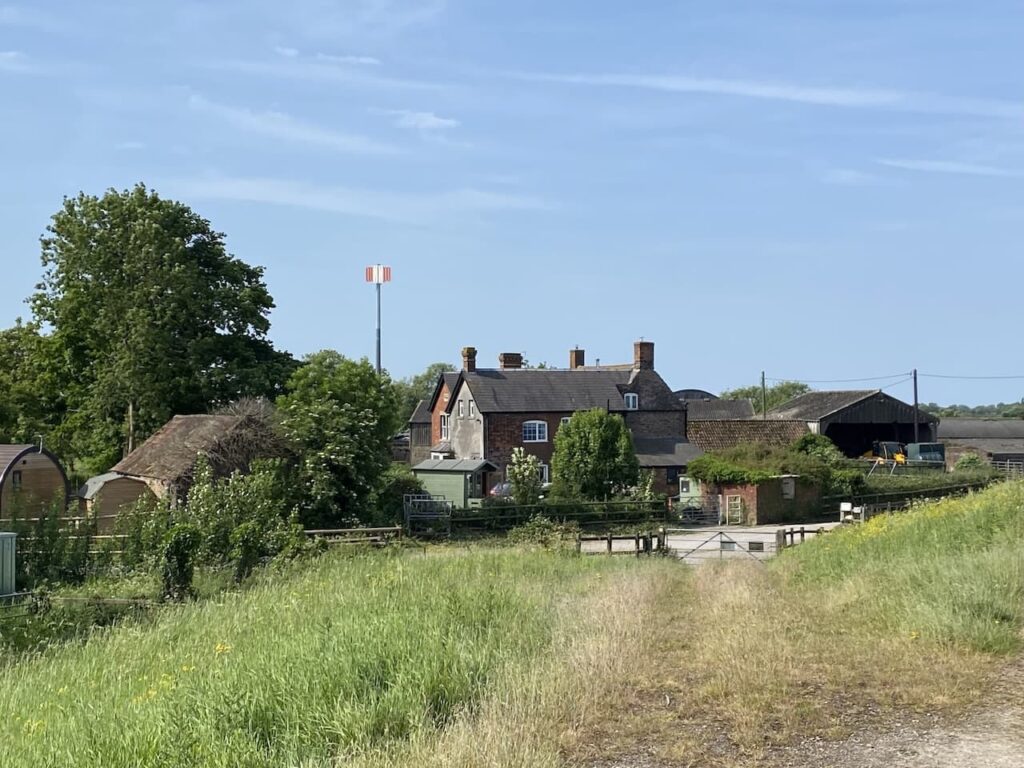
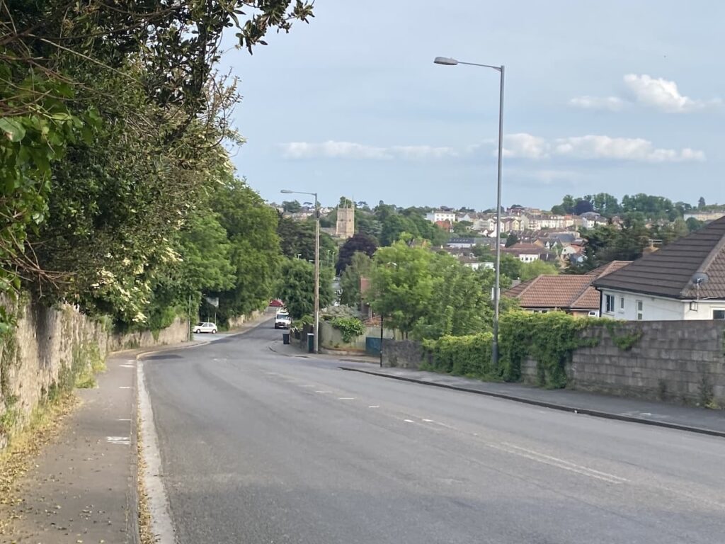
Today I am heading to Bristol and have a full day’s walking ahead of me. However, I make time for a quick visit to a couple of interesting historical locations in the town. I visited Berkeley a few years ago whilst staying locally in the caravan, it is packed with historical buildings and has a very interesting past.
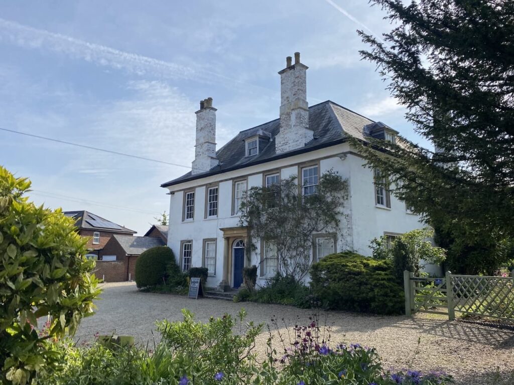
One of the previous residents of Berkeley was Edward Jenner the physician and scientist who pioneered the concept of vaccinations and created the smallpox vaccine. He was born in Berkeley and his old home in the town is now a museum.
The first person Jenner inoculated against smallpox was eight year old James Phipps. Jenner observed that dairy workers who had caught Cowpox appeared immune from Smallpox. He inoculated Phipps, in 1796, with Cowpox and then eight weeks later gave him a dose of smallpox without any adverse reaction. Jenner went on to give Phipps more than twenty doses of smallpox to further his research. He later purchased him a cottage in the town.
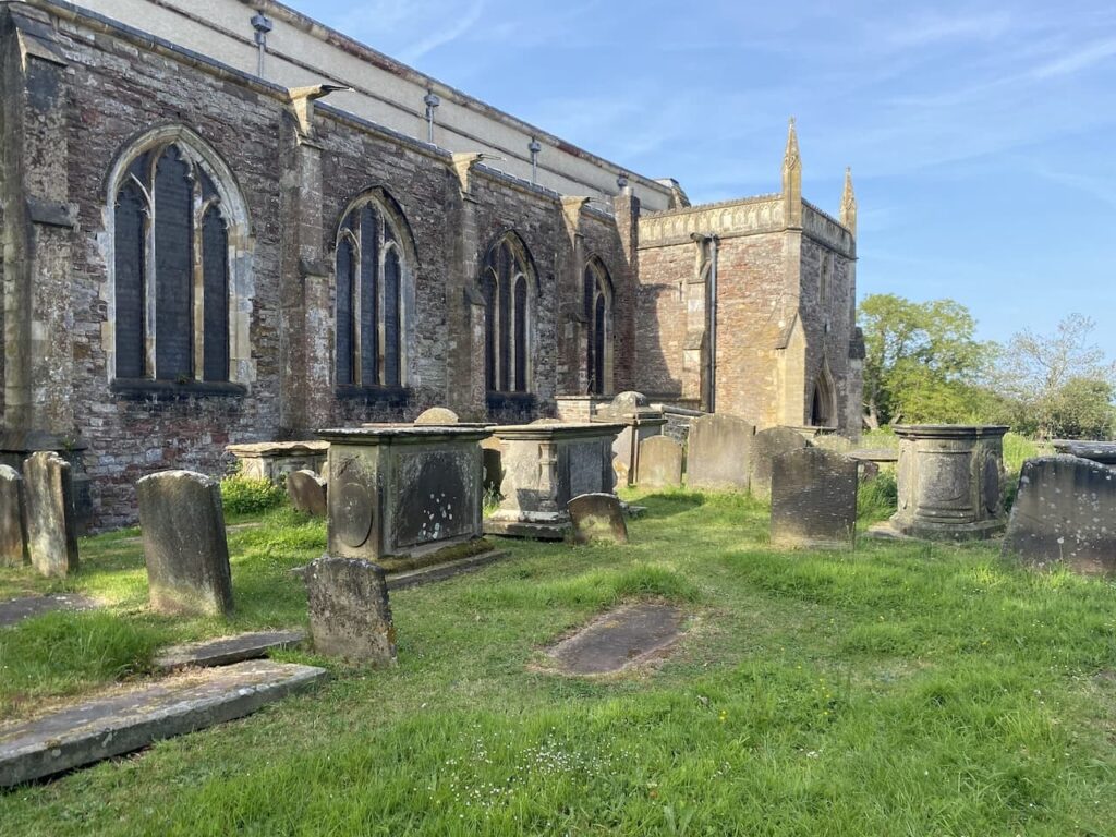
After passing Jenner’s house I walk along to the churchyard. There are a number of interesting graves here not least the tomb of Dicky Pearce. He is said to have been the last court jester. Born in 1665 he was originally the Earl of Suffolk’s fool before joining the Berkeley household. As a jester he would have been an accomplished musician and would also have performed sleight of hand tricks and acrobatics. Sadly his acrobatic skills let him down while performing in the minstrels gallery at Berkley Castle and he fell to his death.
Resisting the temptation to spend more time wandering around the town I leave the village by taking a footpath alongside the Berkeley Pill, retracing the final section of yesterday’s route.
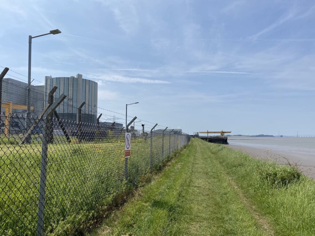
On reaching Lynch Road I turn left and stay with this road heading towards the former Berkeley Nuclear Power Station. Next to the power station is the Gloucestershire Science and Technology Park which is the location of Berkeley Nuclear Laboratories this is one of the UK’s three main nuclear power research centres. The site is also the location of Bloodhound LSR, since 2008 they have been developing a rocket powered vehicle with the aim of breaking the land speed record.
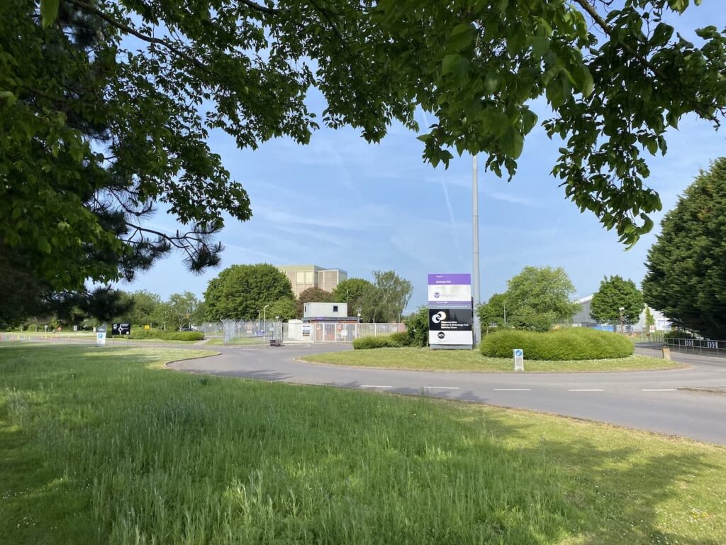
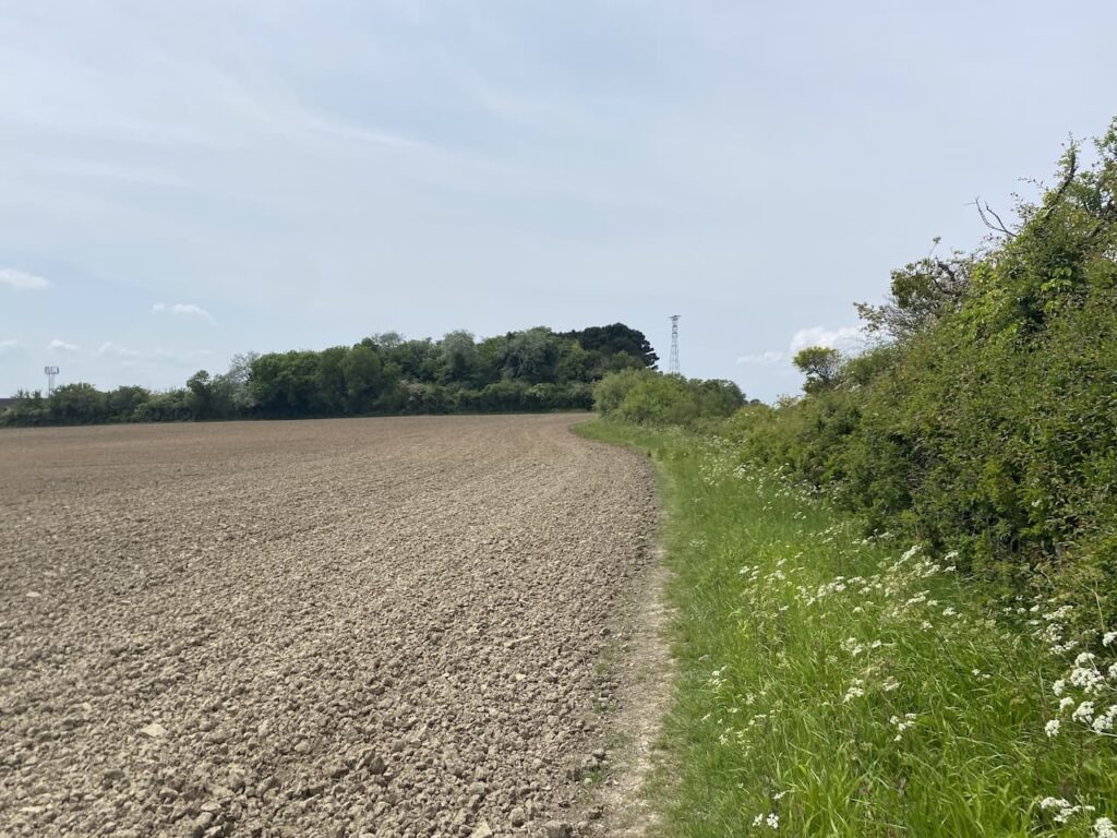
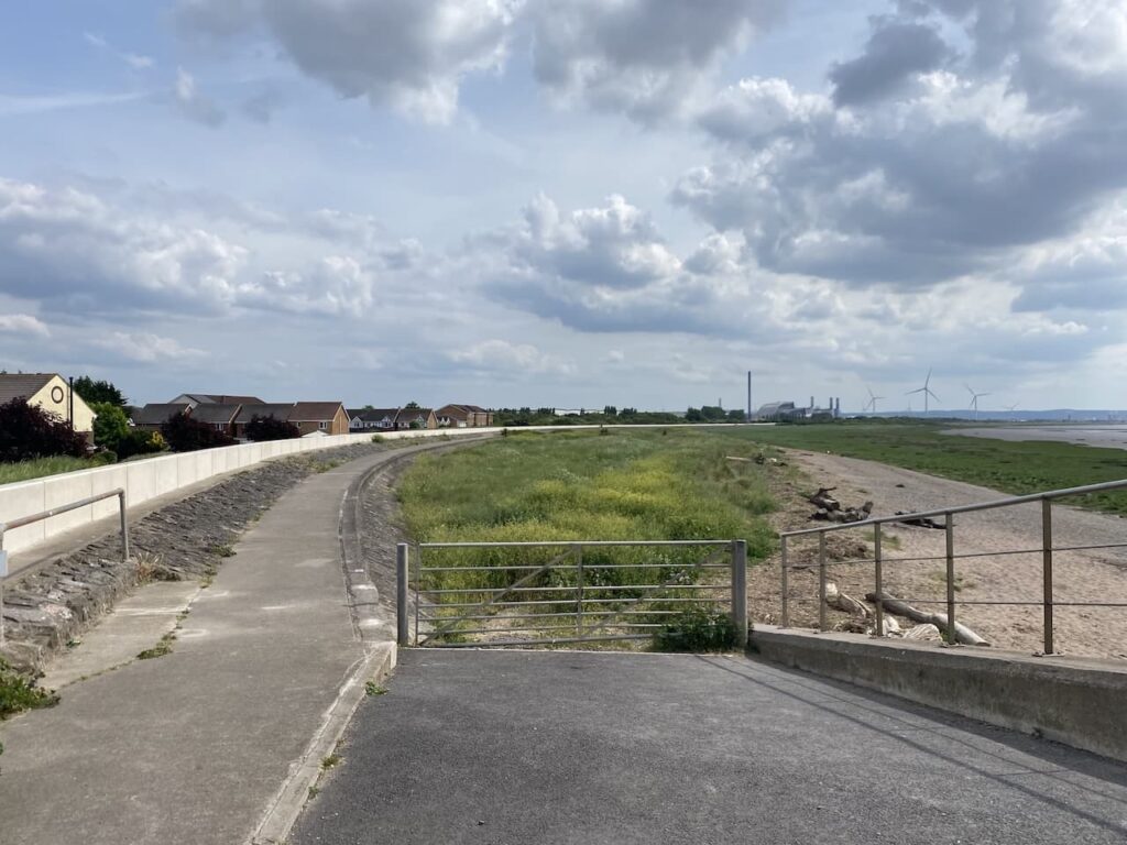
At the site entrance I turn left and follow the footpath way markers to the south of the buildings. Since joining Lynch Road I have been back on the Severn Way and will follow this for much of today’s walk. The hedge-lined path leads to a gate where cattle are grazing in the field beside the river. Here I turn left and head south.
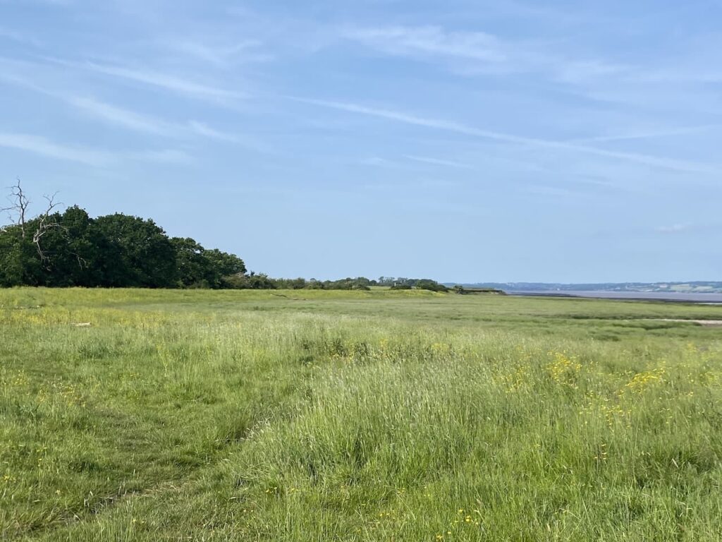
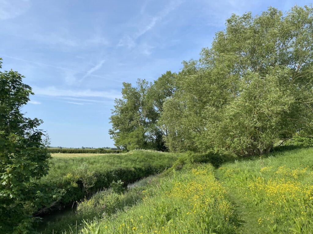
The path goes along a grass embankment which is part of the flood defences. It is a cracking day, ideal for walking.
After going through a gate the path goes along the top of a concrete embankment.
At Severn House Farm I pass a navigation beacon and continue along the embankment above the farm.
After the farm the path once again becomes a grass embankment which is covered in buttercups. In the far distance I can see Oldbury Nuclear Power Station.
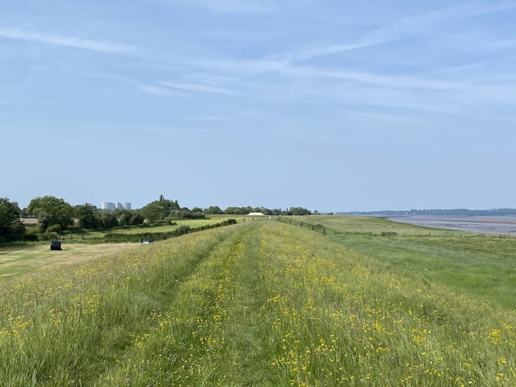
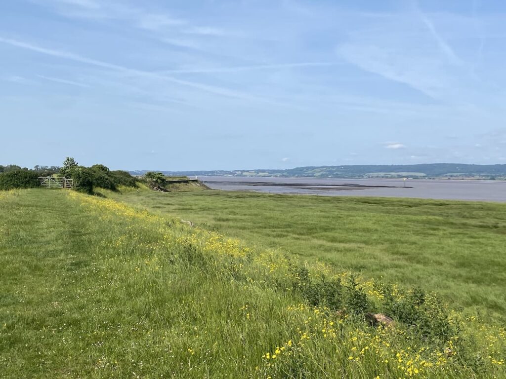
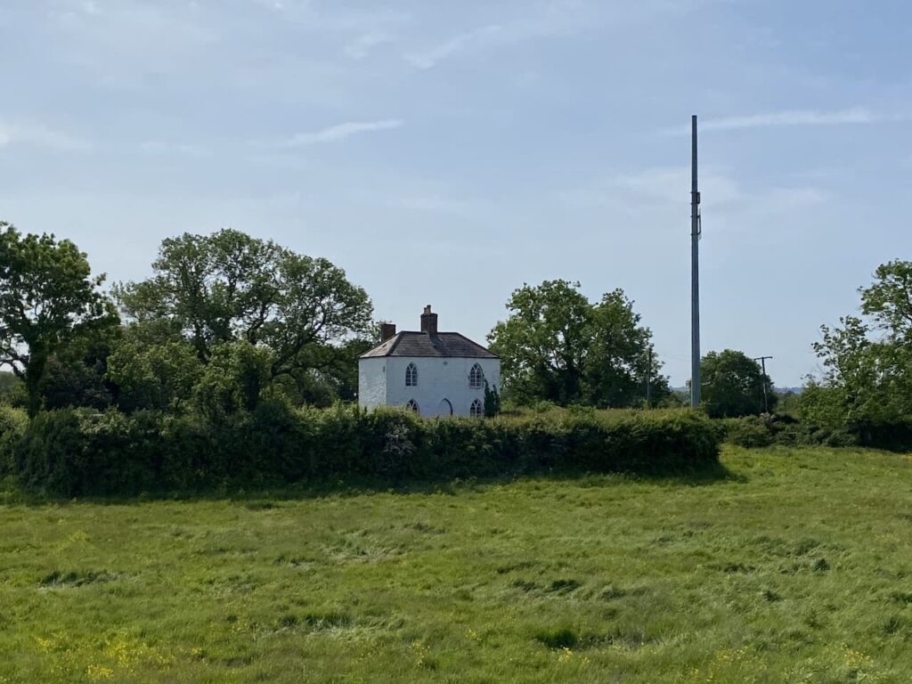
This is easy walking, the route is flat and straightforward to follow. It is not too long before I pass the White House, apparently this house dates from 1845 and has long been associated with navigation on the River Severn. It now has a navigation beacon beside it.
For a while now Oldbury Nuclear Power Station has dominated the view in front of me, I have tried to ignore it and keep my eyes on the river, but somehow a structure of this size can’t be totally disregarded.
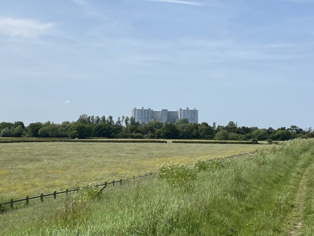
Oldbury Power Station was commissioned in 1967 and the nuclear reactors created enough electricity each day to serve a city twice the size of Bristol. It has two nuclear reactors, the second being commissioned in 1968. The power station was decommissioned in 2012 and is now going through the decommissioning process. The defuelling process will continue until 2027 and apparently the demolition of the reactor buildings and clearance of the site is scheduled for 2096 to 2101. Like the power station I passed at Berkley earlier this is another stark reminder that nuclear fuel leaves a legacy for future generations to clear up.
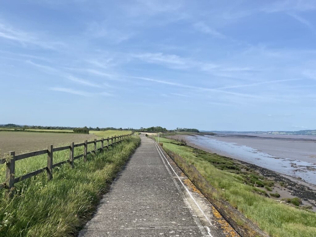
At the power station my route continues along the embankment with the security fencing to my left and the River Severn to my right.
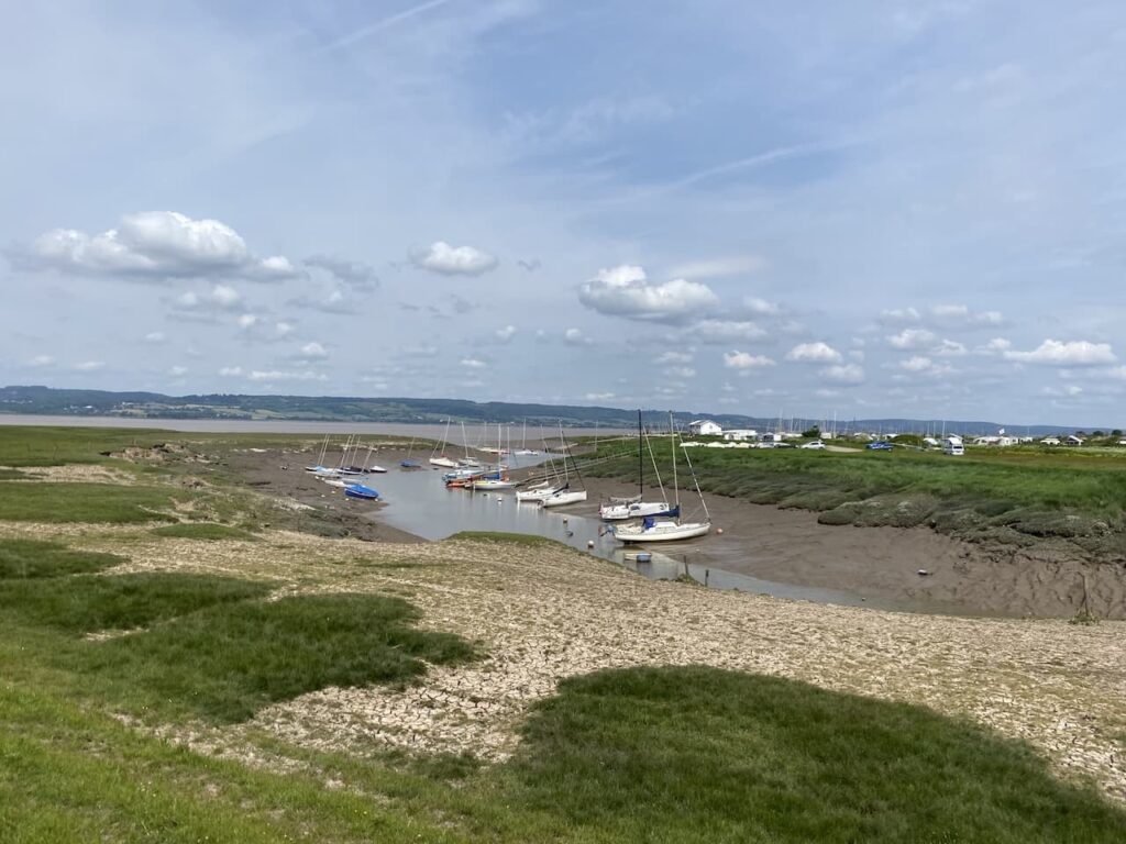
Soon after the power station my route on the Severn Way leaves the edge of the river to briefly head inland around Oldbury Pill.
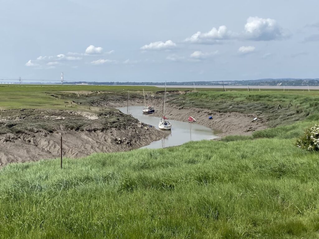
Since 1949 Oldbury Pill has been the location of the Thornbury Sailing Club and judging by the number of boats about it is a popular club.
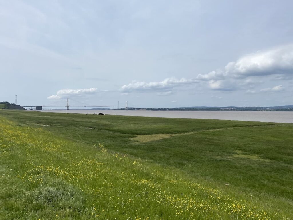
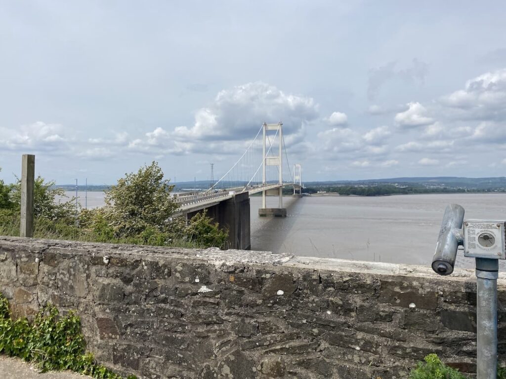
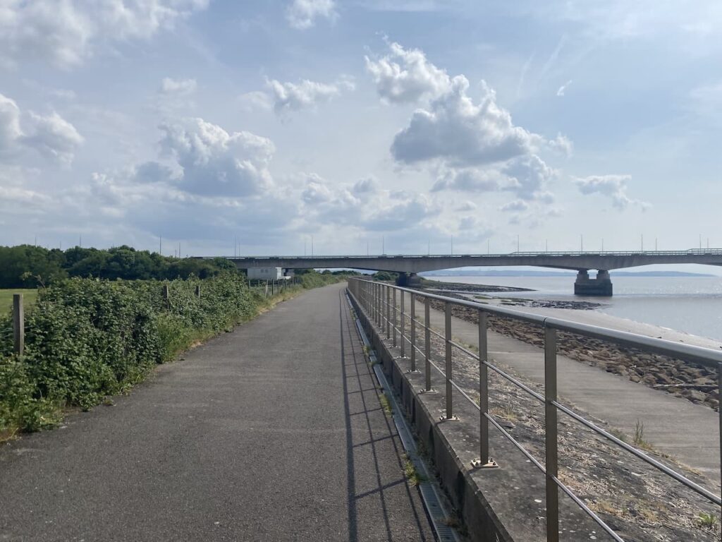
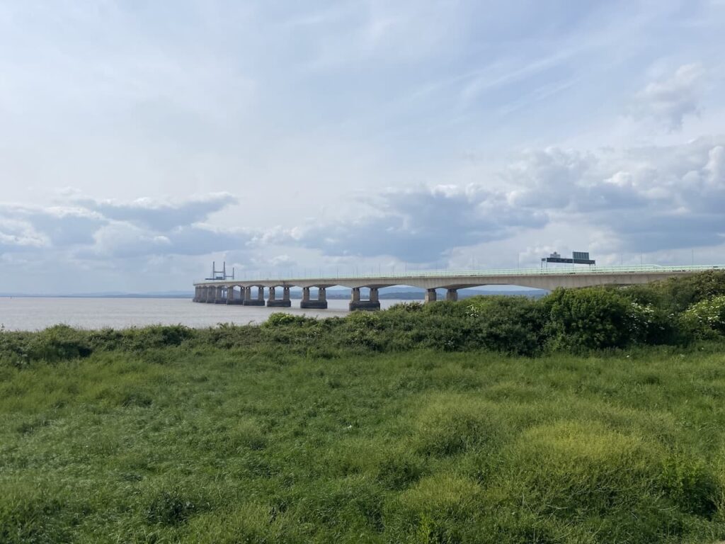
After going around the pill my route continues along the embankment with the two Severn crossings now dominating the view.
As I near the bridge the path leaves the side of the river and heads uphill along the edge of fields heading towards the Severn View Service Station.
The original motorway services were opened in 1966 by Top Rank. It was a spot where travellers stopped to take in the view of the bridge. With the advent of the second river crossing and the diversion of the M4 the main service area moved and the old building was sold and is currently owned by Brightside Insurance which was founded by Aaron Banks, business man and right wing political donor.
Before leaving the old service area I head to the wall which is on the edge of Aust Cliff. I am a man with vertigo, so cliffs are not an area I feel comfortable. However, this spot has happy memories. On our first holiday together as we headed to South Wales my then girlfriend and now wife of over forty years sat to pose for a picture which is in a photo album at home.
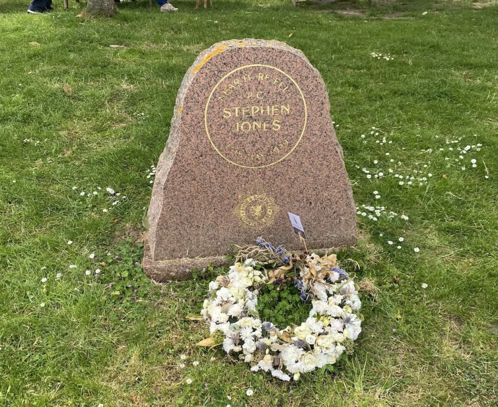
I now follow the path towards the new service area which opened in 1999 and in 2019 was voted the worst motorway service station in the Country. I am in need of a sandwich so hope things have improved in recent years. Outside the service area is a memorial to PC Stephen Jones. Sadly he was killed in 1999 whilst using a stinger device on the M4 motorway in an attempt to stop a sixteen year old hit and run driver who was in a stolen vehicle.
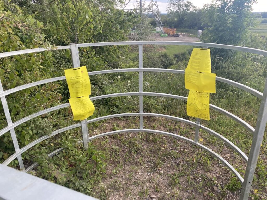
Leaving the service area on the Severn Way footpath I take a footbridge over the motorway and on joining a road turn left and continue down to a junction where I turn right towards the coast. I should now follow the route of the Severn Way between Old Passage to pass Aust Wrath and Northwick Wrath on the way to New Passage. However my plans are quickly scuppered because the road is closed to all traffic including pedestrians whilst sea defence work is being undertaken.
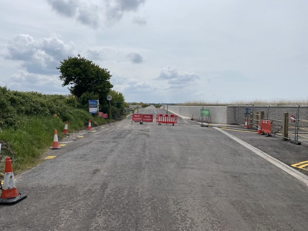
There is a footpath diversion sign and I follow this for a while but it is clear it not going to take me anywhere near my intended destination so it is is with a degree of frustration I look at my options. I decide the only way to avoid the closure is to retrace my steps towards Aust and pick up the A403 and follow this until I can rejoin my planned route. What followed was two miles of very unpleasant walking beside a main road. On a couple of occasions I attempted to rejoin my planned route, but every time I was scuppered by footpath closure signs.
Eventually at North Worthy Farm I was able to follow a footpath across fields to rejoin the coastal path.
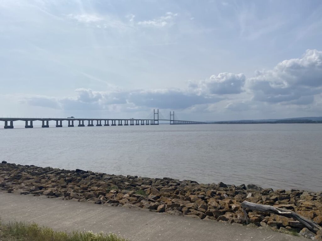
It is with some relief that I continue on and pass under the second Severn crossing.
This bridge is known as the Prince of Wales Bridge and was opened in 1996, it is 3.2 miles long. For the first twenty-two years of its existence there was a toll to cross the bridge, but since 2018 if has been free.
To celebrate being back on track I stop for a cup of tea whilst taking in the view and enjoy the tranquility after the noise of walking beside the busy A403. Resuming my walk I head along the sea defence wall with Severn Beach to my right.
Just as I am relaxing into my walk I meet a couple who explain that the path ahead has been closed. I can’t believe it, but a quick look through my monocular confirms my planned route is blocked by heavy metal construction fencing.
So once again I have to reroute. This time by heading into Severn Beach and taking thre road through the houses to head south and join the A403 once again. There again follows an unpleasant section by this busy road as I follow it past a power station. Here I hope to be able to rejoin the coastal path, but despite there being way markers the route is so overgrown it is is impossible to follow. After a series of scratches and stings I decide that this is pointless and instead follow the A403 through an industrial area and then as it turns sharply right I continue straight on along Severn Road. I had intented taking a footpath on the right and attempt to rejoin my planned route. However, once again I find the footpath has been closed, this time for work on overhead power cables.
I decide it is clearly not my day and rather than continuing to try and get back to my planned route it is probably best to just knuckle down and walk into Bristol via Henbury and Westbury on Trym.
There is little point my describing the route because no sane person would attempt to follow it. However the map attached to this blog has my intended route and hopefully it will be fully open soon.
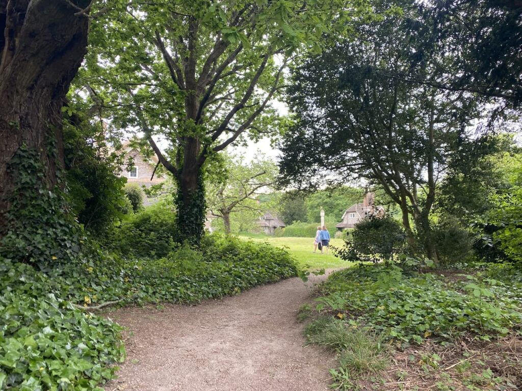
My route takes me across the M49 and then through Hallen before crossing the M5 and continuing on into the outskirts of Henbury where I pass Blaise Hamlet, this is a National Trust owned hamlet of 9 thatched cottages. The hamlet was built around 1811 for retired employees of the Quaker banker and philanthropist John Scandrett Harford who lived in nearby Blaise Castle.
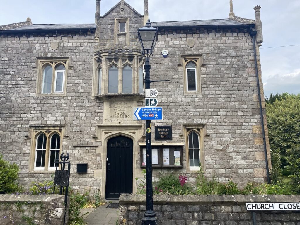
A bit further on I reach the impressive Henbury Village Hall which is over 400 years old. My mood is not improved by the waymarker in front of the village hall for a route to the Severn Bridge which bypasses most of the diversions I have encountered this afternoon!
I now pick up the B4055 and follow this to Westbury on Trym, trudging along pavements lined by shops and houses was not what I envisaged when I planned this 500 mile walk. It is only day 3 but I am beginning to wonder if this was a good idea.
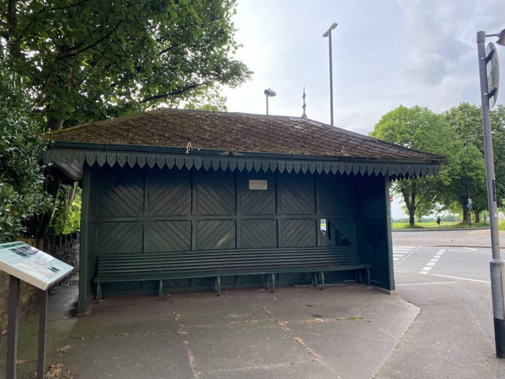
From Westbury on Trym I soon join the A4108 and follow this to Clifton where I pass what initially looks like a bus shelter but turns out to be The Haven Shelter. This was constructed in 1917 as a shelter for injured World War I soldiers who were convalescing in the nearby Queen Victoria Jubilee Convalescent Home. It was located here close to the Downs because there was an acre of land where the injured service men took walks.
It is a warm Sunday evening and the bars and cafes are busy as I pass through Clifton and head down to the centre of Bristol and my overnight accommodation at the Travelodge.
After a quick shower and change it is time to head out for a pint and something to eat. I head towards the waterfront where there are numerous bars and cafes however I am not sure if it is my mood or my age but this bustling centre of activity is not to my liking. I see some odd sites, some of which will take a while to erase from my memory and after a quick pint in an unfriendly bar wander off to find a quiet curry house and a back street bar.

My walk today covered 29 miles, further than planned and whilst this blog describes the route I walked the latter part is not worth repeating. However the map below shows the route I had planned to take and hopefully this is now accessible.
You can view this walk and download the GPX File on OS Maps (OS Maps subscription required)
To follow this walk you will need Ordnance Survey OS Explorer – 167 – Thornbury, Dursley & Yate and OS Explorer – 154 – Bristol West & Portishead
28th May 2023
© Two Dogs and an Awning (2023)
All information on this site is provided free of charge and in good faith and no liability is accepted in respect of damage, loss or injury which might result from it. To the best of my knowledge the routes are entirely on public rights of way or within areas that are open for public access.
Walking can be hazardous and is done entirely at your own risk. It is your responsibility to check your route and navigate using a map and compass.