Today we have planned a pleasant circular walk from Mill End. From the public car park on the outskirts of the village of Mill End we walk besides the road into the village. At the junction with the A4155 we turn left and pass Millend Farm before taking a footpath on the right leading to Hambledon Place.
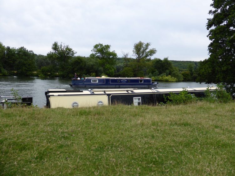
The footpath turns to the right heading towards the River Thames after a couple of hundred yards we meet the river and turn right following alongside the riverbank. This is pleasant, flat, walking, enjoying occasional glimpses of the river.
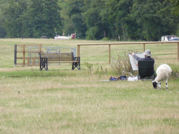
This is a different walking environment than we have become accustomed to, much busier. We rarely encounter others whilst walking and I cannot recall spotting an artist for a long time.
Just before reaching the end of the towpath we arrive at a monument. The inscription reads “This Monument was erected to commemorate the successful action fought by Hudson Ewebank Kearley, First Viscount Devonport PC, which resulted in the Court of Appeal deciding on the 28th March 1899 that Medmenham Ferry is public.” The ferry crossing gave access to the far bank of the Thames rather than taking a long detour to find a bridge.
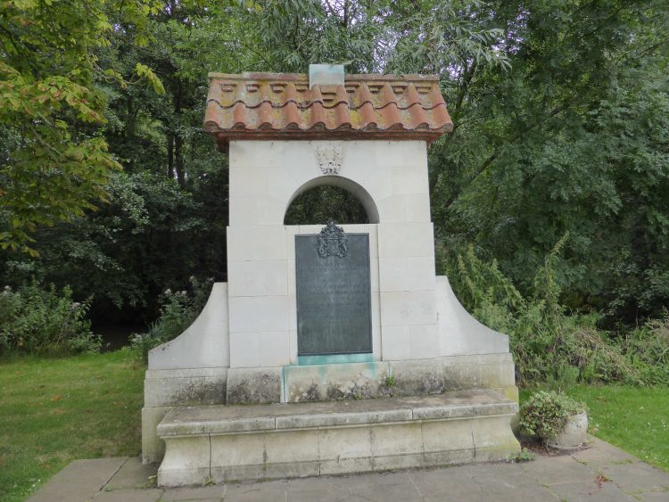
Hudson Kearley (1856 – 1934) was an interesting character. Apparently he was a grocer and politician, starting his career in 1872 working for Tetley and Sons, but in 1876 he set up his own company that in time became International Stores. His political career included being the Minister of Food Control during World War I, he was also the first chairman of the Port of London Authority. It is good to see that he took time out from his business and political activities to fight for public access to the ferry.
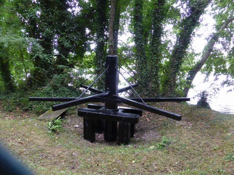
We have to leave the riverbank here and walk up the lane towards Medmenham. After a few hundred yards we take a footpath on our right that soon crosses a field to meet the A4155, after a few yards along the road the footpath continues. It leads below Danesfield House, now a hotel and spa, that can’t be seen from the path. However, we can see the Hurley Weir Capstan Wheel.
This is an interesting bit of kit. The notice board informs us that the earliest type of river locks were called ‘flash locks’ and were first used by the Romans to enable the river to be navigable at times of low water. These locks had a gate made of wooden boards that, when removed, enabled boats to go downstream on a ‘flash’ of water.
Boats coming upstream had to be pulled up on a rope attached to a capstan wheel. Men would turn the wheel and enable the boat to navigate the ‘flash’ of water. Hurley Weir capstan wheel dates to c.1300 and was one of many that once stood on the Thames. In 1790 the flash lock was replaced with the conventional pound lock. This capstan wheel is now the only one remaining on the River Thames.
Continuing our walk we soon pass through a tunnel and then shortly after take a right turn to follow a footpath towards Harleyford Manor Golf Club. We pass a couple of holes before going around the back of the clubhouse and then the back of the splendid manor house before continuing towards East Lodge.
On reaching East Lodge we turn right on a footpath towards the river skirting some buildings at Low Ground Farm before continuing to the towpath, here we turn left and head towards Marlow. On the opposite bank is Bisham Abbey.
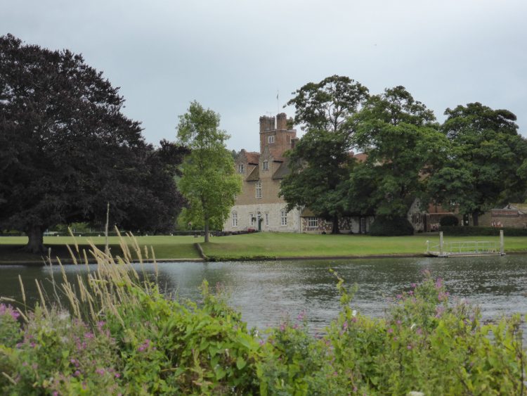
Bisham Abbey is now the National Sports Centre. The manor house was built around 1260, King Edward I took it over in 1307. Later Henry VIII granted the manor to Anne of Cleves as part of her divorce settlement, much better than having her head chopped off!
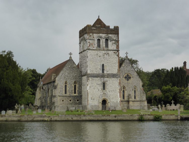
Along from the Abbey is All Saint’s Church, in a great setting right alongside the river. The Norman tower is said to date from around 1175 with the rest of the building dating from the Victorian restoration of 1849.
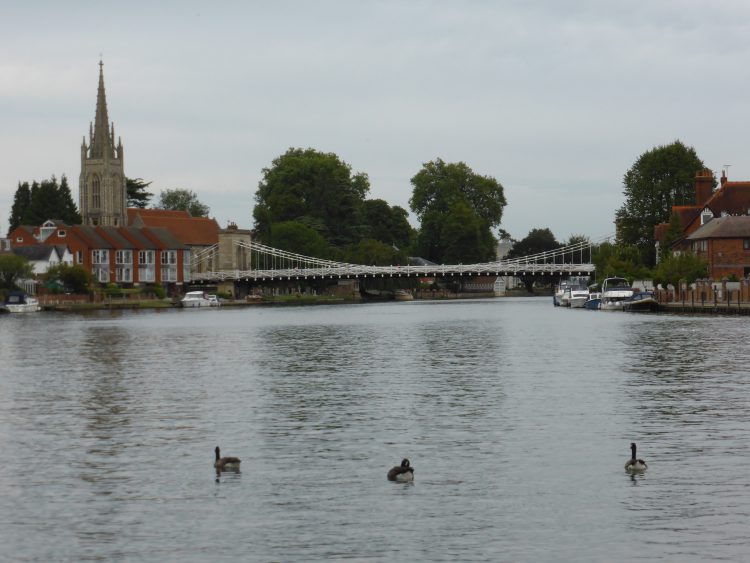
We carry on towards Marlow, the closer we get the more people we encounter. By the time we are in sight of its lovely bridge crossing the Thames we are in a park bustling with families playing and walking besides the river with ice creams.
Too busy for us, we opt to turn around and head back alongside the river. Within five minutes we are away from the noisy throng with just the occasional couple out for an amble. This is the Thames Path, it shortly leads us to Temple Lock and weir.
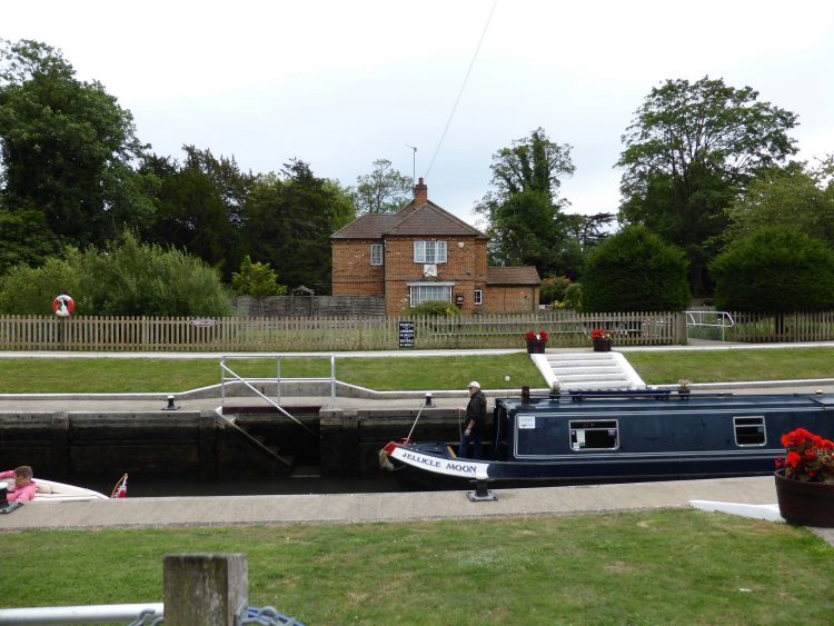
We watch a couple of boats go through the lock and then continue to Temple footbridge. A notice board tells us that it was opened on 24th May 1989.
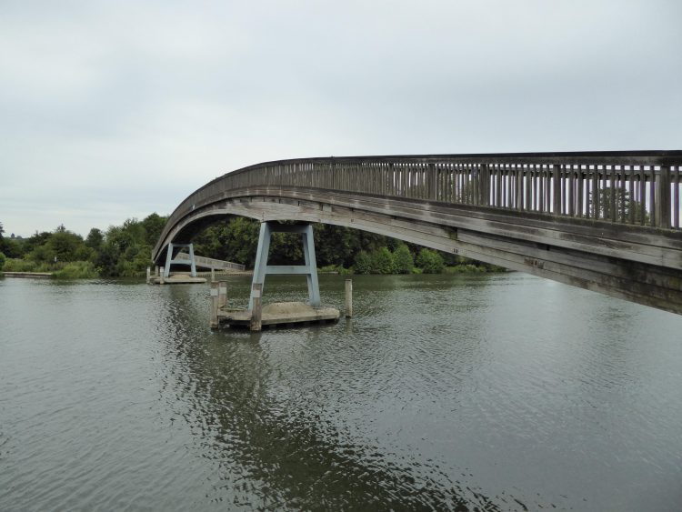
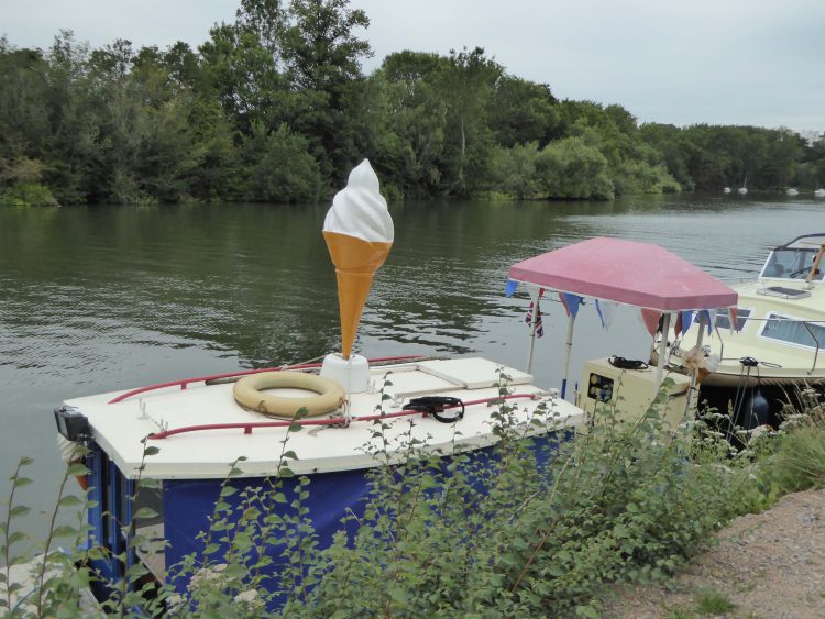
We cross and continue along the Thames Path passing Hurley Lock, which appears to be a popular spot. Soon we are in open countryside again and on our own. At Frogmill there are moorings besides the river and Lynnie gets excited at the sight of a boat selling ice cream, sadly closed for business today.
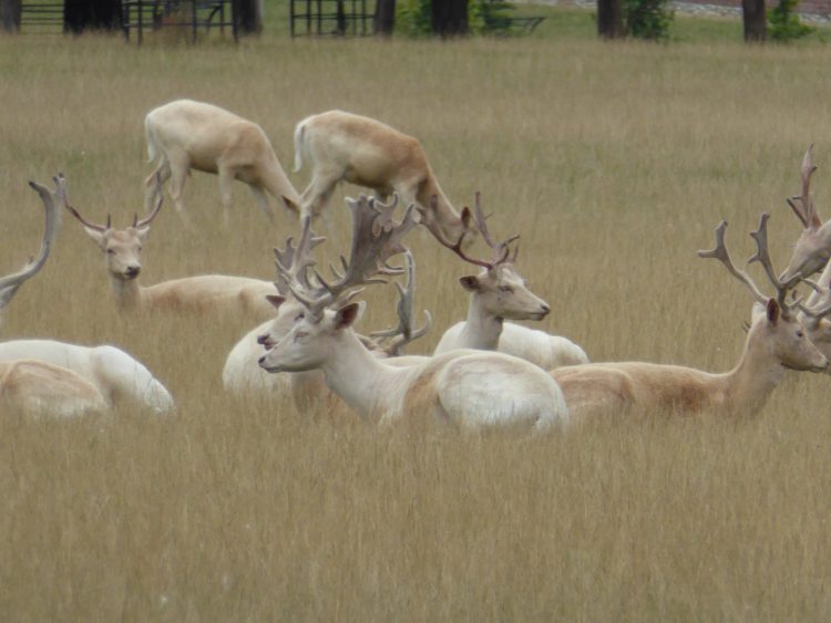
The Thames Path continues over a couple of fields and we see evidence of bears. When we spot them they are in a far corner of a field and not at all interested in the dogs so we continue without any worry. Going through a metal gate we enter into the deer park surrounding Culham Court. Another photographic opportunity for Lynnie!
The Thames Path passes in front of Culham Court and then into the small village of Aston. I was hoping that the local pub, the Flower Pot, would be open. I have stopped here previously and enjoyed a cracking pint, but unfortunately it is closed for the afternoon.
We follow the lane down to the river and then turn left to walk alongside the riverbank for almost a mile until we reach Mill End Weir.
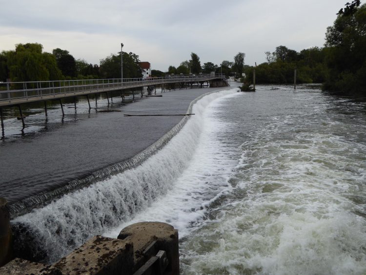
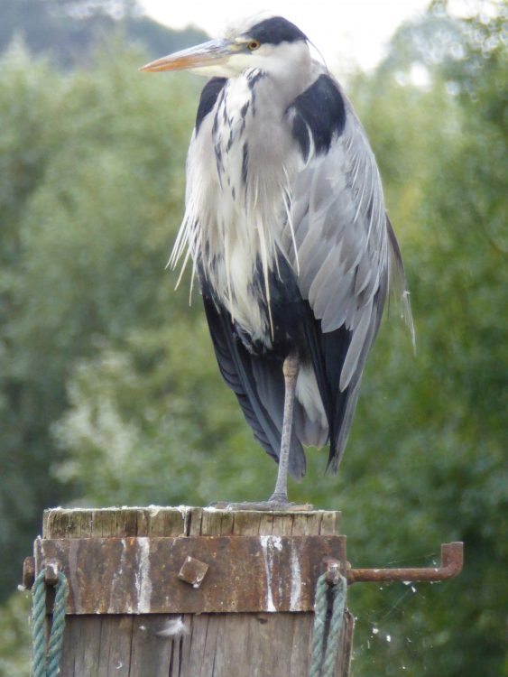
A heron on a post on the weir provides another ideal opportunity for Lynnie to play with her camera!
Eventually we head on across the weir, bringing us into Mill End village and it is then just a short stroll back to the car. This has been a good wander of around fourteen miles, but not at all challenging as it is a flat, easy route to follow.
It is time to head back to Cholsey Grange to enjoy a beer whilst looking at the view.
18th August 2015
[To follow our walk you will need Ordnance Survey Explorer Map 171 – Chiltern Hills West and Ordnance Survey Explorer Map 172 – Chiltern Hills East]
© Two Dogs and an Awning (2015)
All information on this site is provided free of charge and in good faith and no liability is accepted in respect of damage, loss or injury which might result from it. To the best of my knowledge the routes are entirely on public rights of way or within areas that are open for public access.
Walking can be hazardous and is done entirely at your own risk. It is your responsibility to check your route and navigate using a map and compass.
